My Trip Info:
Total Ascent: 6014ft (1834m)
Net: 5201ft (1586m)
Loss: 813ft (248m)
Start Ele: 3313ft (1009m)
Max Ele: 8514ft (2595m)
Distance: 18.2mi (29.2km)
Total Time: 9h 58m
Ascent: 5h 50m
Descent: 4h 1m
Time at Summit: 7m
Start Time: 11:58
End Time: 21:56
Sunset: 19:22
Equipment Used:
Helmet
Poles
Headlamp
Water Filter
Group Size: 2
Mountain Info:
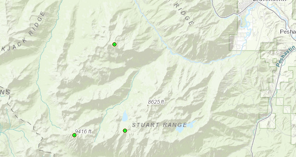
Cashmere Mountain (link):
Major Summits in Washington State: #28
High Summits in Washington State: #54
Prominent Summits in Washington State: N/A
Elevation: 8514ft (2595m)
Prom: 1656ft (505m)
Key Col: 6858ft (2090m)
Cashmere Mountain - West Peak (link):
Elevation: 8279ft (2523m)
Prom: 279ft (85m)
Key Col: 8000ft (2438m)
Point 7555 - Windy Pass North (link):
Elevation: 7555ft (2303m)
Prom: 75ft (23m)
Key Col: 7480ft (2280m)
All the mountains near where I live were getting rained out on the 13th. However, the Stuart area/the Enchantments was going to be rain free until nighttime. I’d already done
Stuart and
Dragontail, the two tallest peaks in this area. Cashmere was the last major summit (500m+ prom summit) I hadn’t done in the Enchantments, so the choice was obvious.
The three major summits in the Enchantments now done
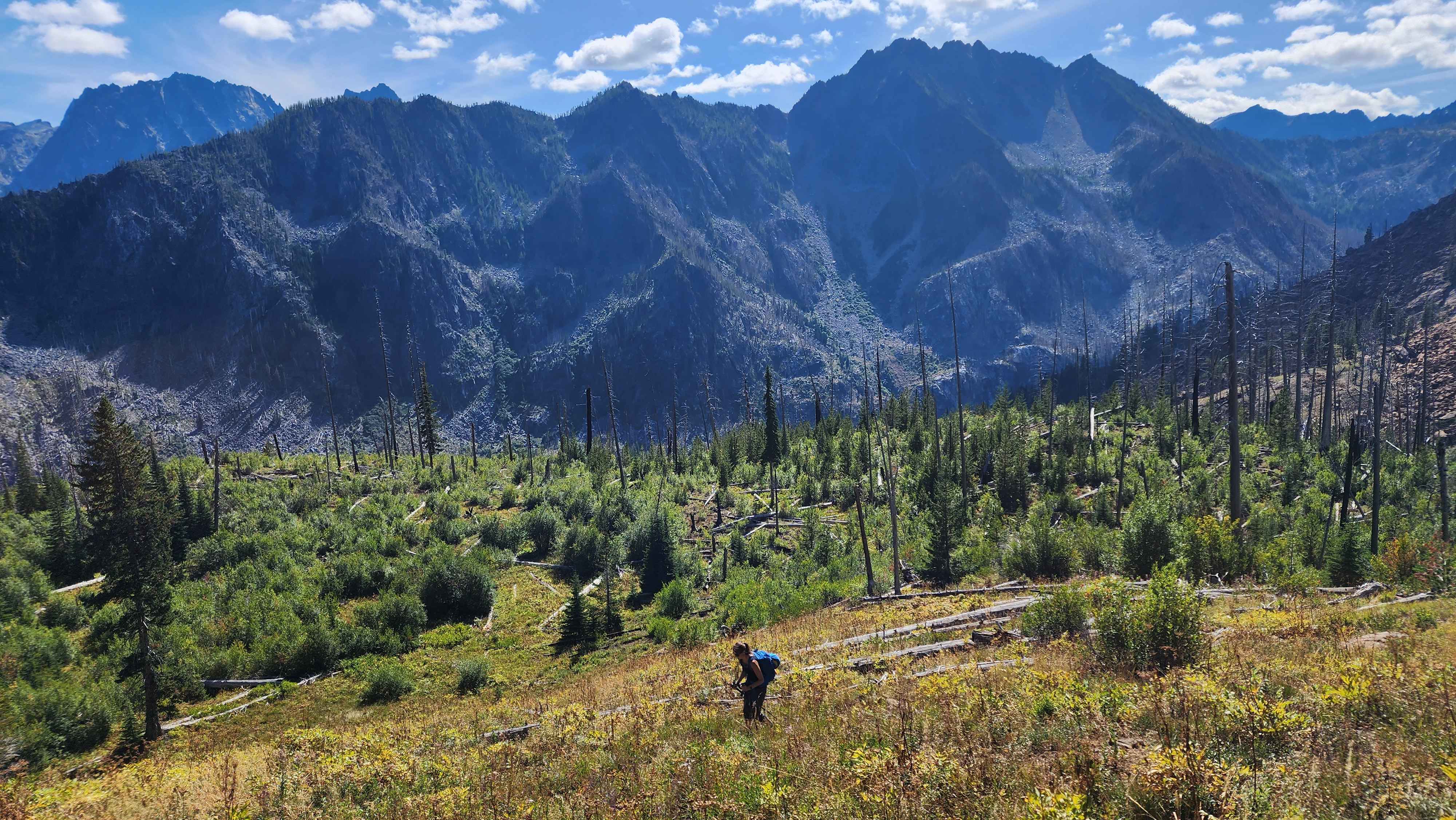
We got to the trailhead just before noon and started the boring valley hike to Little Eightmile Lake.
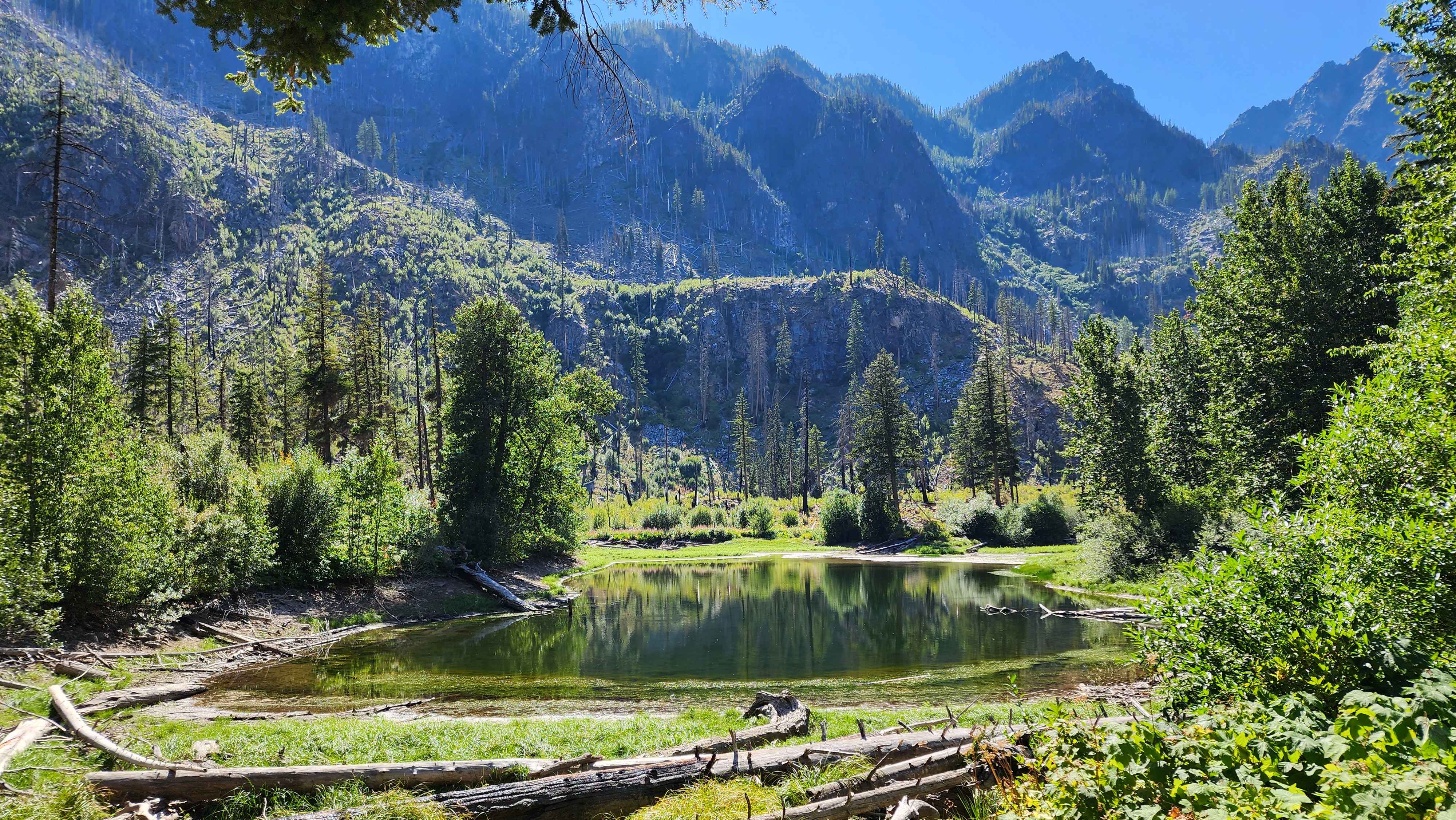
Little Eightmile Lake
We took the turn up at Little Eightmile Lake to go up the ridge to Lake Caroline. The trail through this section was surprisingly overgrown for being such a highly-walked trail. We continued past Lake Caroline and filled up our water at Pioneer Creek that comes from Little Caroline Lake.
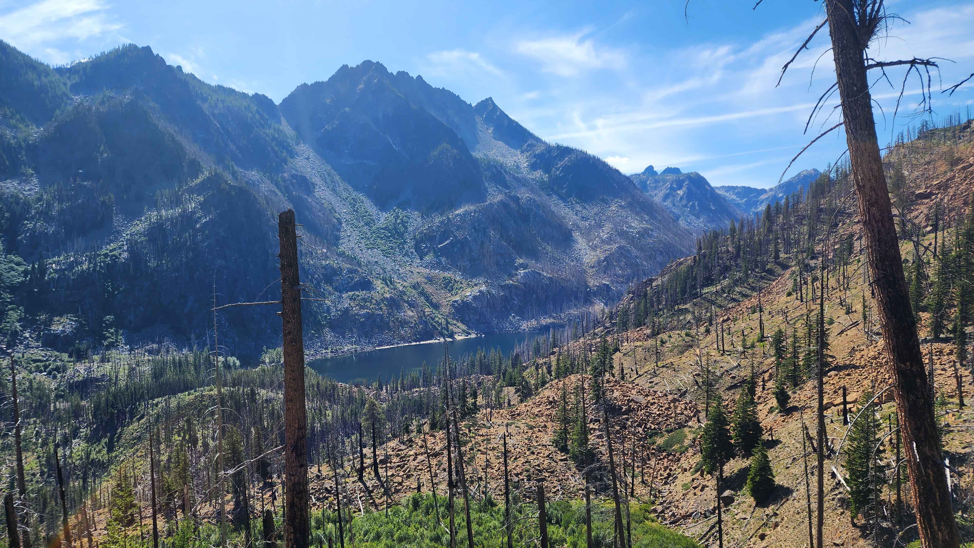
Eightmile Lake from above
Hiking up the switchbacks to Lake Caroline
After a bit more walking from Little Caroline Lake, we reached Windy Pass, where we had to leave the maintained trail. We took the trail along the ridge, which was very obvious and easy to follow. I walked up to Point 7555 (Windy Pass North), which was just a bit off trail.
The first view of Cashmere when hiking up to Windy Pass
The turnoff trail at Windy Pass
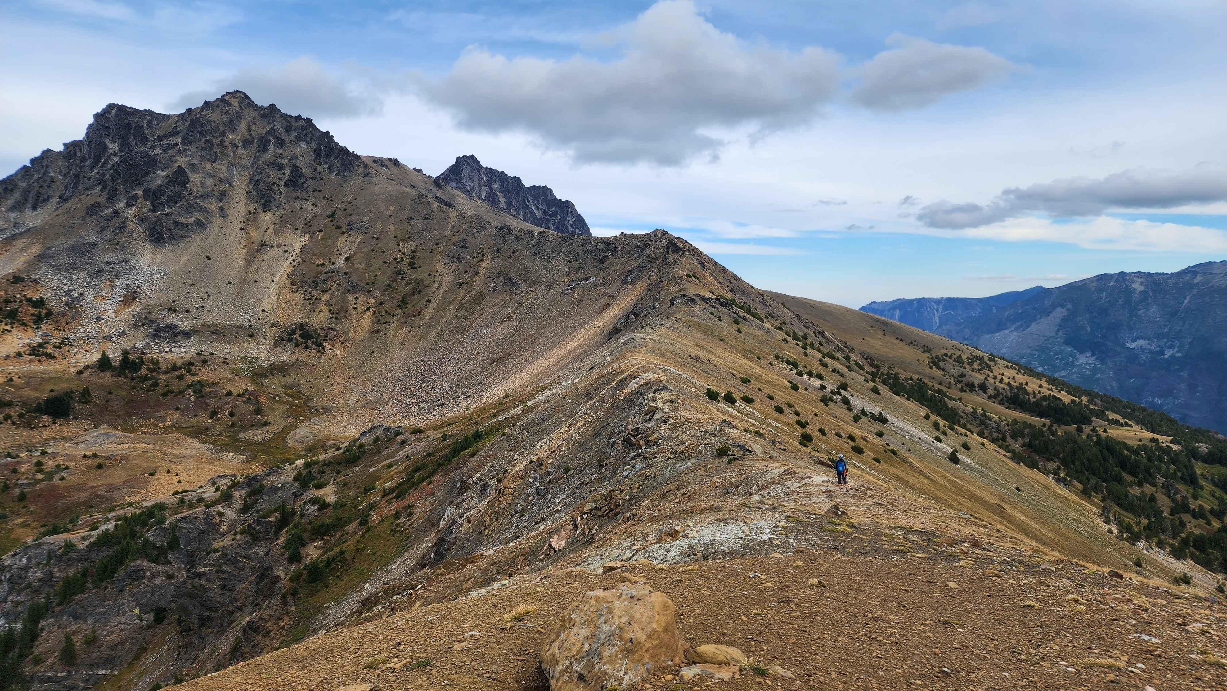
On Point 7555 (Windy Pass North) looking at the ridge
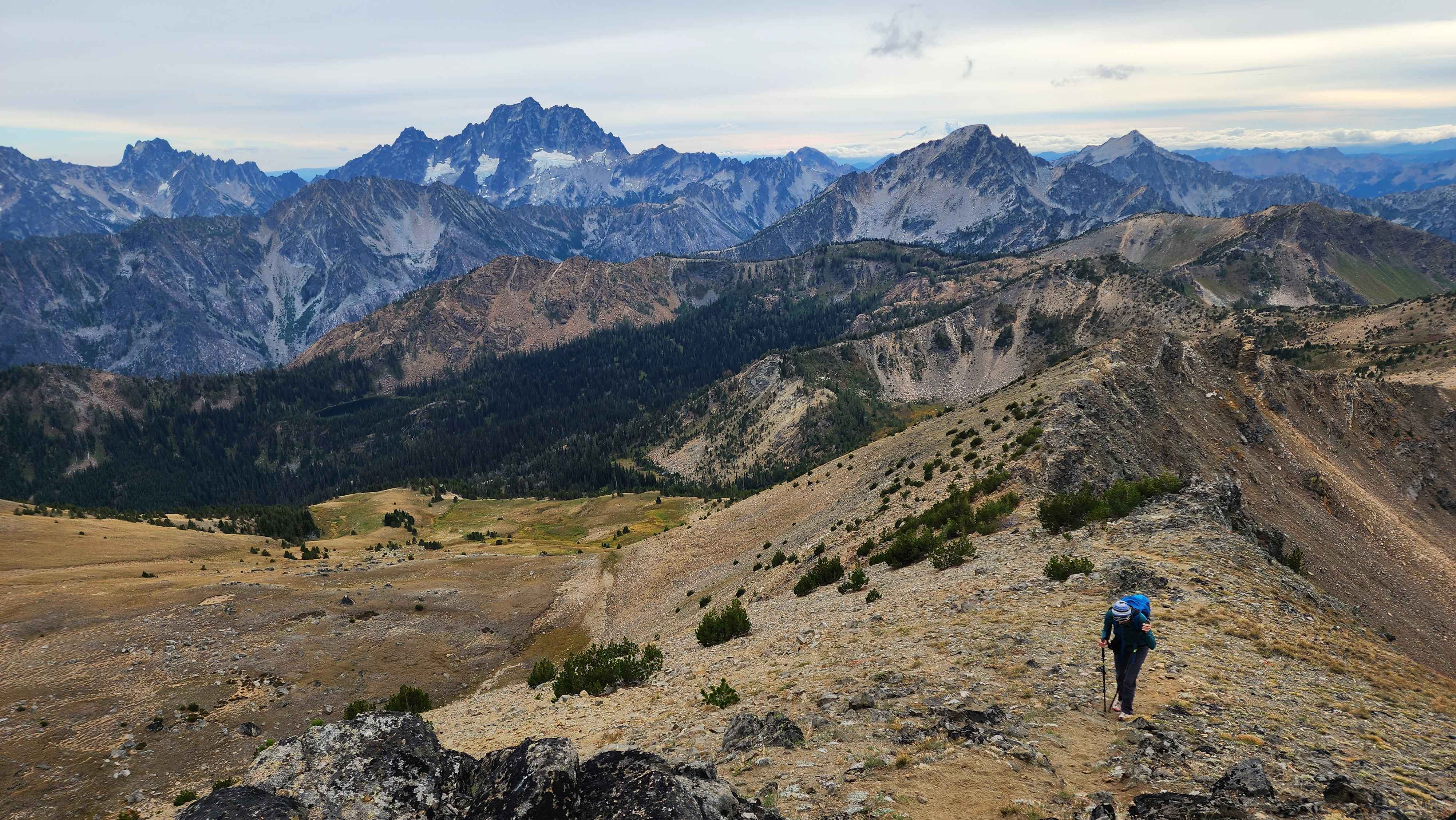
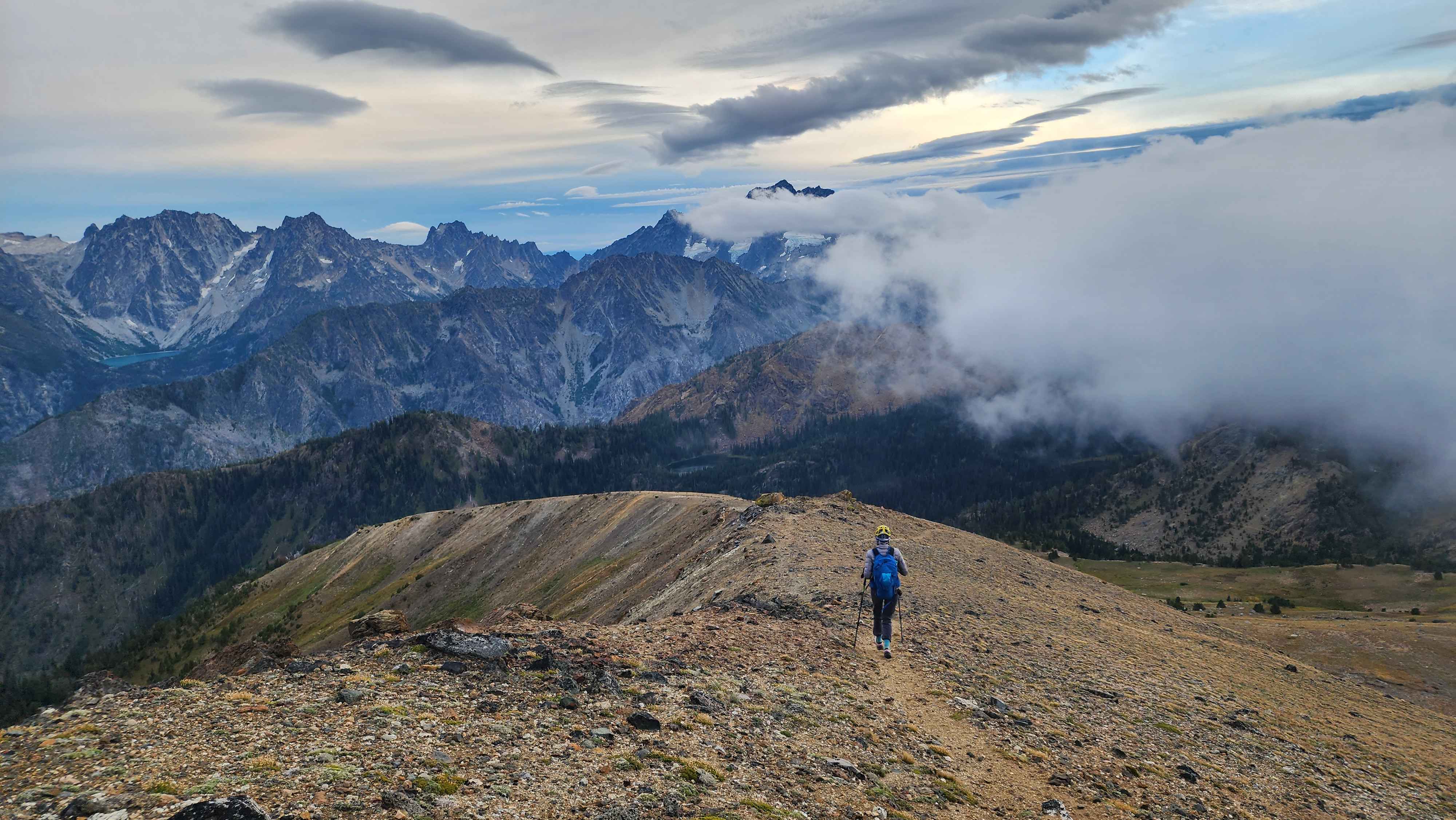
Hiking up the ridge with
Stuart in the background to the left
View of
Dragontail and Colchuck Peak from the ridge
We made it to where the trail goes below the West Subpeak of Cashmere. I climbed up to the summit of the West Subpeak, which added about 280ft of ascent. I climbed up a little slab on the southwest side of the peak that was about class 4. There is an easier approach from the southwest side of the peak.
Hiking below the West Subpeak
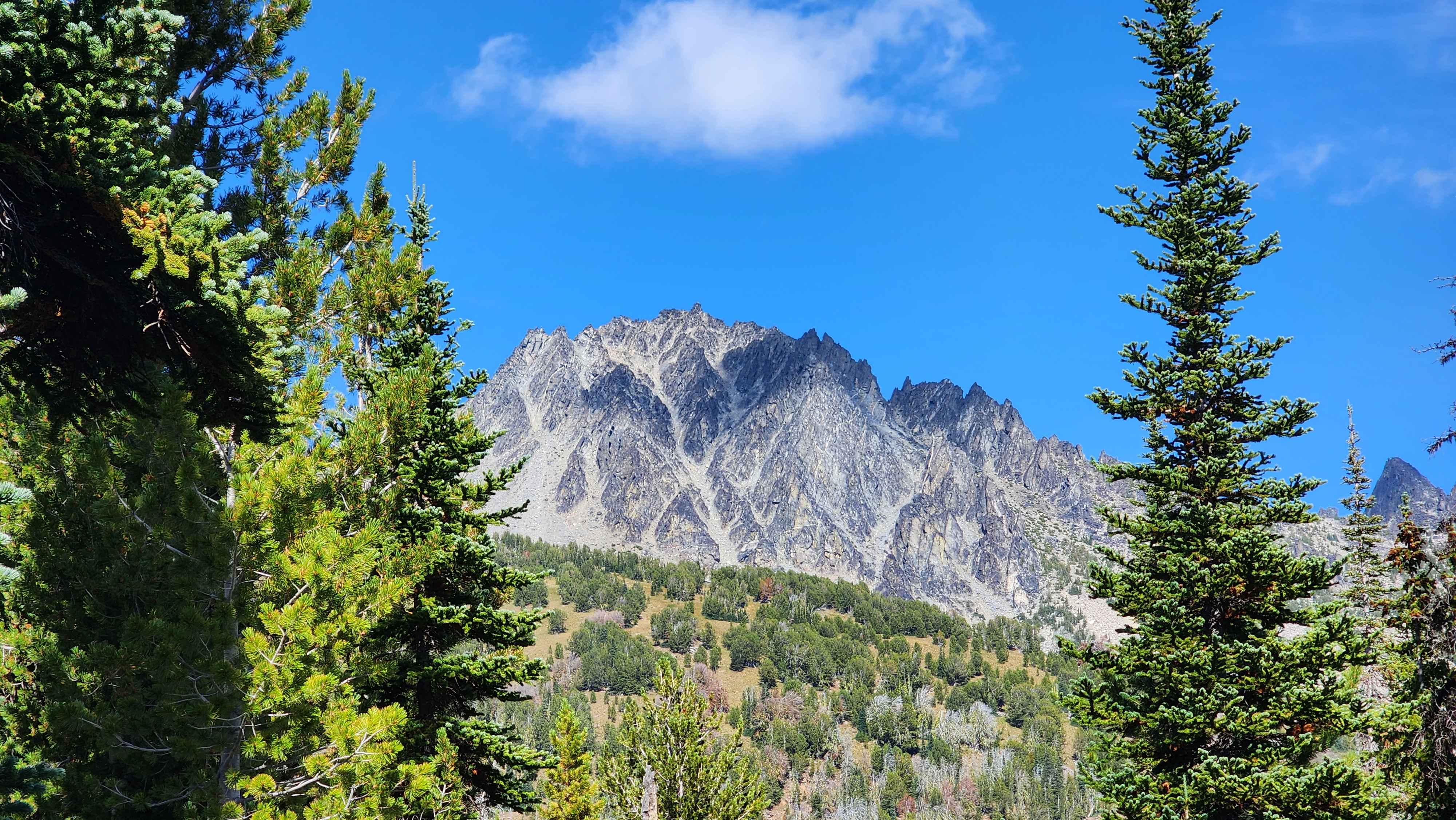
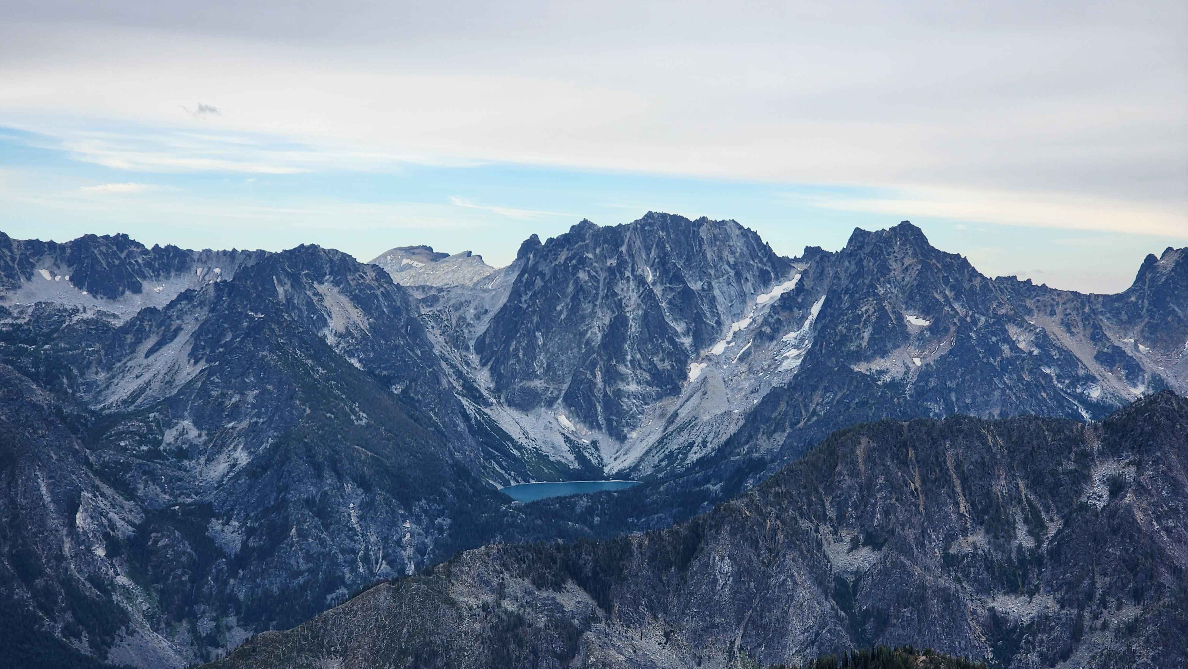
View of Cashmere from the West Subpeak
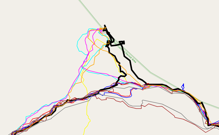
My route in black up the West Subpeak. Take other's route up the southwest side if you don't want to climb the slab
The short class 4 climb I did to summit the West Subpeak
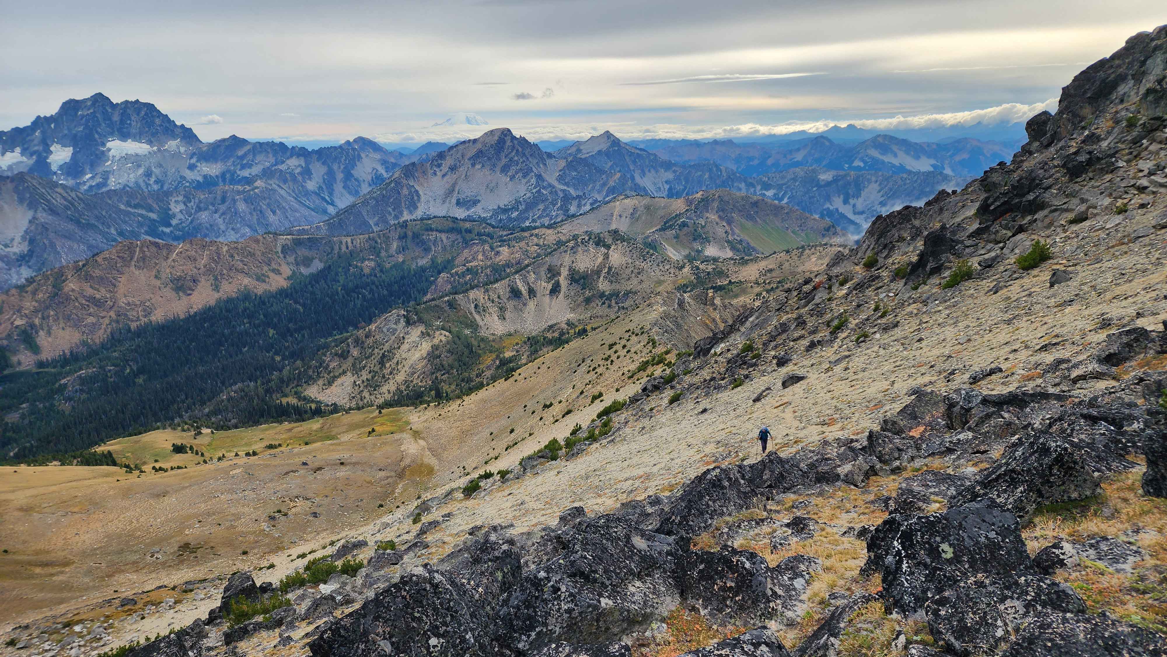
Meeting back up with my partner to continue the trek (Rainier in the background to the left)
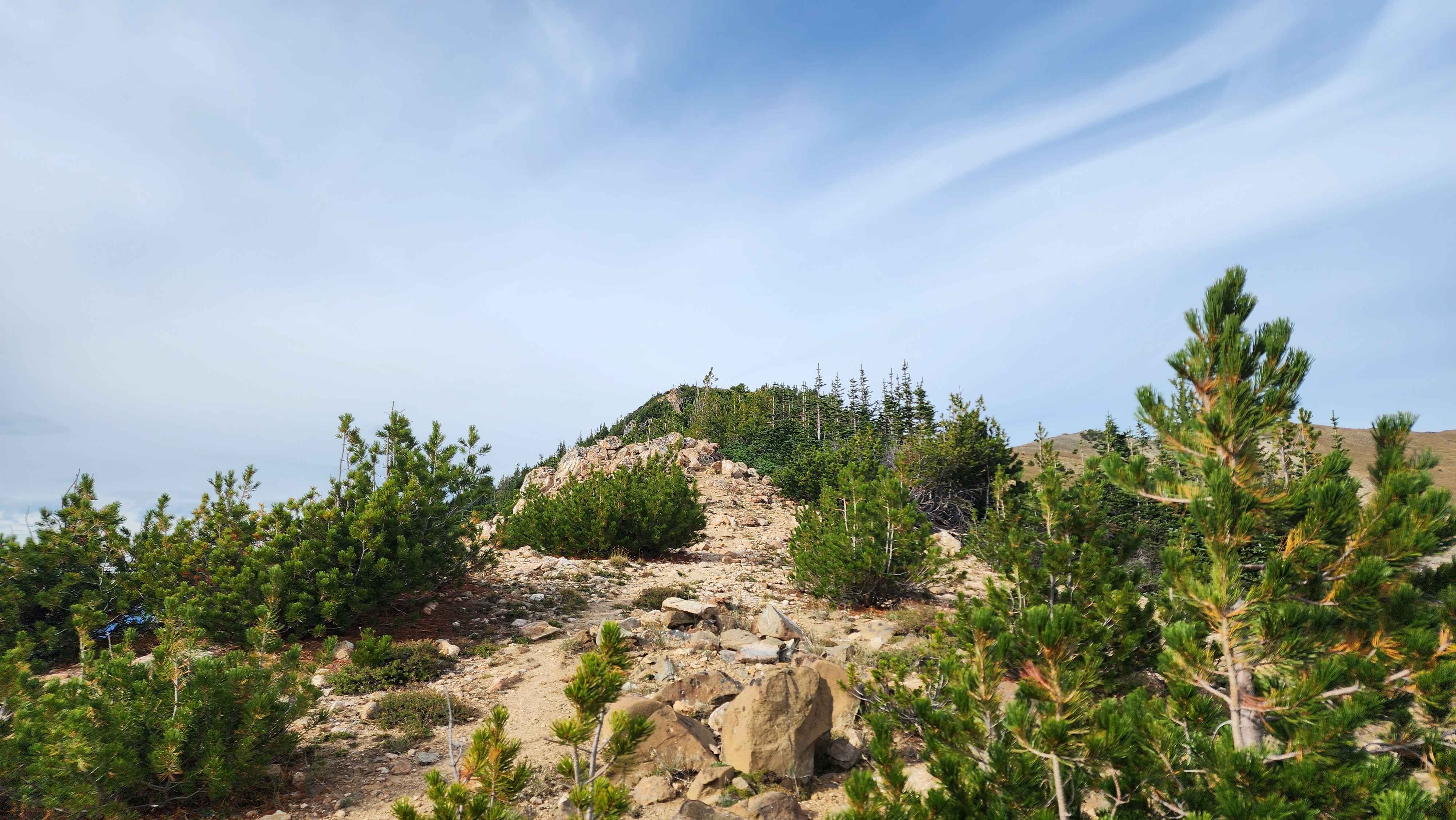
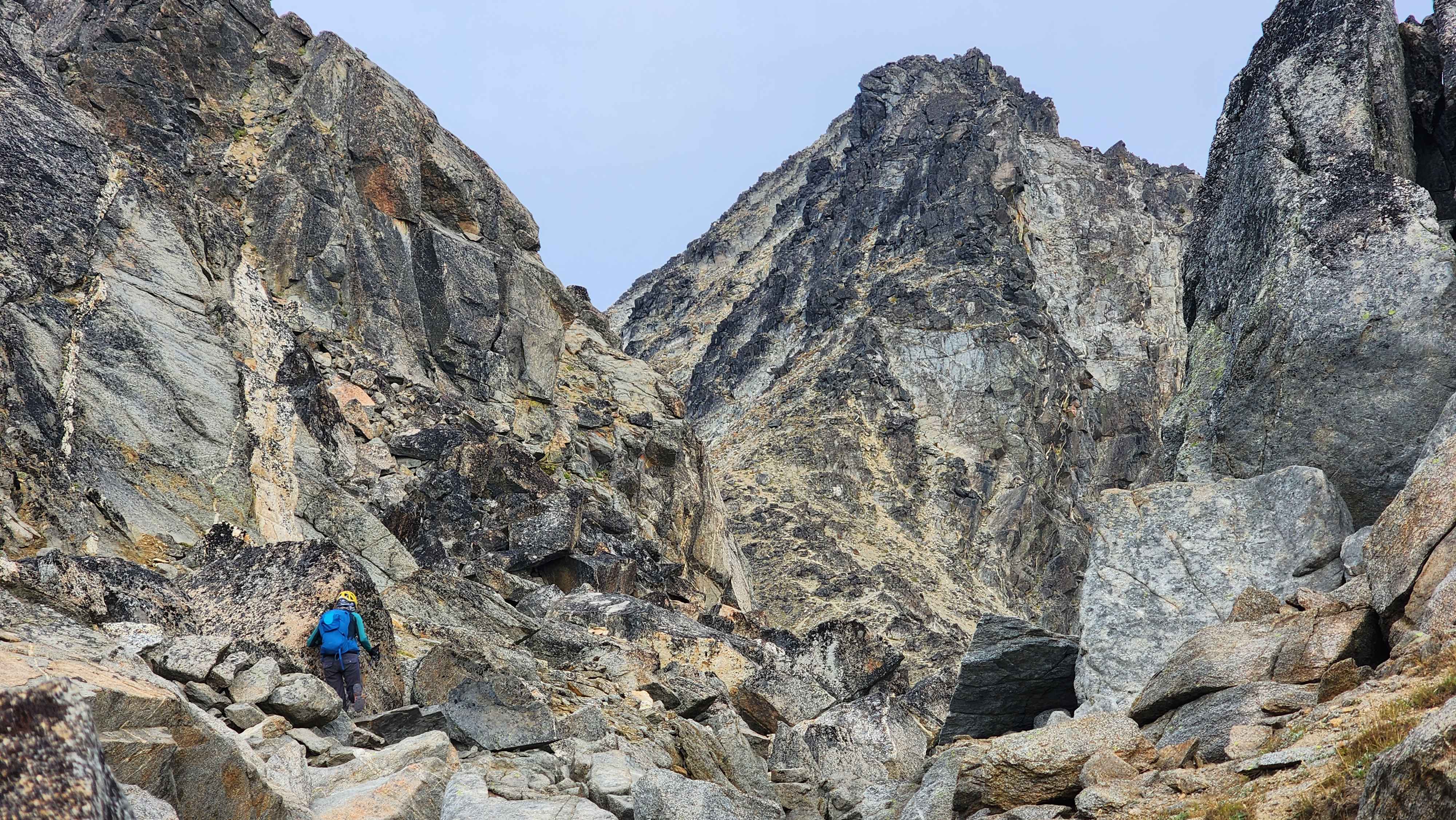
The trail then went to a large boulder field that wasn’t hard to cross. After the boulder field, the trail comes back and goes up Cashmere.
At the start of the boulder field
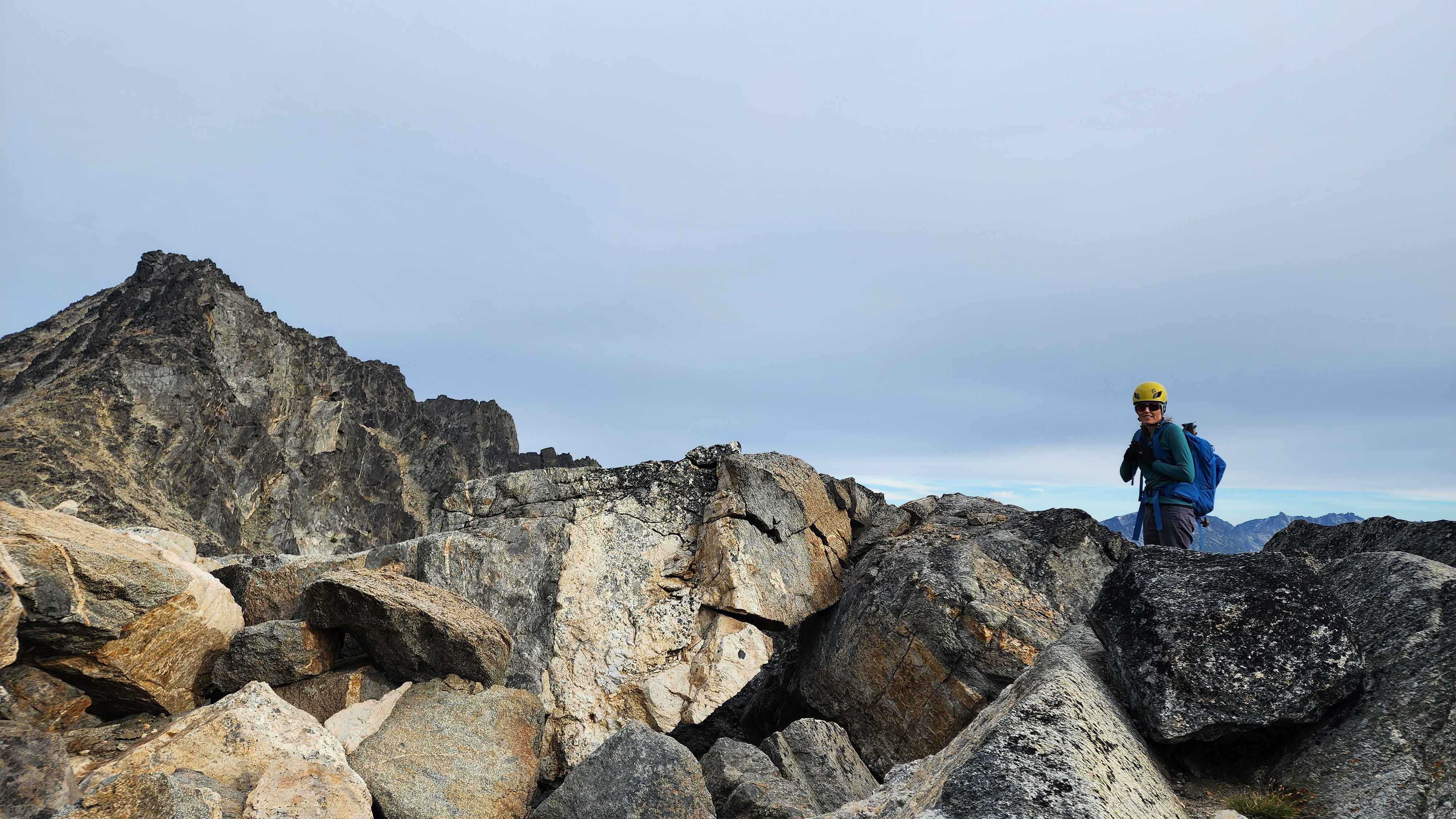
Hiking across the boulder field

The trail down from the boulder field

The trail up to Cashmere
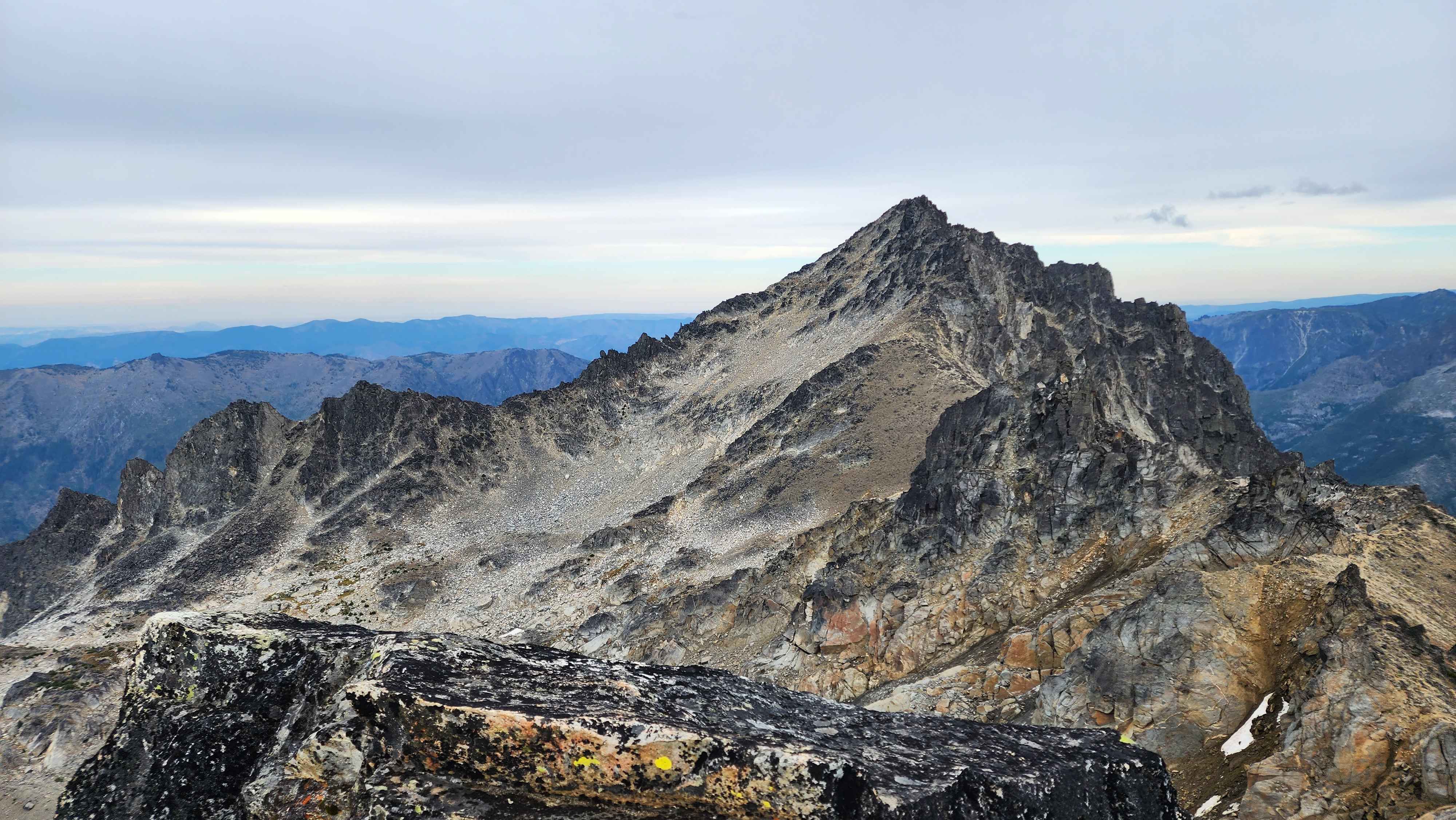
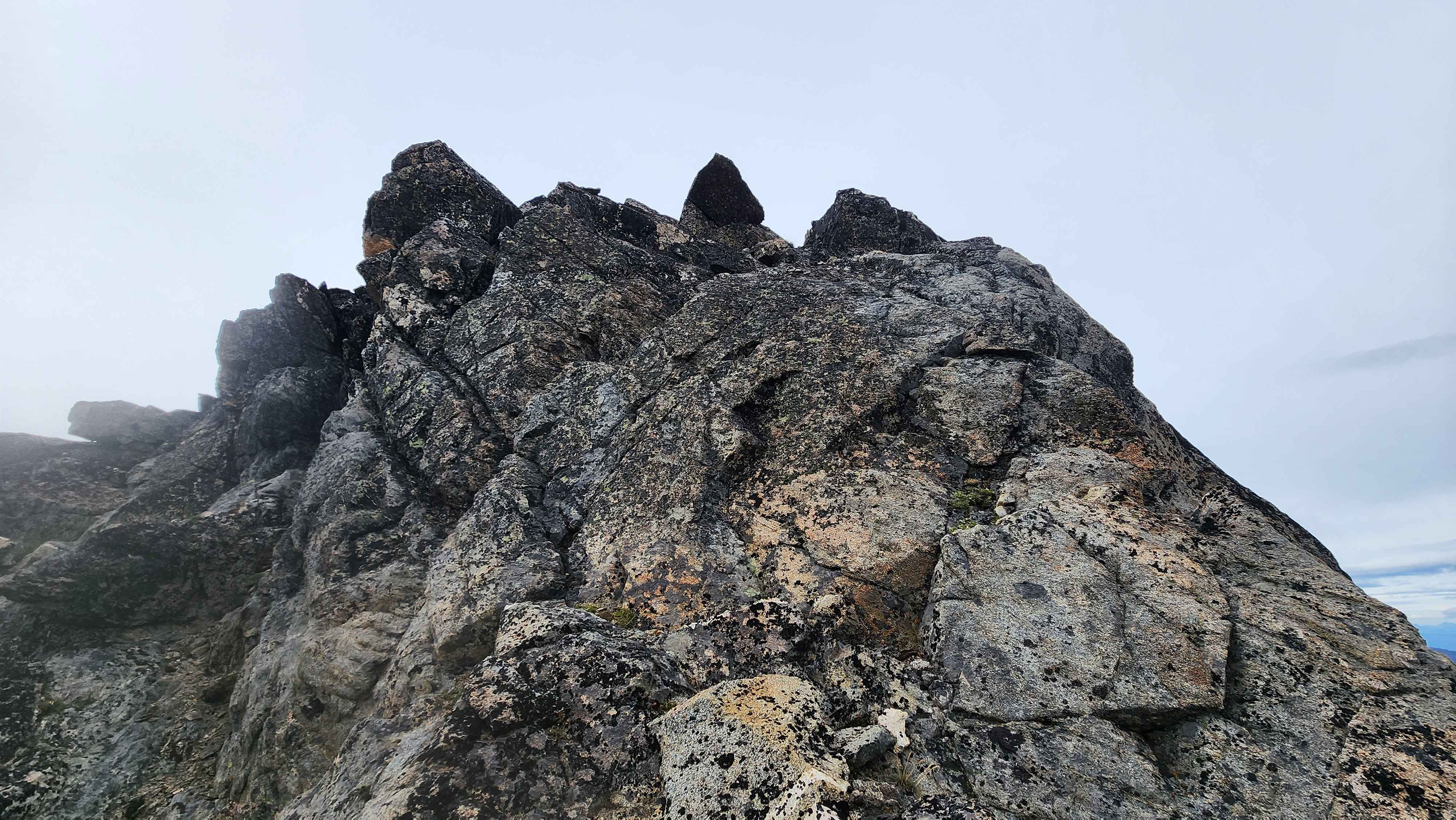
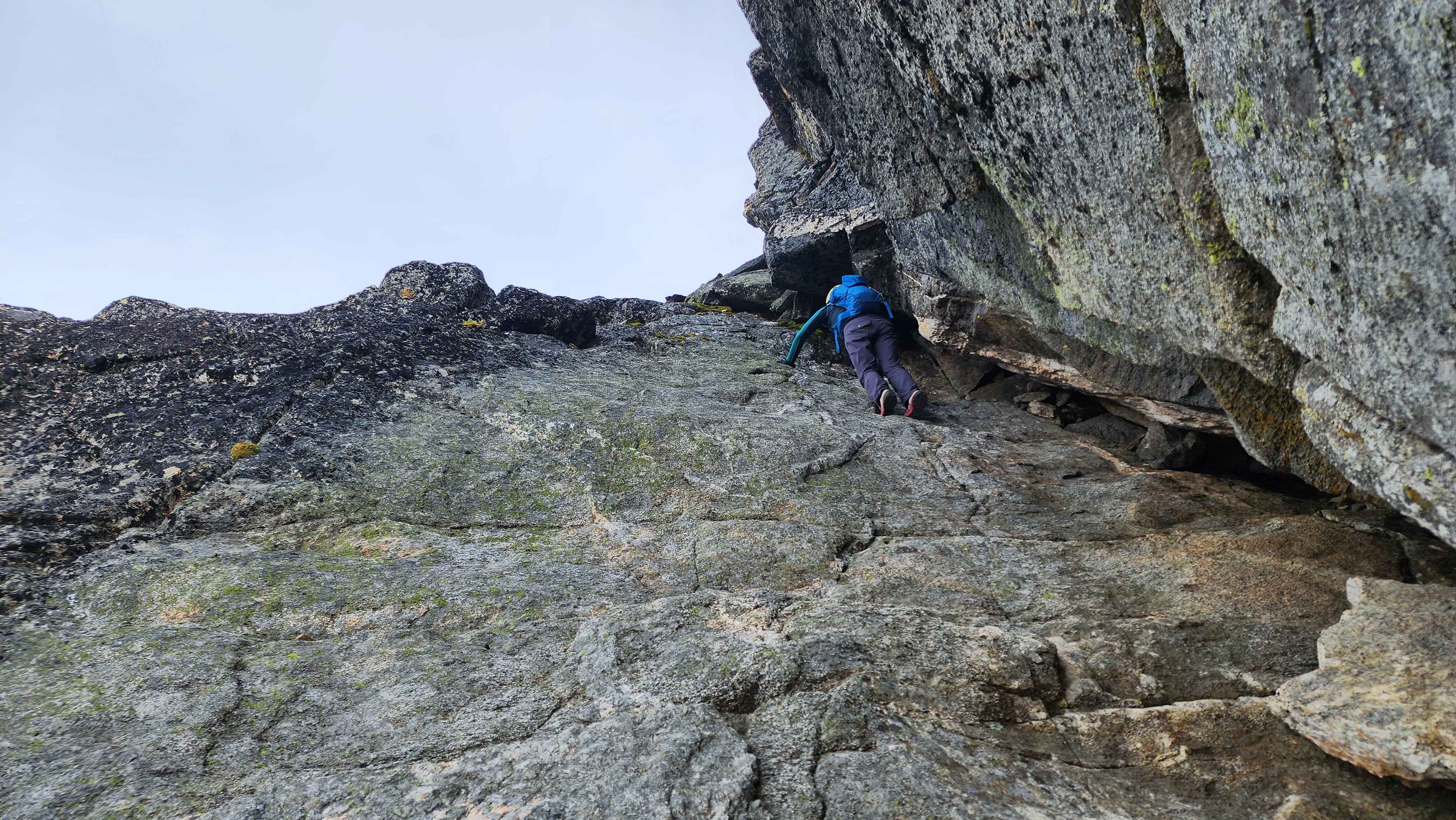
We took a very unconventional route up to the summit from this point. The standard route keeps going across the side to a class 3 chute; we went up much sooner than the standard route. The route we took was class 4 at minimum, but we took some side routes that were class 5. We even found a little flat wall that was 5.4 or so.
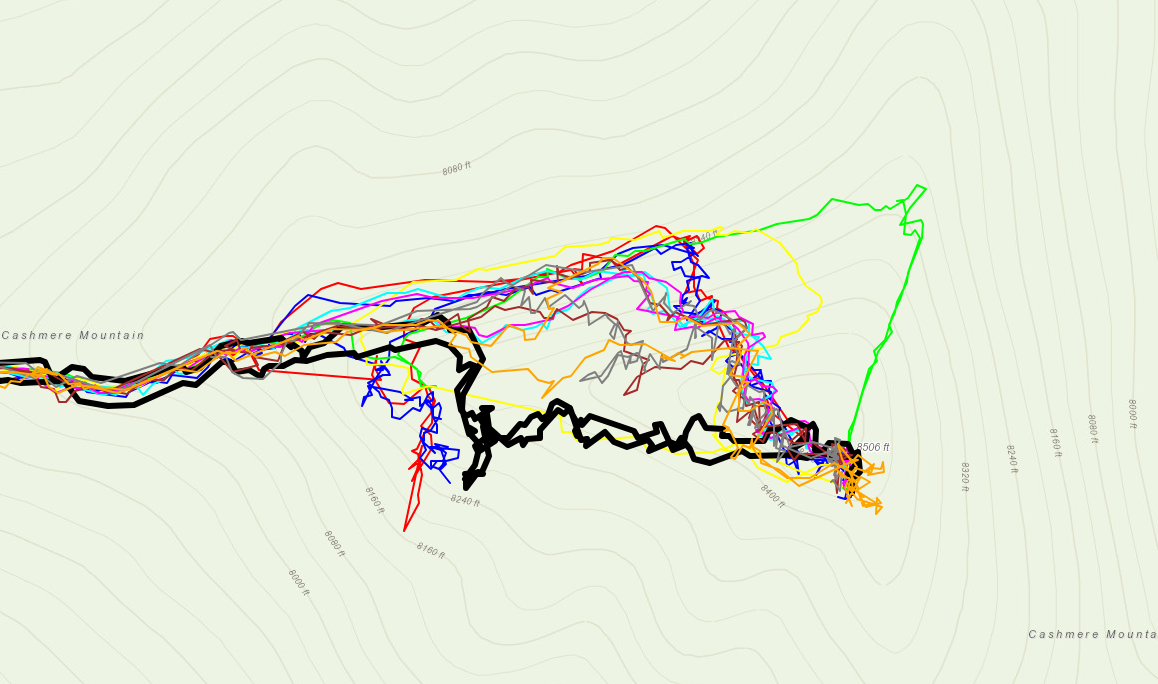
Our route up is in black; the main route continues on the trail and goes up where most the tracks go up at
Climbing up the 5.4 wall
Scrambling up a class 4 section
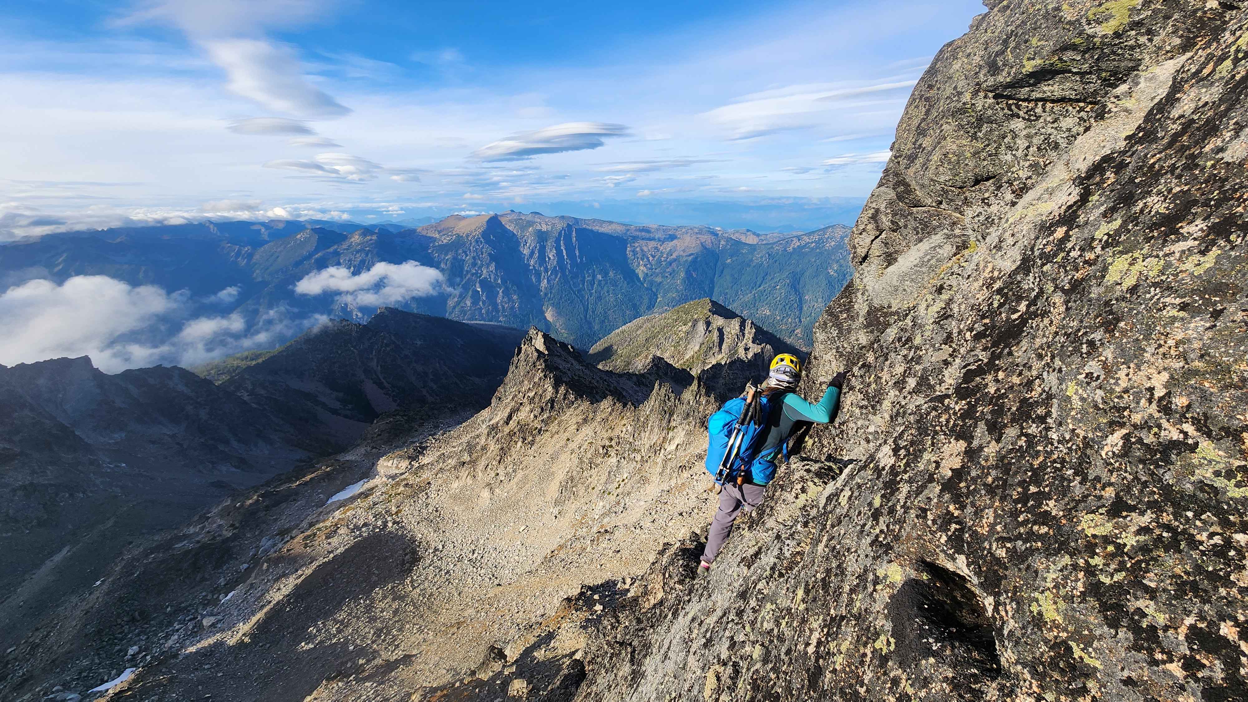
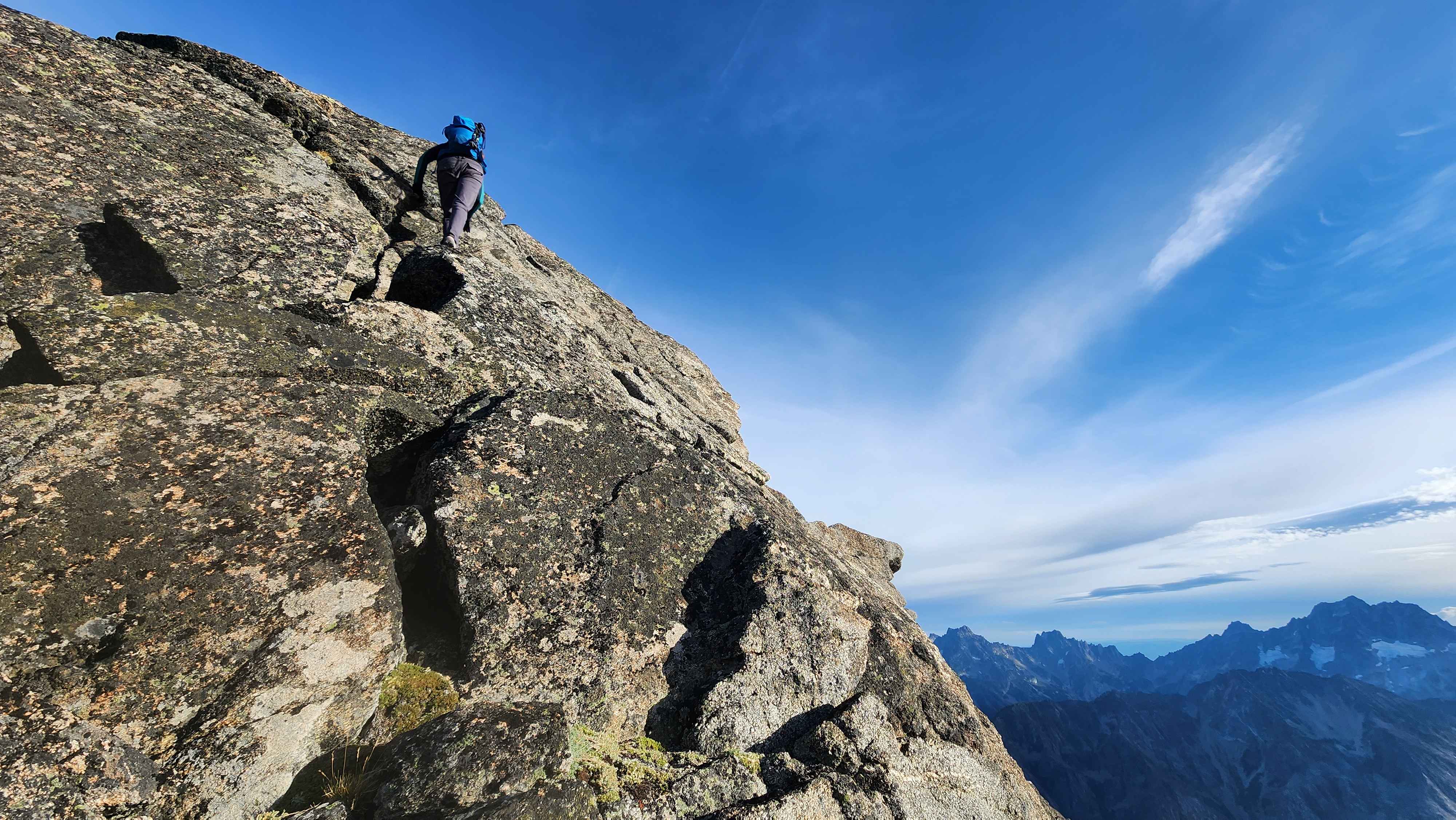
Climbing across an exposed ledge to get to a better route up
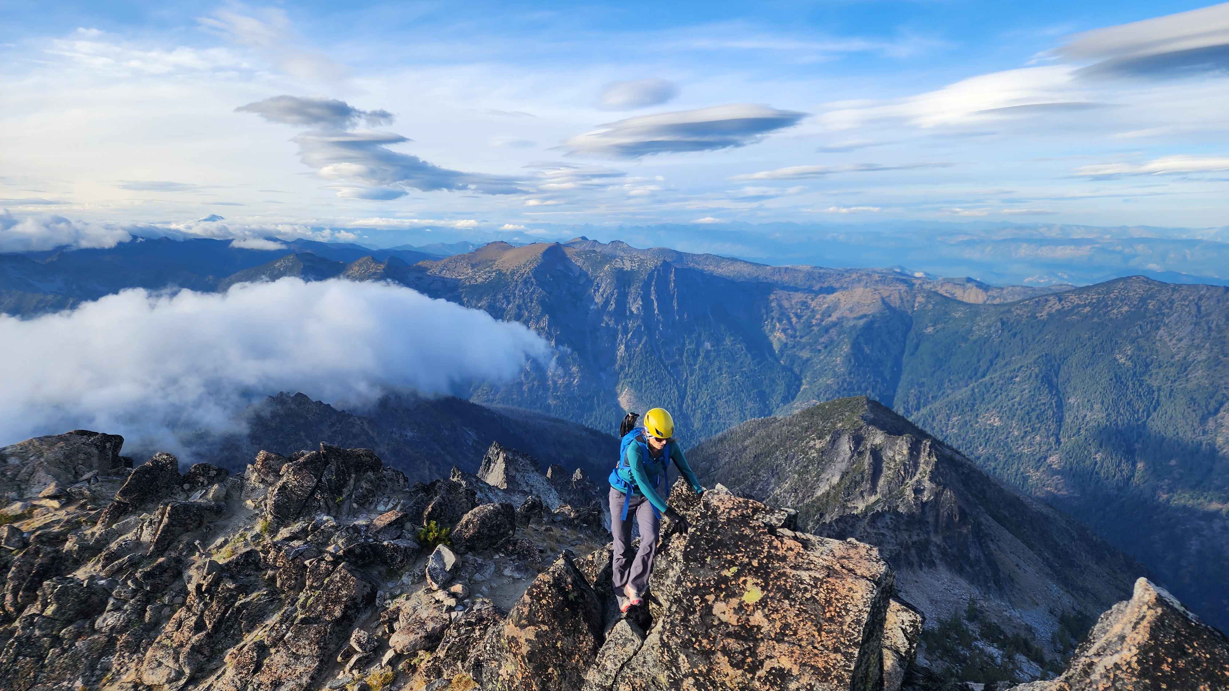
Almost to the summit
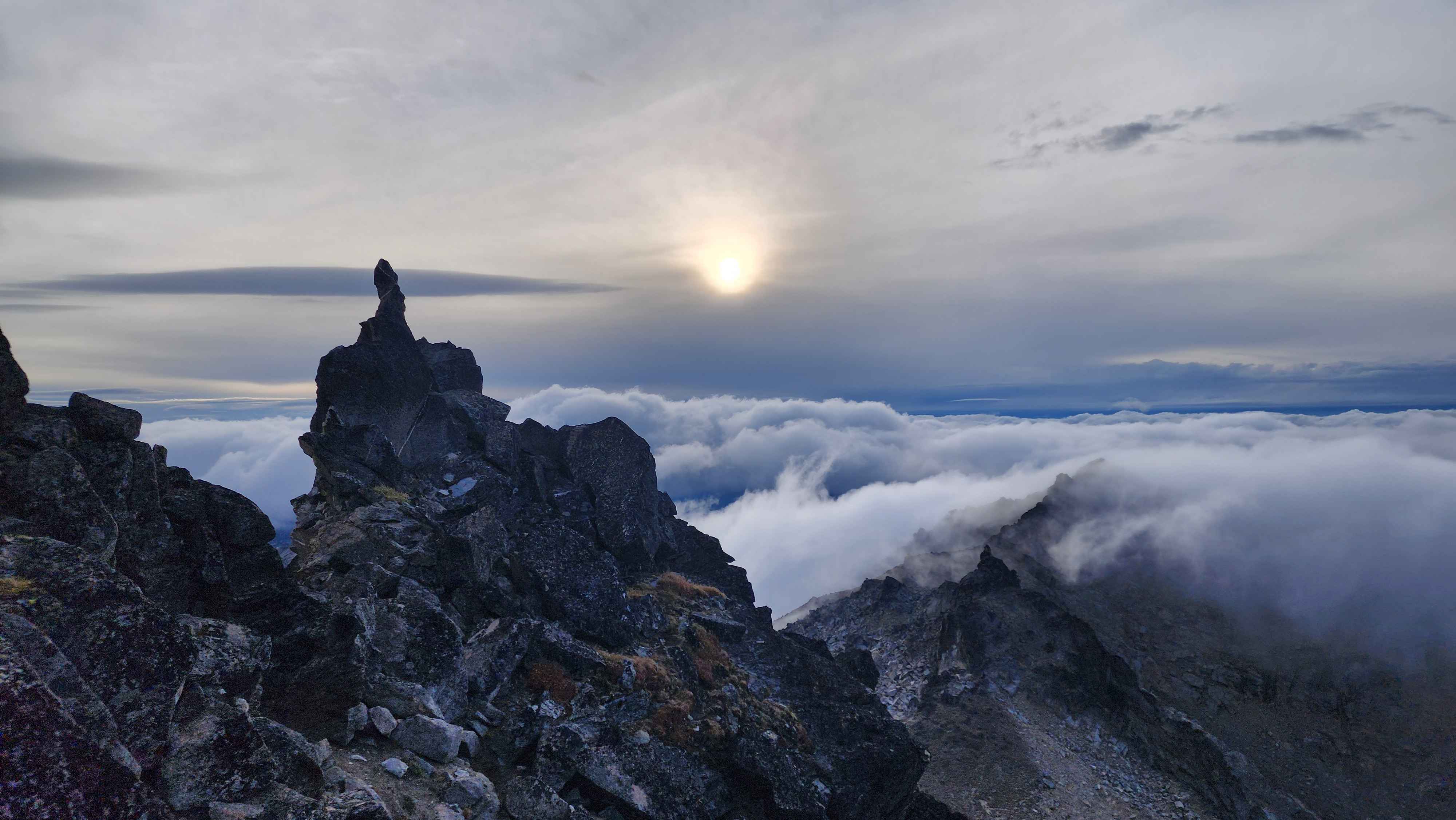
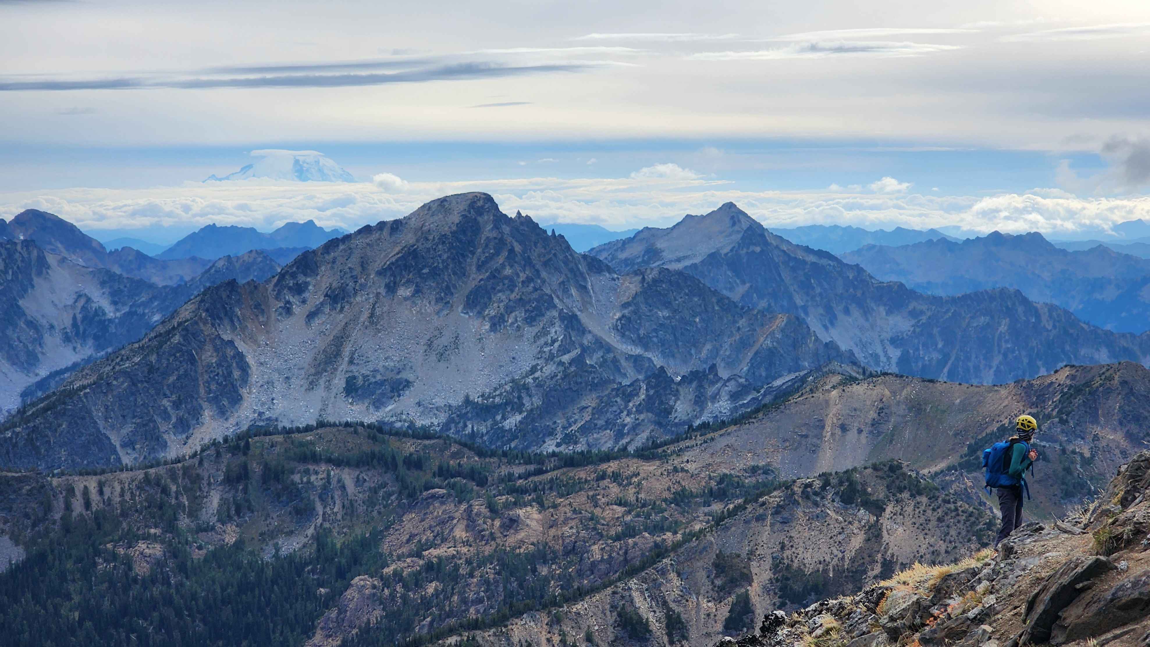
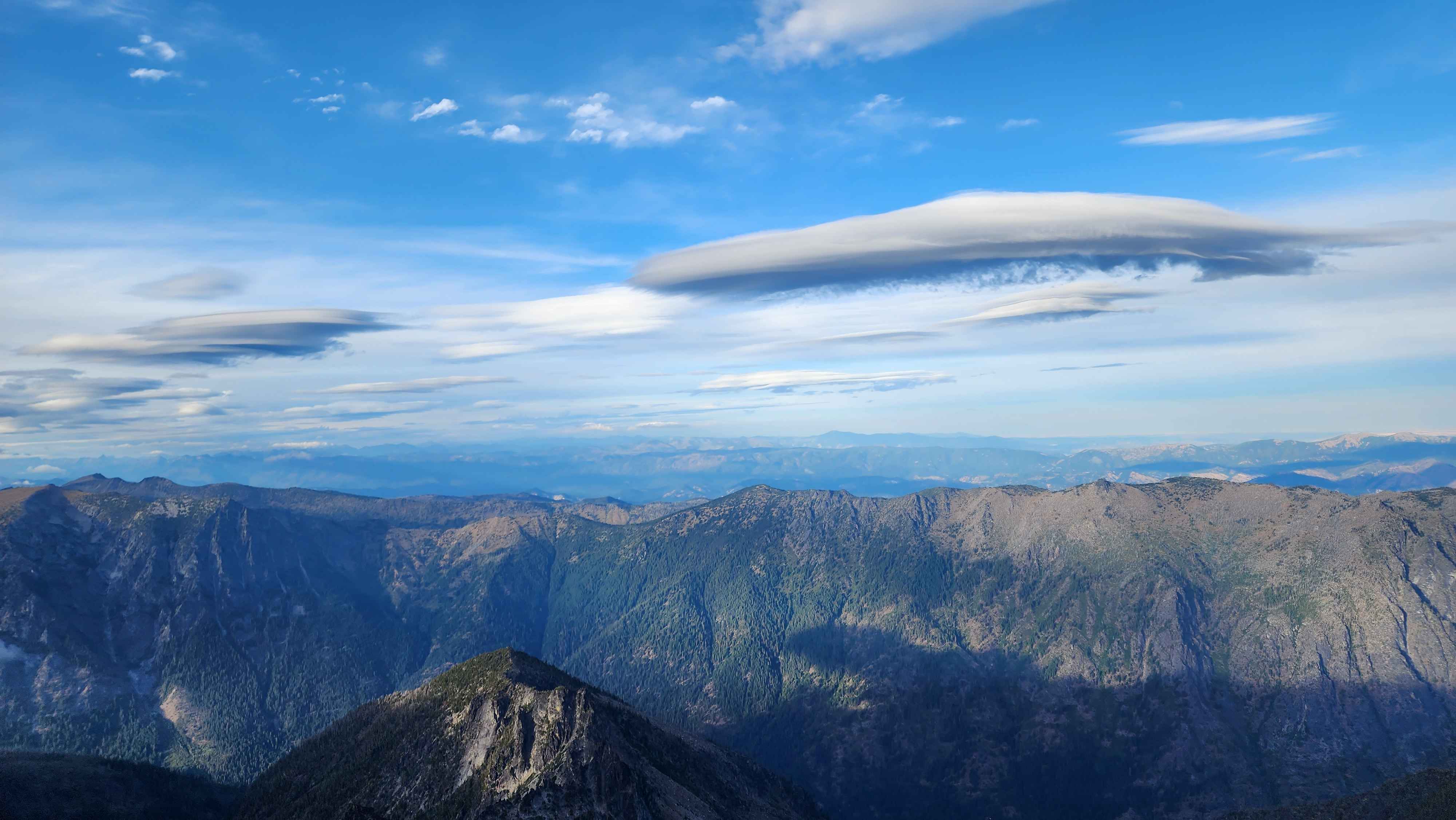
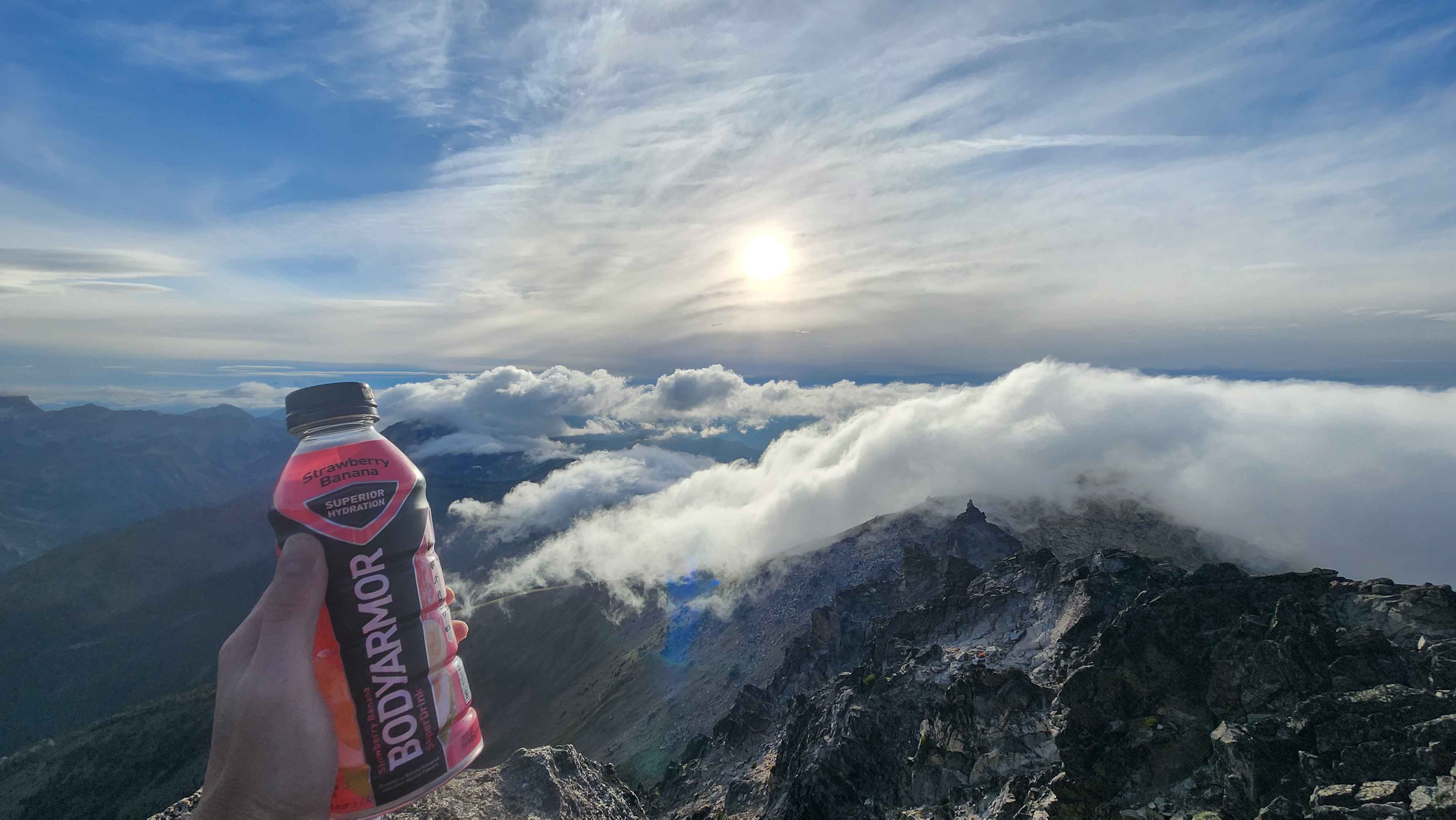
After climbing for longer than we expected, we made it to the summit. The views were very cool with the clouds that day. It kept looking like a cloud was going to hit us, but it never did. We snapped some photos and went back down the same way we went up the summit block (except we skipped the 5.4 part).
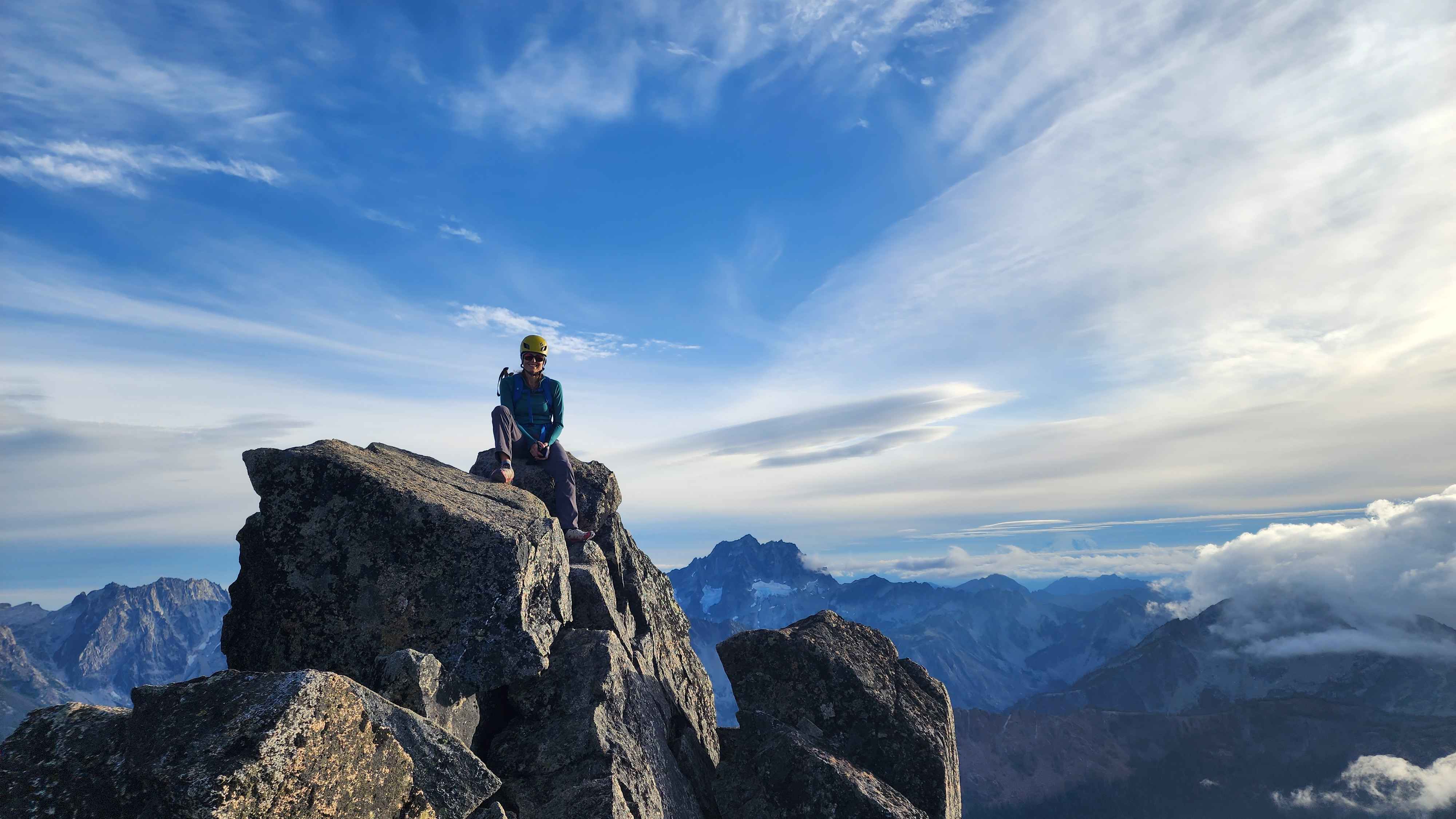
On the summit
The view at the summit
The clouds that looked very close to us
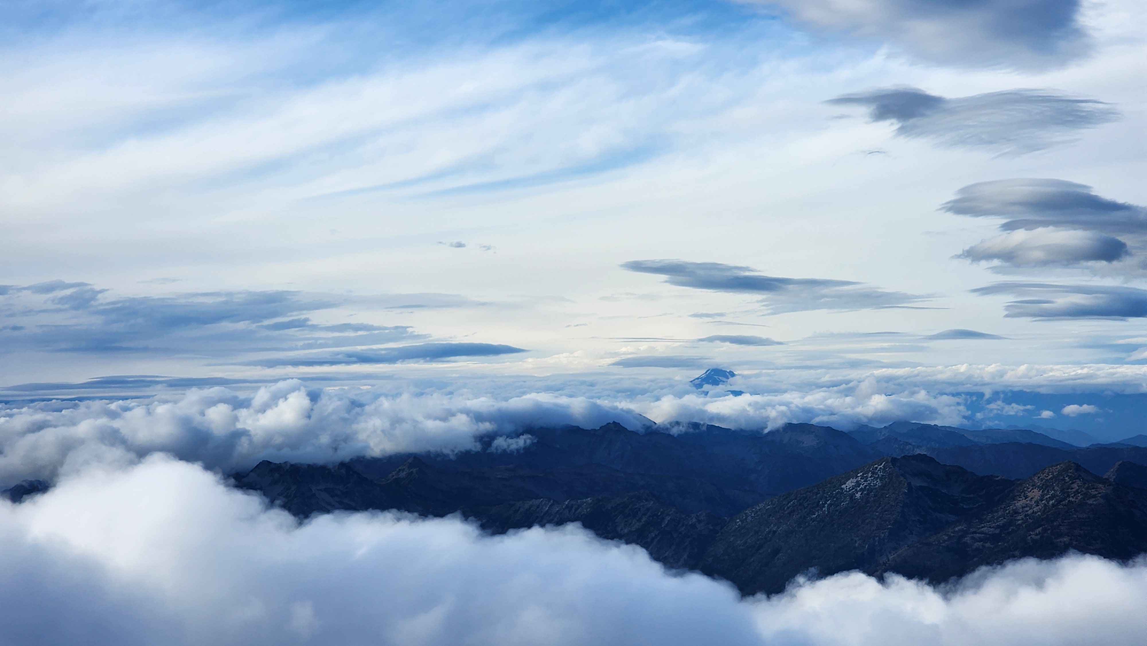
The crazy cloud blanket
We took the meadow route down, which was way shorter than the ridge. However, I wouldn’t recommend going up this way since it was way less interesting, and there was a bit of bushwacking. Going down this way was great way to save some time.

Heading down off the summit block
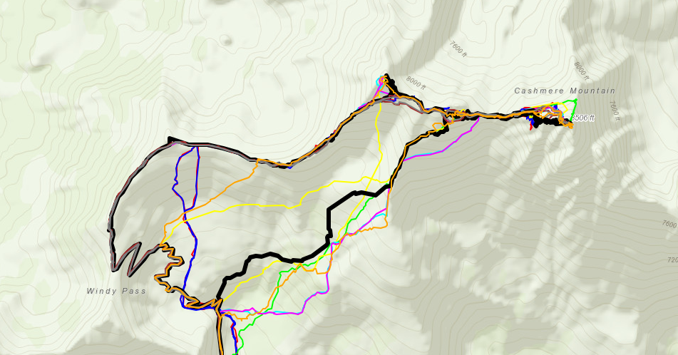
Our route down the meadows in black, with several other people's routes down in the other colors
Using the short trail to get further down the meadows before turning off