My Trip Info:
Total Ascent: 4977ft (1517m)
Net: 4116ft (1255m)
Loss: 861ft (262m)
Start Ele: 1889ft (575m)
Max Ele: 6005ft (1831m)
Distance: 13.4mi (21.6km)
Total Time: 6h 47m
Ascent: 3h 32m
Descent: 2h 53m
Time at Summit: 22m
Start Time: 13:32
End Time: 20:19
Sunset: 19:40
Equipment Used:
Helmet
Poles
Headlamp
Water Filter
Group Size: 1 (Solo)
Mountain Info:
Mount Forgotten:
Major Summits in Washington State: #140
High Summits in Washington State: N/A
Prominent Summits in Washington State: #69
Elevation: 6005ft (1831m)
Prom: 2725ft (830m)
Key Col: 3280ft (1000m)
Peak 5396:
Elevation: 5396ft (1645m)
Prom: 236ft (72m)
Key Col: 5160ft (1573m)
I got to the trailhead at 13:32, continuing my series of afternoon peak bags. The trail started out going north along the road to the valley. The trail then turned up the valley and started gaining a bit of elevation. The entire first part to the falls was very underwhelming, but there were some good views of the nearby mountains from the valley.
I filtered water at the falls and started climbing the switchbacks. The trail was very defined the whole way so there were no route-finding challenges.

The upper part of the falls
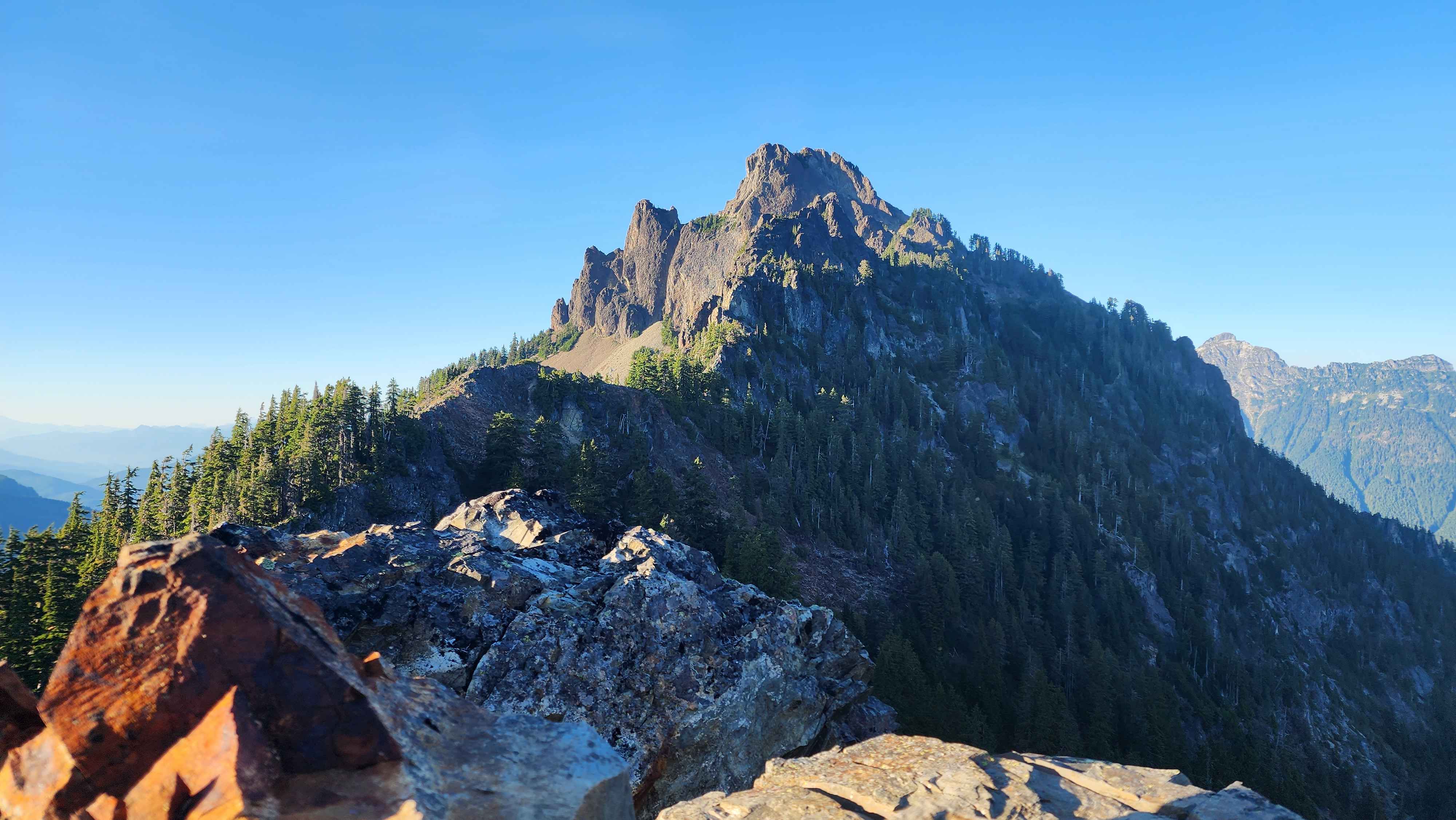
After the switchbacks the area opened up and provided some good views of the surroundings and Mount Forgotten.

Photo from the open area

Photo of Glacier Peak

Mount Forgotten to the far right with Baker in the distance
There was a small tarn in this area which I appointed as my emergency water spot. I then continued past Peak 5396 and down the climbers trail for Mount Forgotten. The trail dropped me down a hundred feet or so into the top of the gully. There was a cool lookout point on some rocks that I walked out to on the way down.
View of Forgotten from the lookout

The lookout to the left on the flat rock

The small tarn
The trail was not the best in this section, being a little scrambly, but it was completely fine. The trail then continued up the southeast side of Forgotten until the plateau to the east of the summit. The trail had some overgrown spots, but there was no route finding at all.

Wildflowers in bloom

The meadows full of ripe blueberries along this section of the trail
At the plateau the trail turned to go up the mountain. At the plateau there was a larger tarn than the first one, which ended up being a much better place to filter water from on the way down than the other tarn. There was no real scrambling on the trail to summit besides the gravel and dirt chute. The chute was barely even class 2, so it was not an issue at all.

The chute

The plateau with the large tarn down below

The trail going up the mountain side
The summit had much better views than I expected. Many of the other major summits of the Mountain Loop Highway could be seen, such as Pugh, Glacier, and Sloan. I could also see Baker clearly in the distance.

At the summit

Mt Baker in the distance

Mt Pugh to the right and White Chuck Mountain to the left

Sloan Peak to the far left
The summit block had three distinct peaks: the east peak (the main summit), the middle peak, and the west peak. The east peak was the main one that the trail went to. The middle peak was not far away but required a small, exposed class 3 scramble to get to. The south side was a cliff, and the north side was a slightly smaller cliff, which made the scramble a bit scary. This was the only section I felt the need to put my helmet on for. The west peak was visibly lower than the other two, so I didn’t bother with it. I’m not sure if the middle or east peak is the true summit, but I’d like to think it’s the middle since it’s a bit harder to get to.

Standing on the east peak with the middle peak right in front with the west peak hidden behind
The way down was just as easy to navigate as the way up. I stopped by a few lookouts I pasted on the way up and went up to Peak 5396, which was an extra 150ft of ascent or so. I ended up walking in the dark for the last section that’s outside of the valley. There were lots of large frogs on the trail in the dark which was crazy.

Photo next to the summit I got on the way down
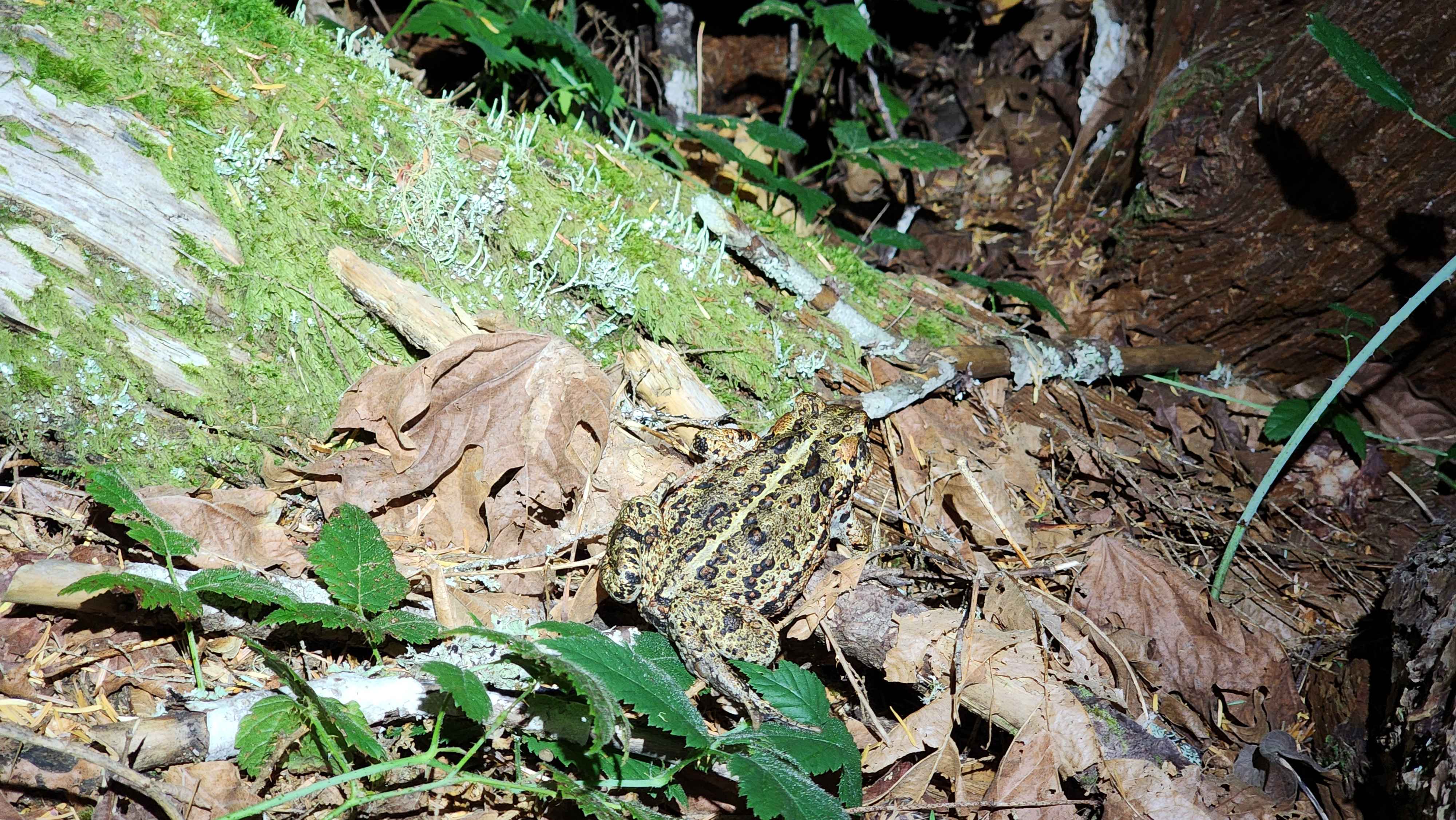
One of the large frogs

Photo of Forgotten from Peak 5396