After summiting
Mt Stuart, Fernow became our next big summit objective. We weren’t planning on doing another big summit this year, but after discussing climbing Maude, we decided to go for Fernow too, since it’s in the same area. We never ended up summiting Maude as we were too tired the third day after summiting Fernow.
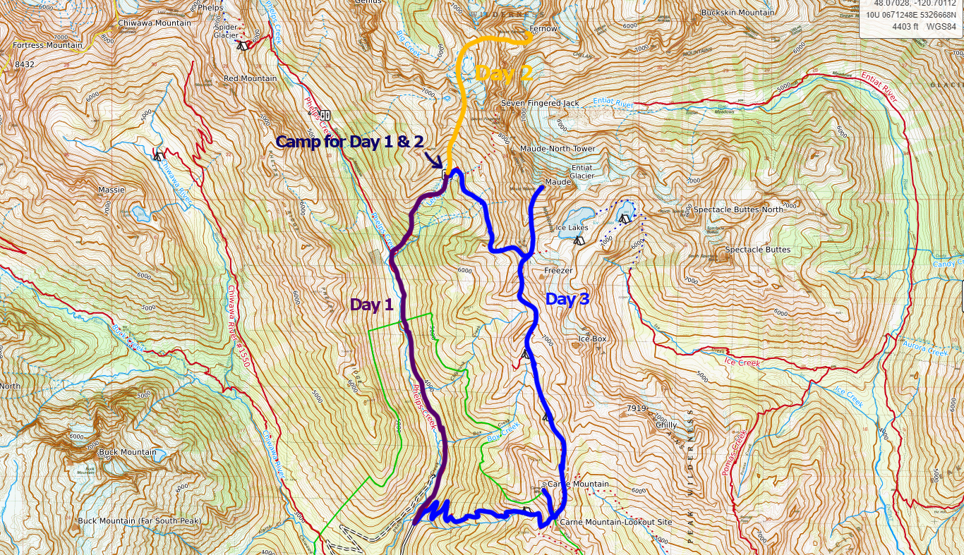
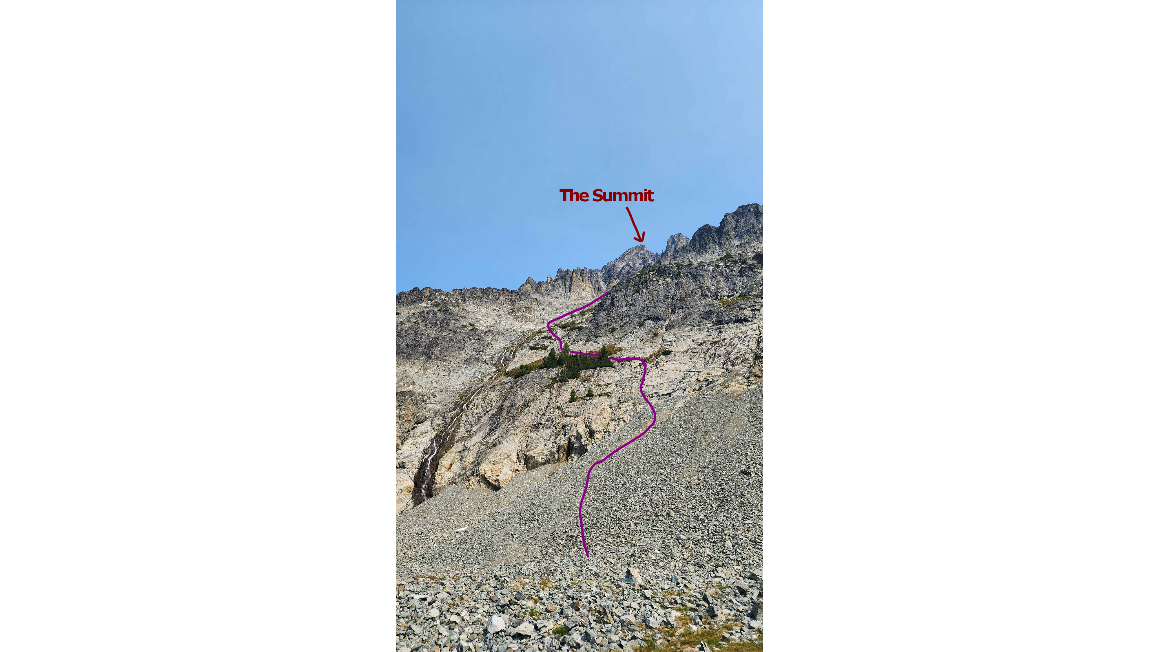
The original plan (the final route is at the top of the page)
We got to the trailhead an hour or so before dark at 18:02. We then did the unremarkable approach to the base camp. The trail was well maintained, except for a few sections with small pokey trees overgrown onto the trail. The day still clocked in at 2.7k ft of ascent, which was something. The only thing to note was the large waterfall visible from the switchbacks. We got to the base camp (Leroy Creek Camp) at 20:49 and set up our camp in the dark.
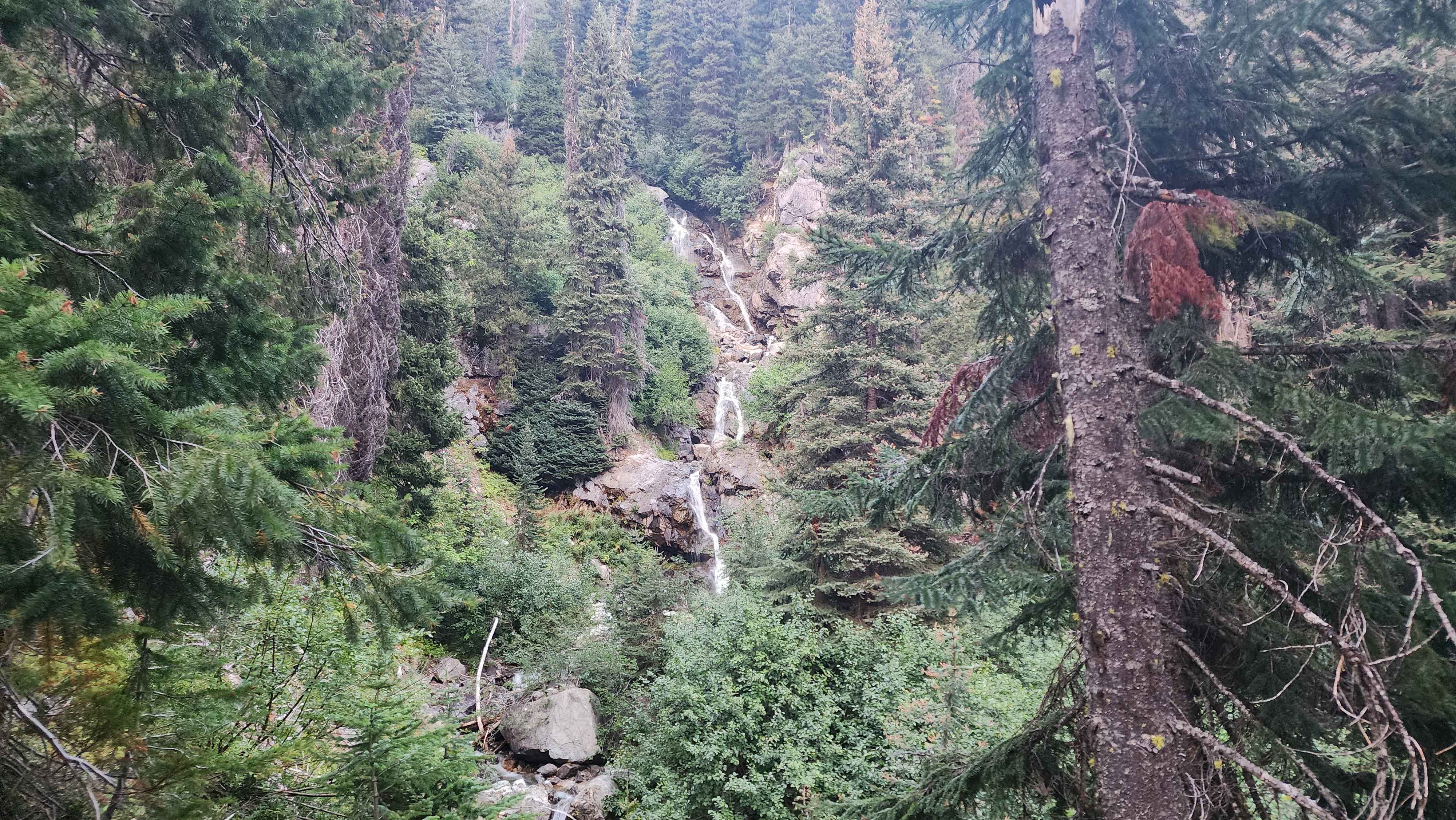
The waterfall
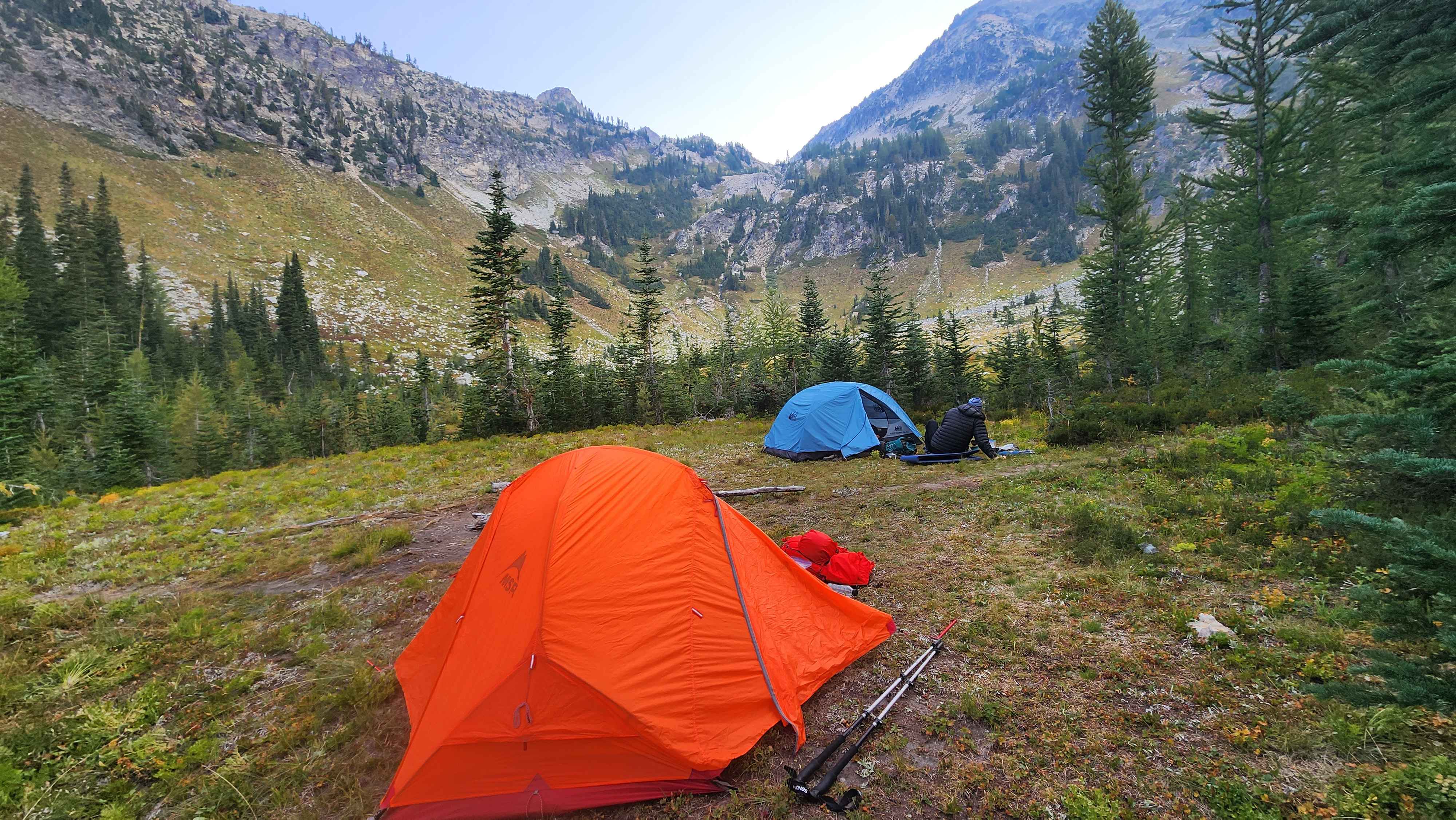
Our camp at Leroy Creek Camp (Fernow base camp) in the morning of the summit day
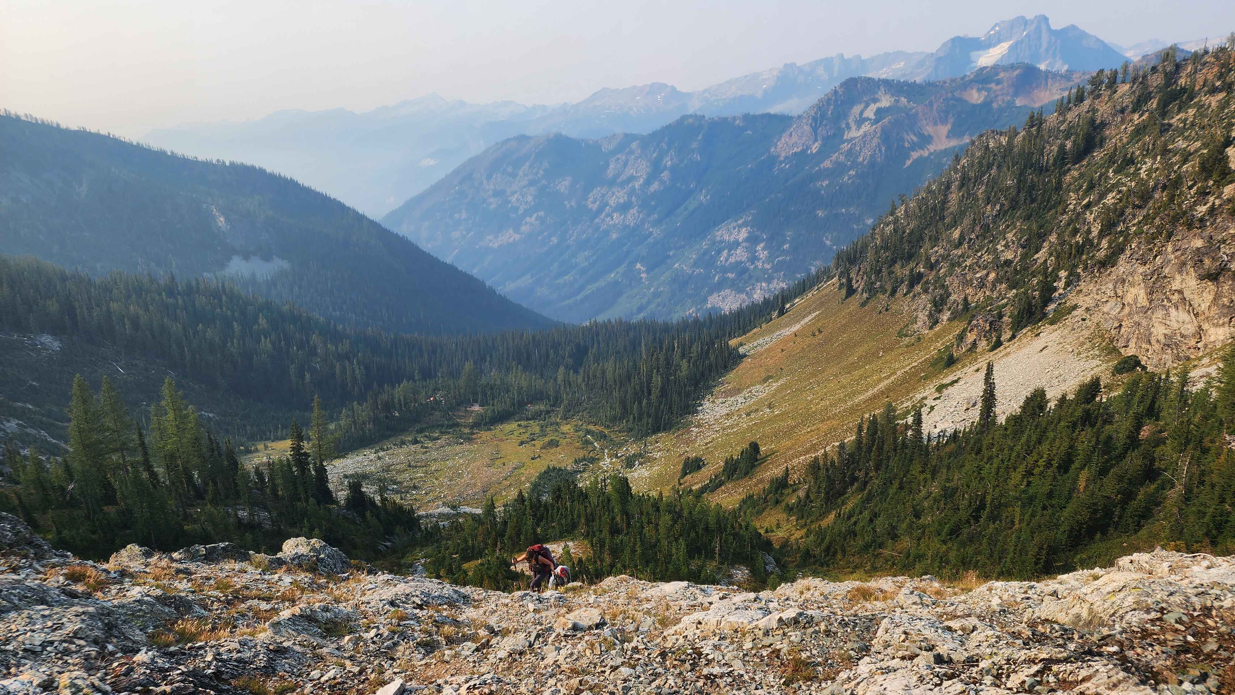
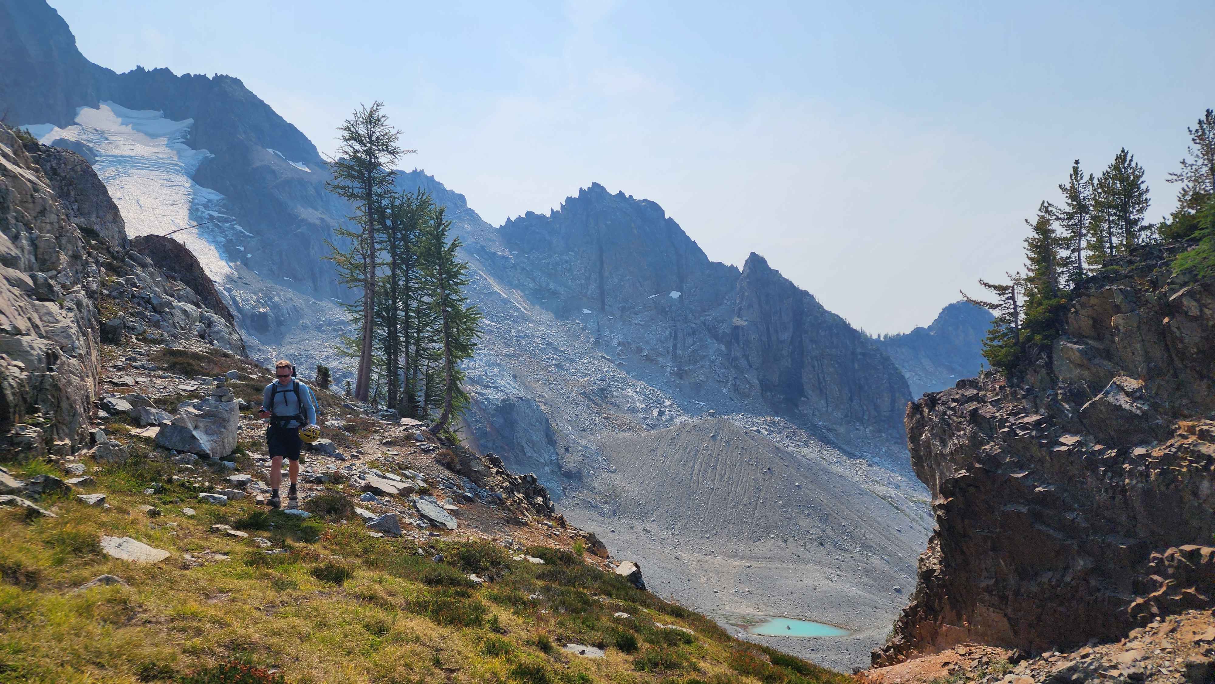
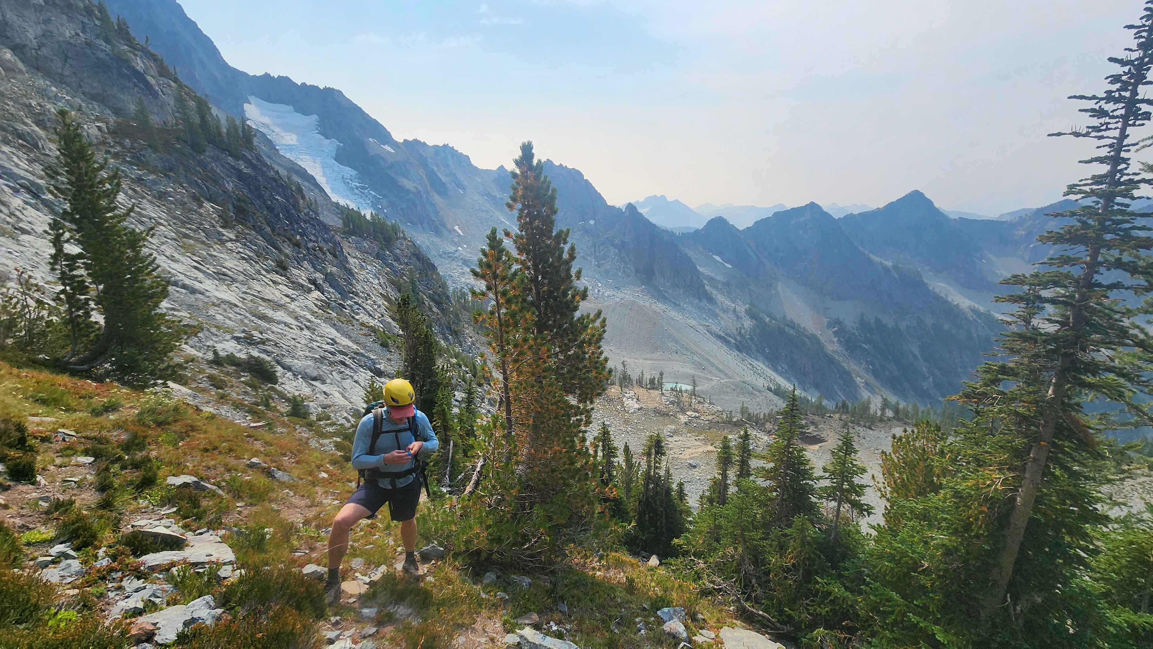
We awoke the next day and started up the ridge at 8:39. The first section of the route goes up out of the valley and onto the ridge next to Seven Fingered Jack. There was loosely a trail through this first section; we started out walking through the grass, which eventually led to a small rock scramble part.
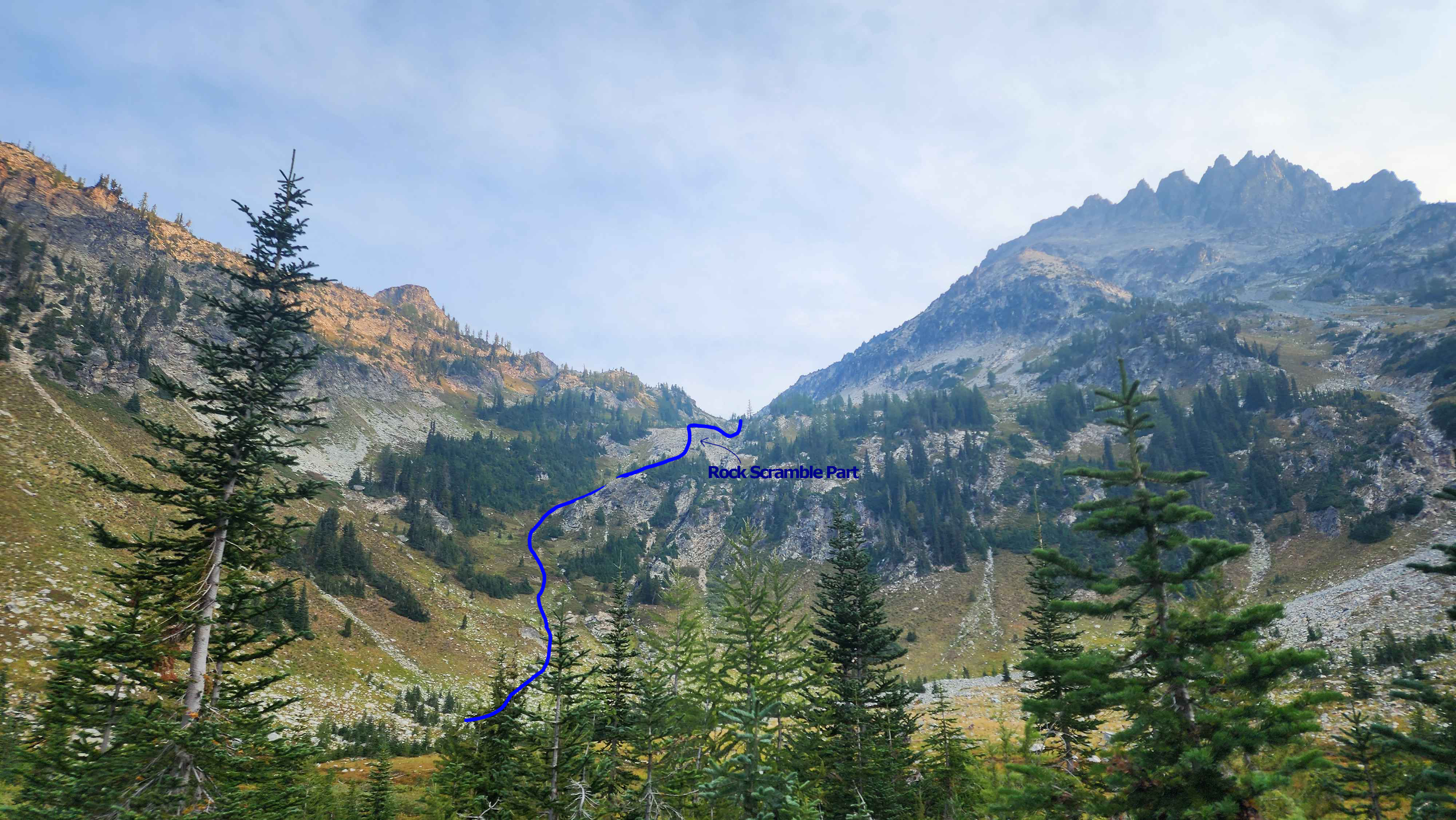
The route up the grass part
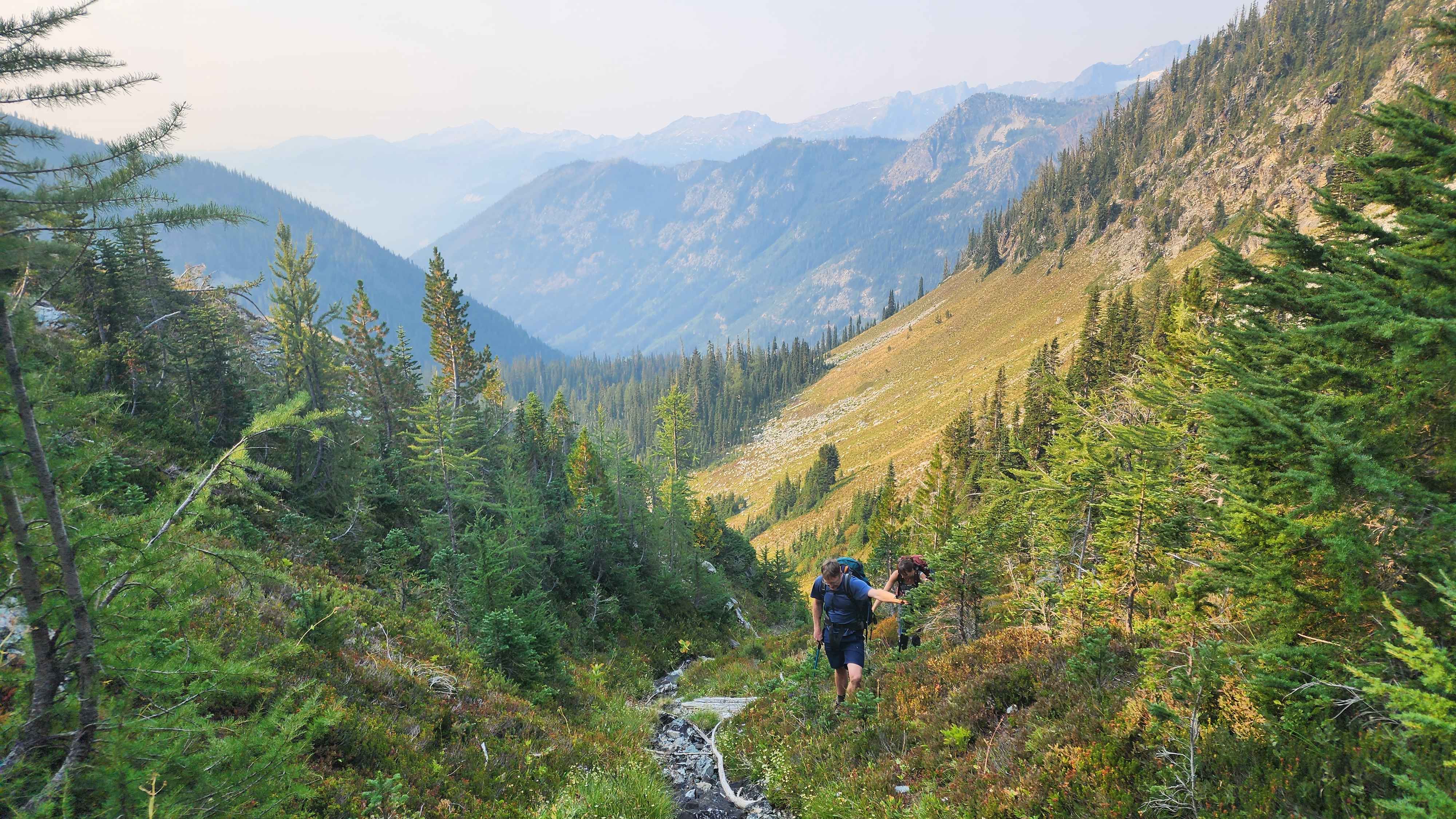
Hiking up the grass part
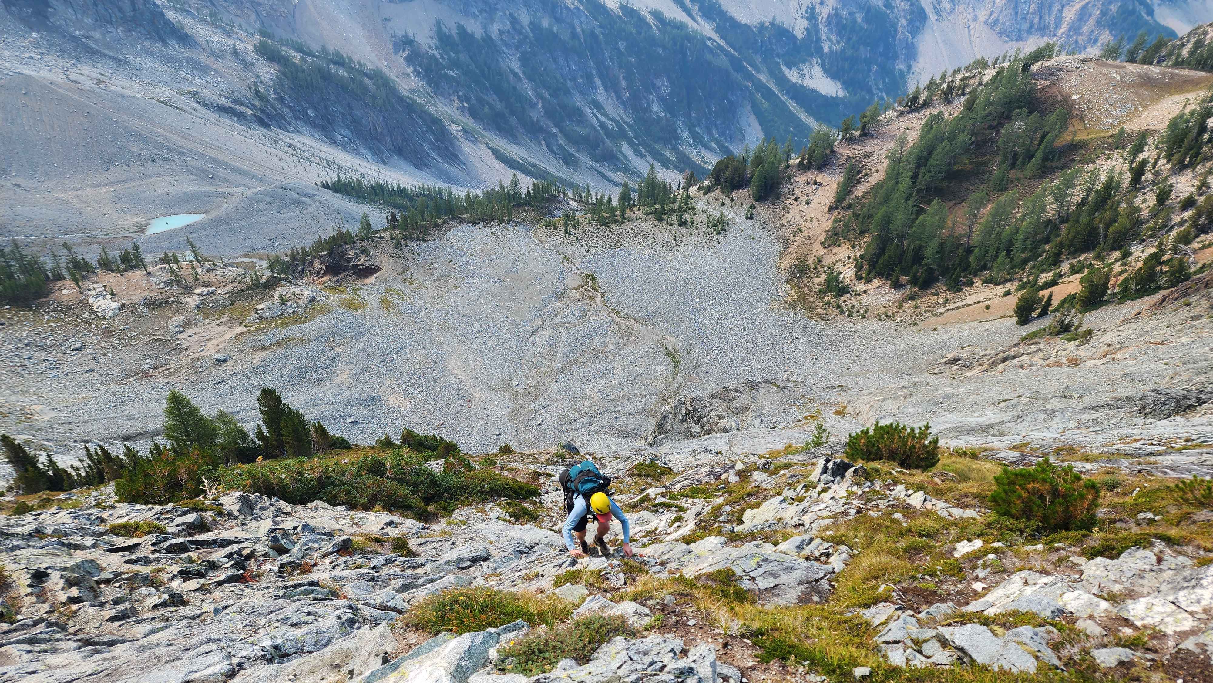
At the top of the rock scramble
The route went through a bit more of the grass section, then eventually led to a rock field. The rock field was a change of pace from the grassy meadows below. The rocks were in fine quality throughout this section; very few were loose, and most were large. There was also a small snowfield sitting below. We went to the wrong part of the ridge and had to walk over to the correct part. There were rock cairns marking the correct route down the ridge, which made it easy to find once we looked for it.
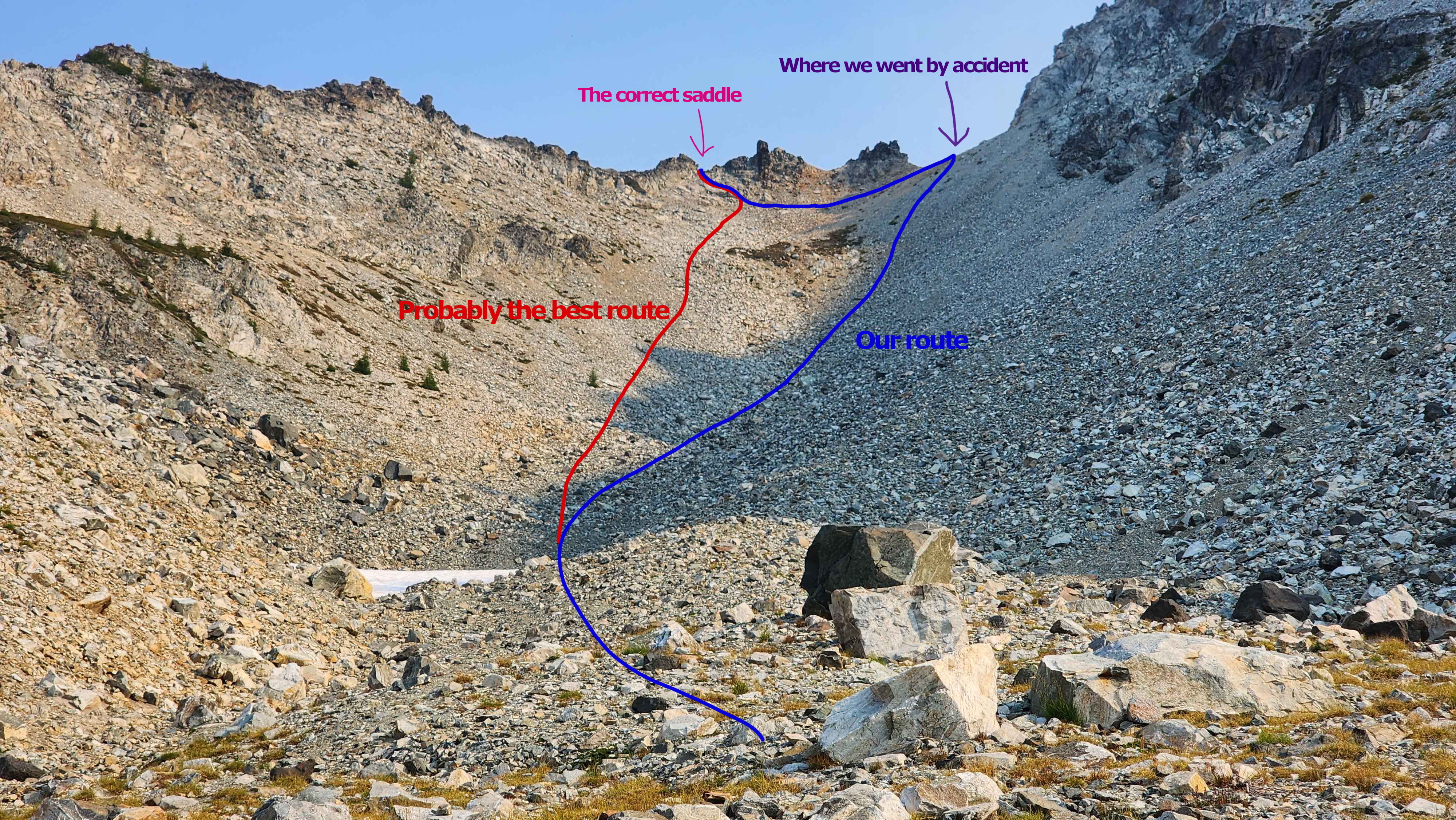
The route up the rock field
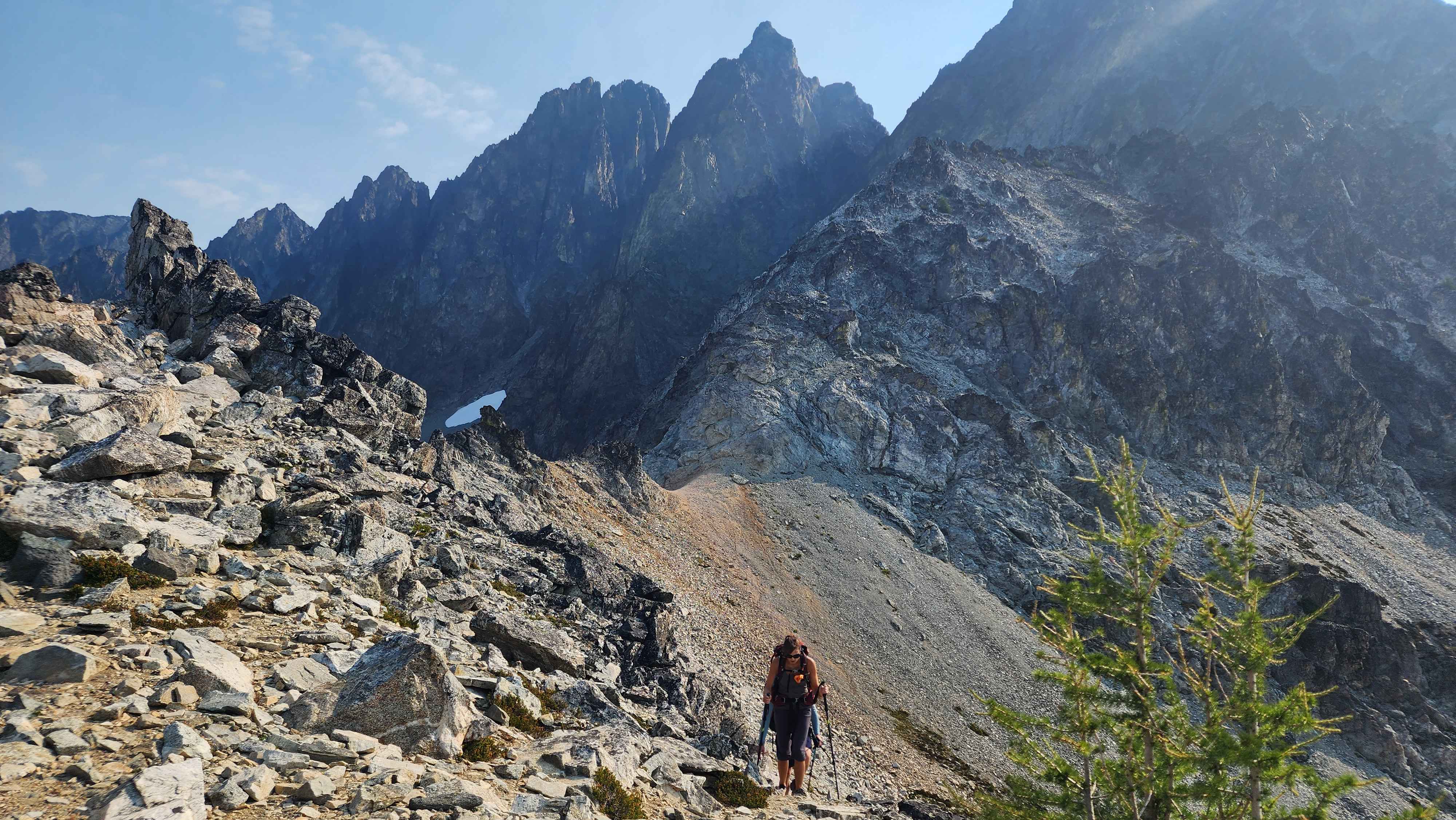
Approaching the correct sadle
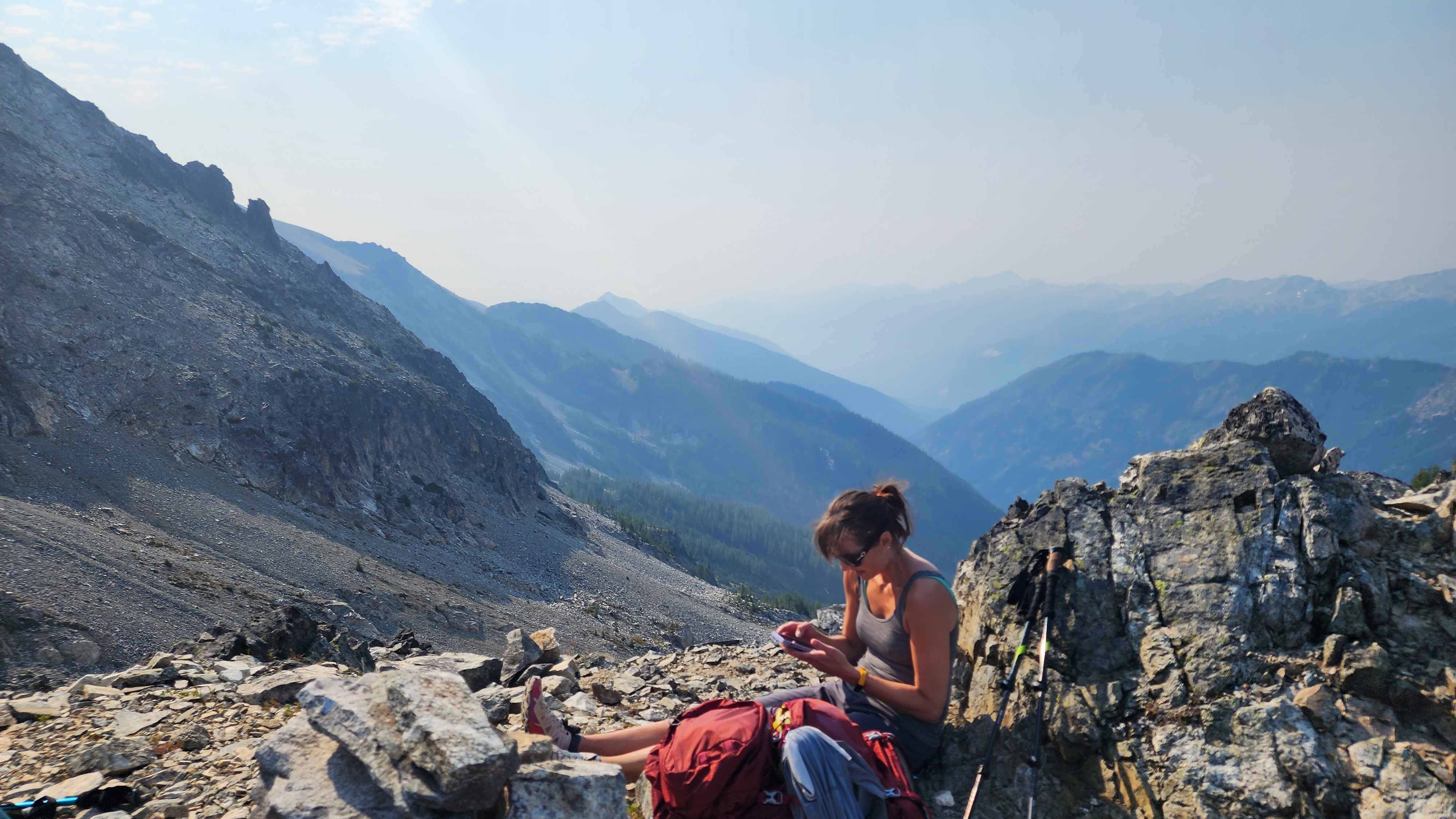
The ridge was the only place on the route with cellphone reception
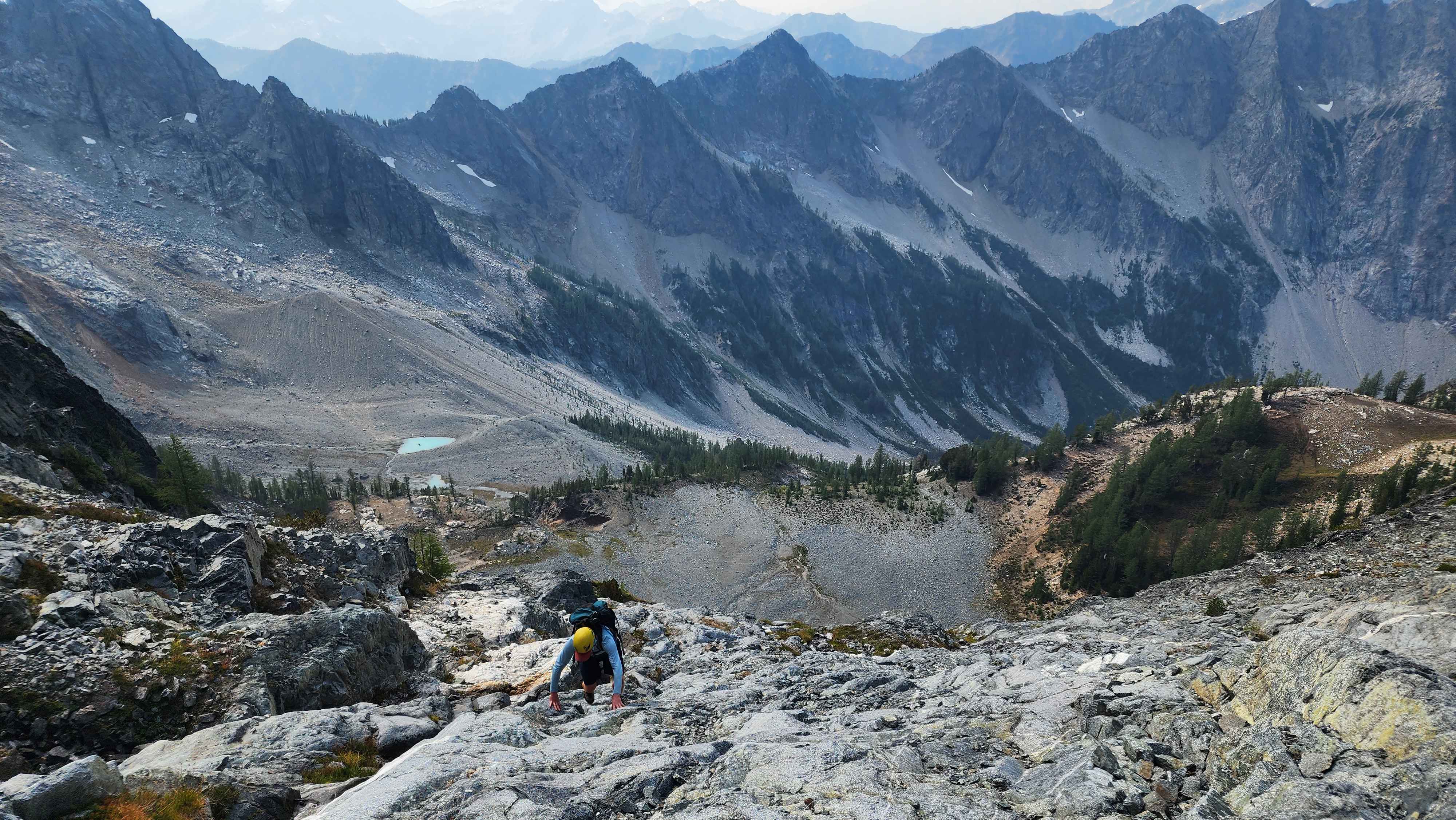
We sat at the ridge for a bit and ate some food. Eventually we decided to head down the route off the ridge. The first section was a scramble down a small rock chute.
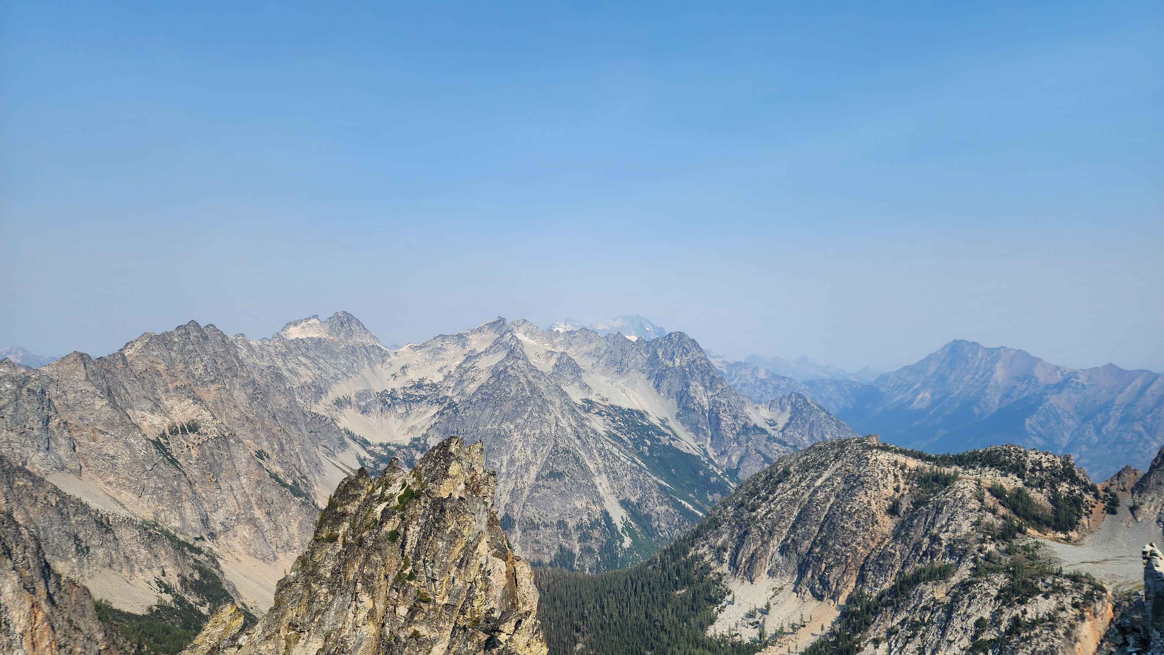
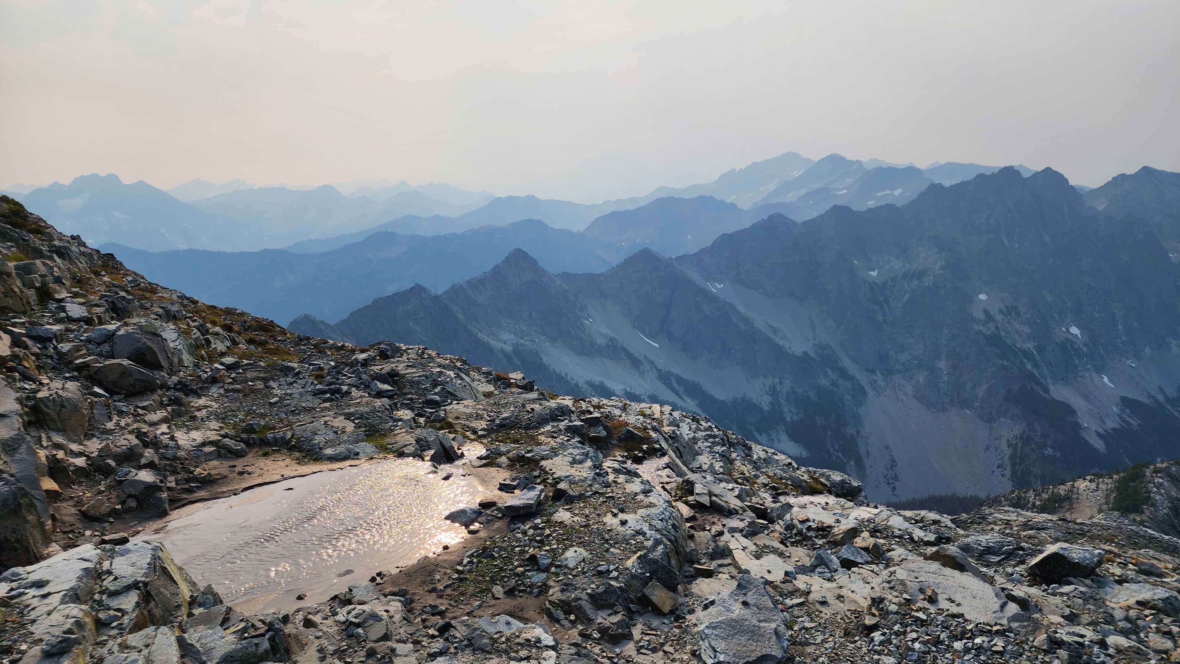
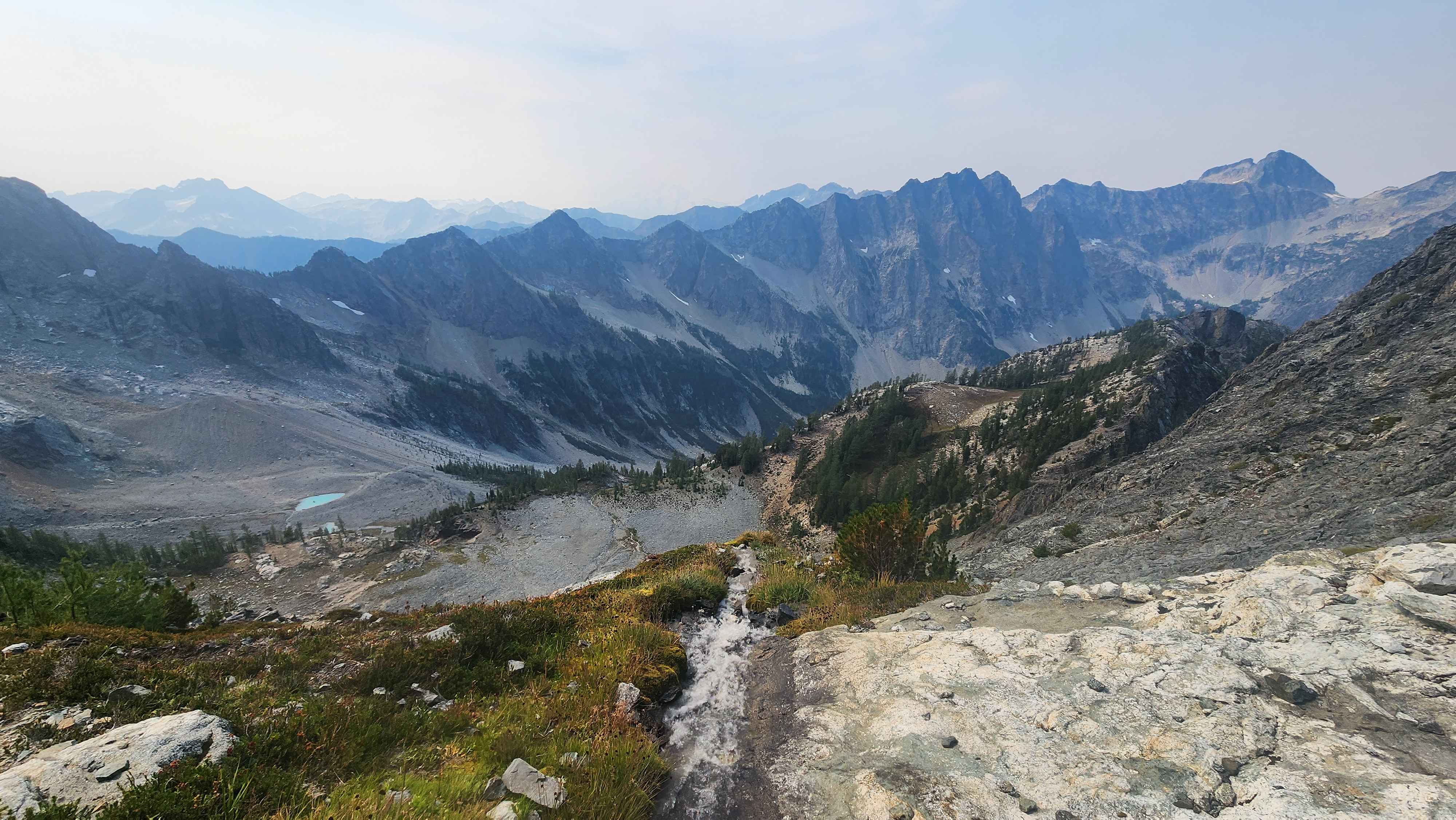
The view on the ridge to the north
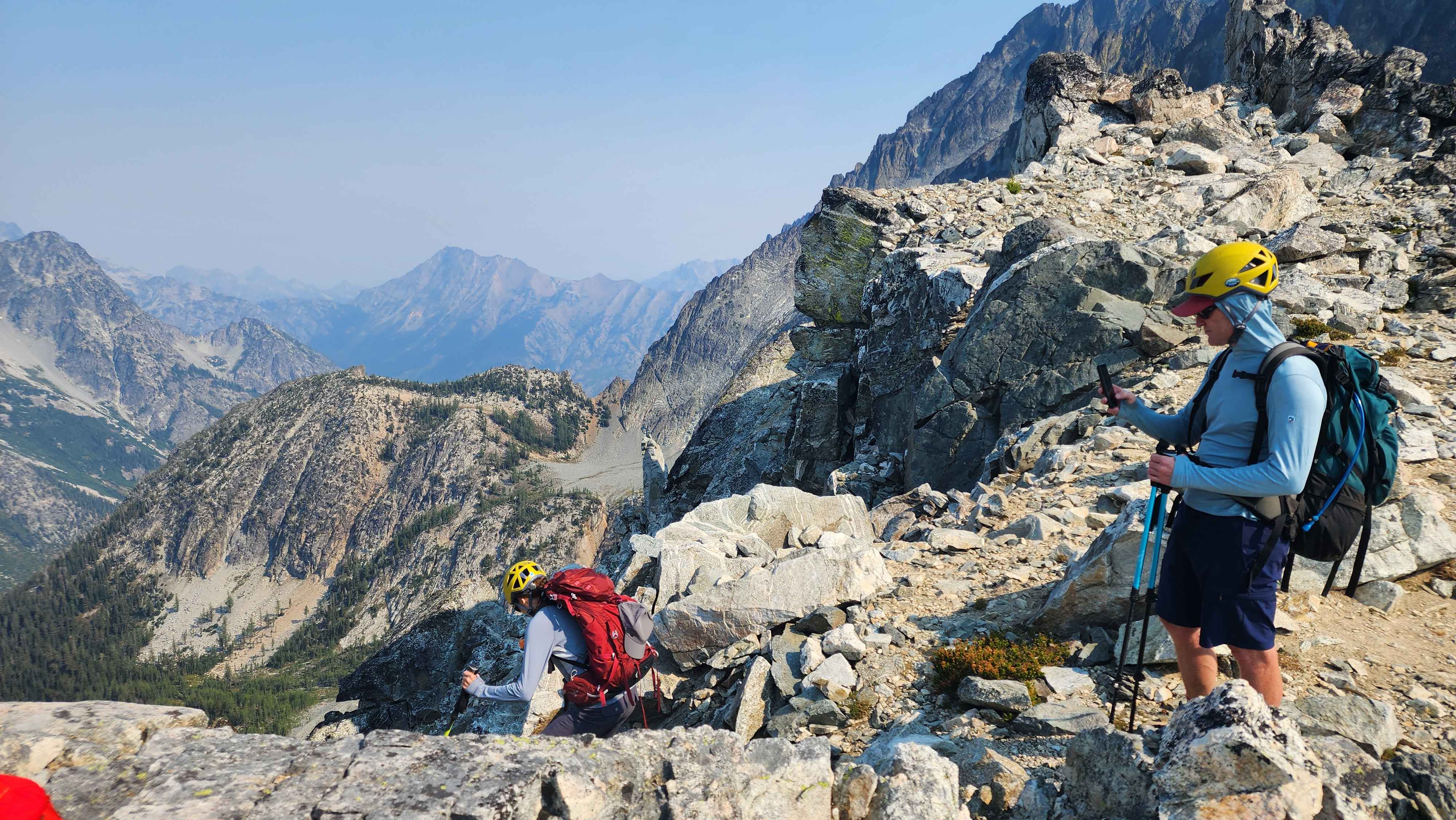
Starting the descent down the rock chute
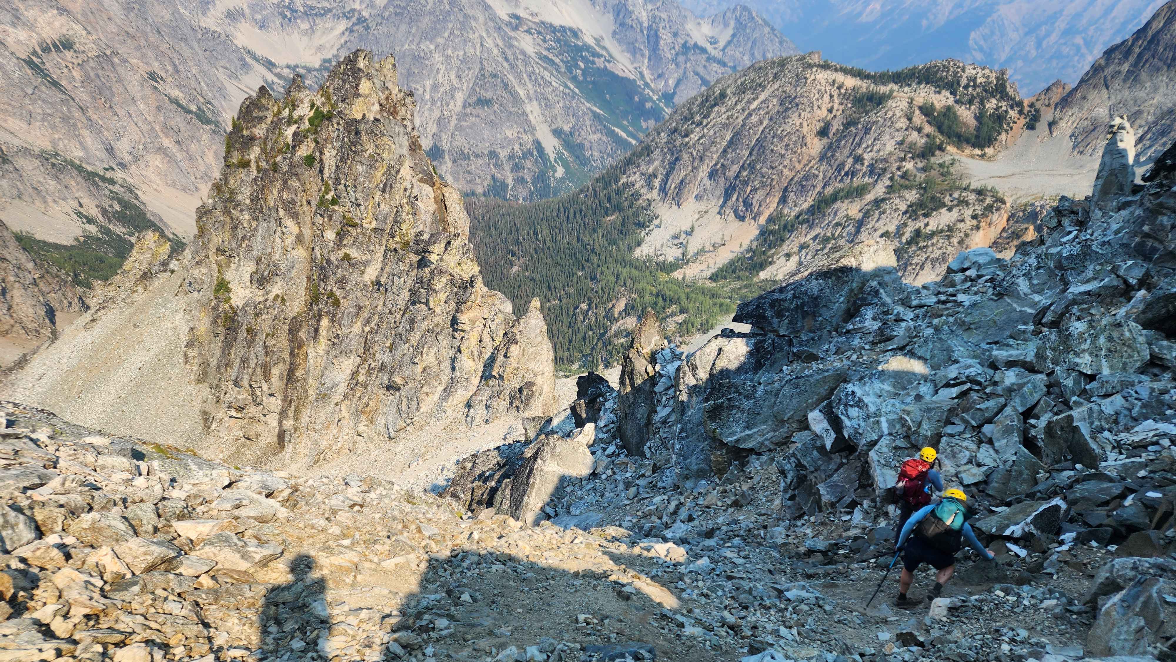
Going down the rock chute
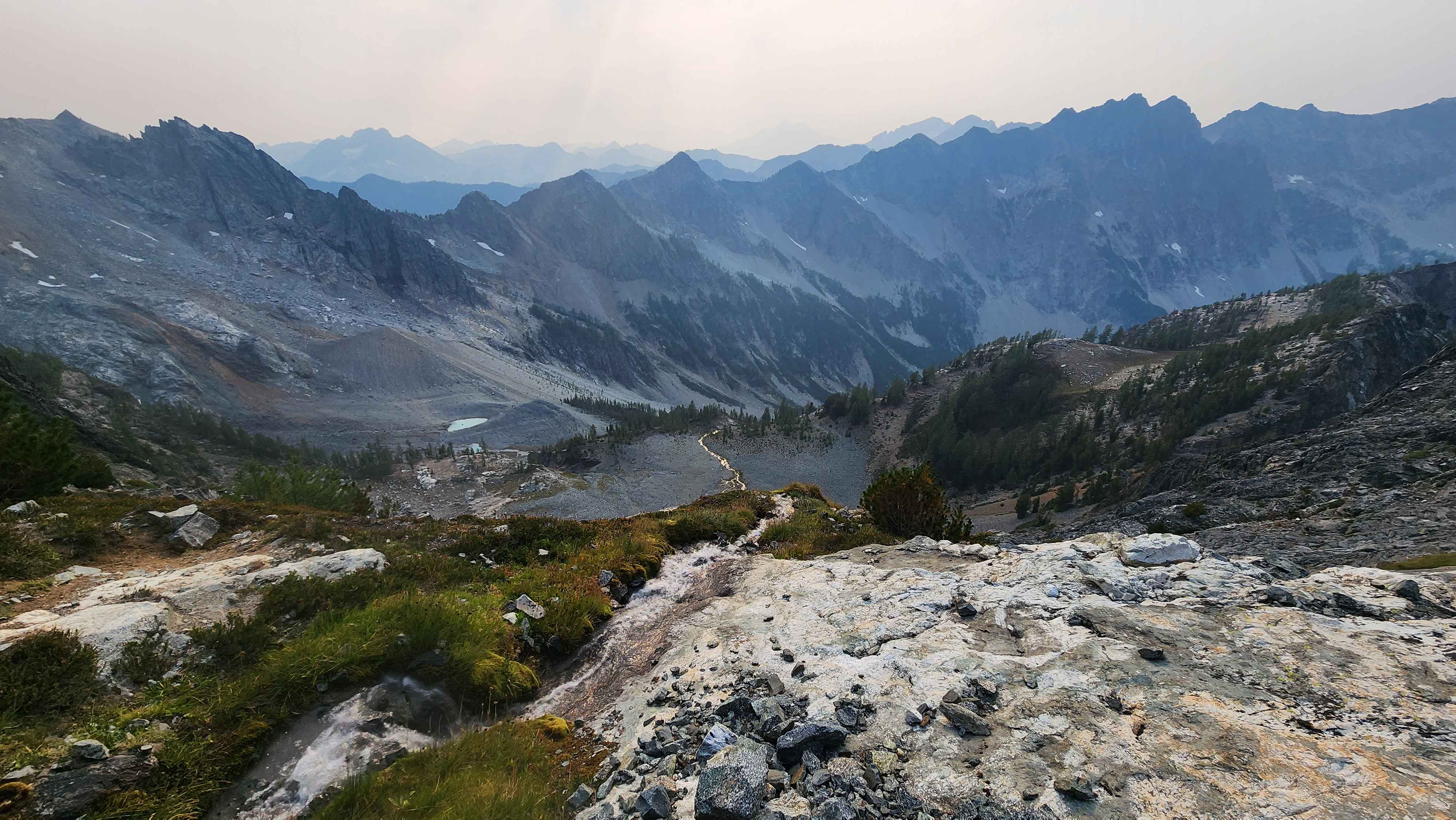
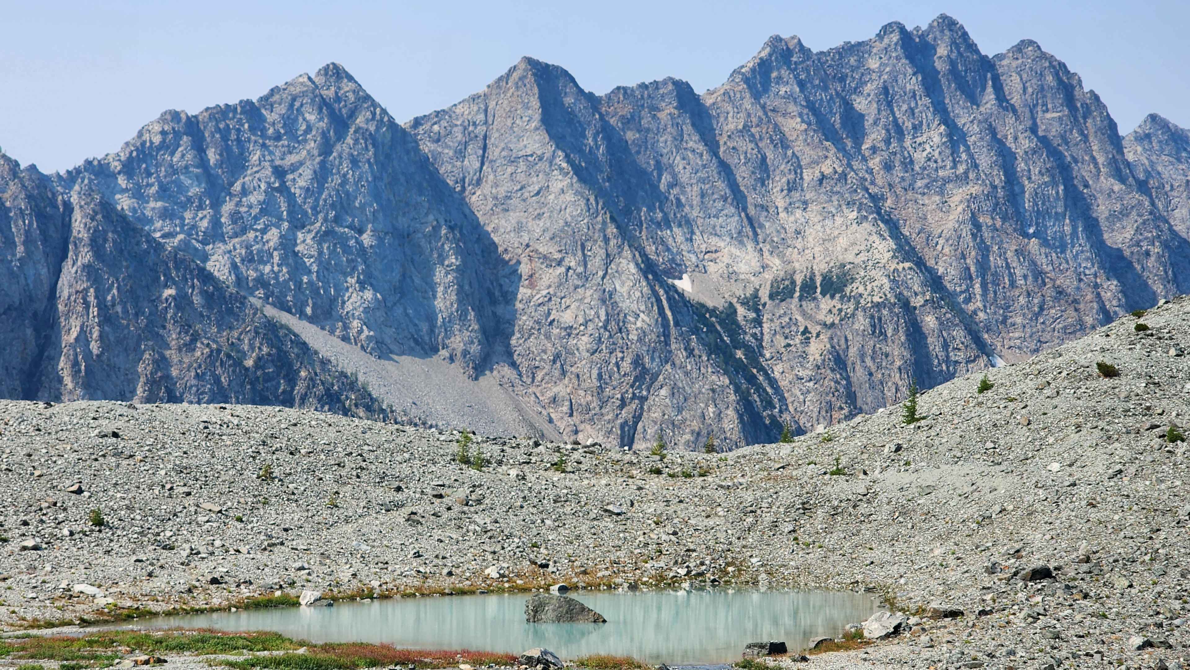
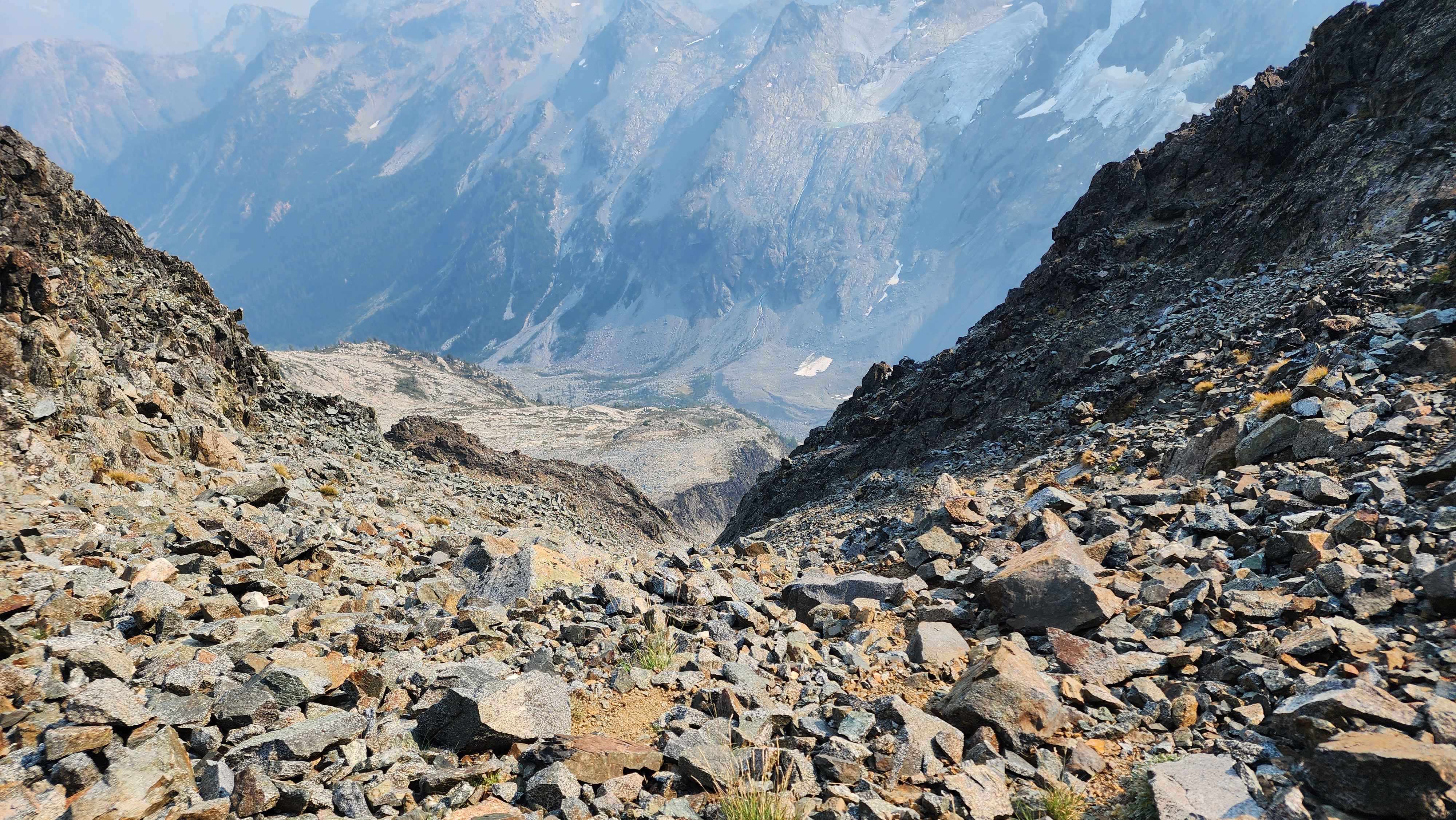
The route quickly turns to the right and goes across the side of the slope to a rock field. This section is marked well with rock cairns up to the rock field. We got a sight of the lake down below; the lake was so blue it looked like it was full of chemicals. I promptly gave it the unofficial name of “Chemical Lake.”
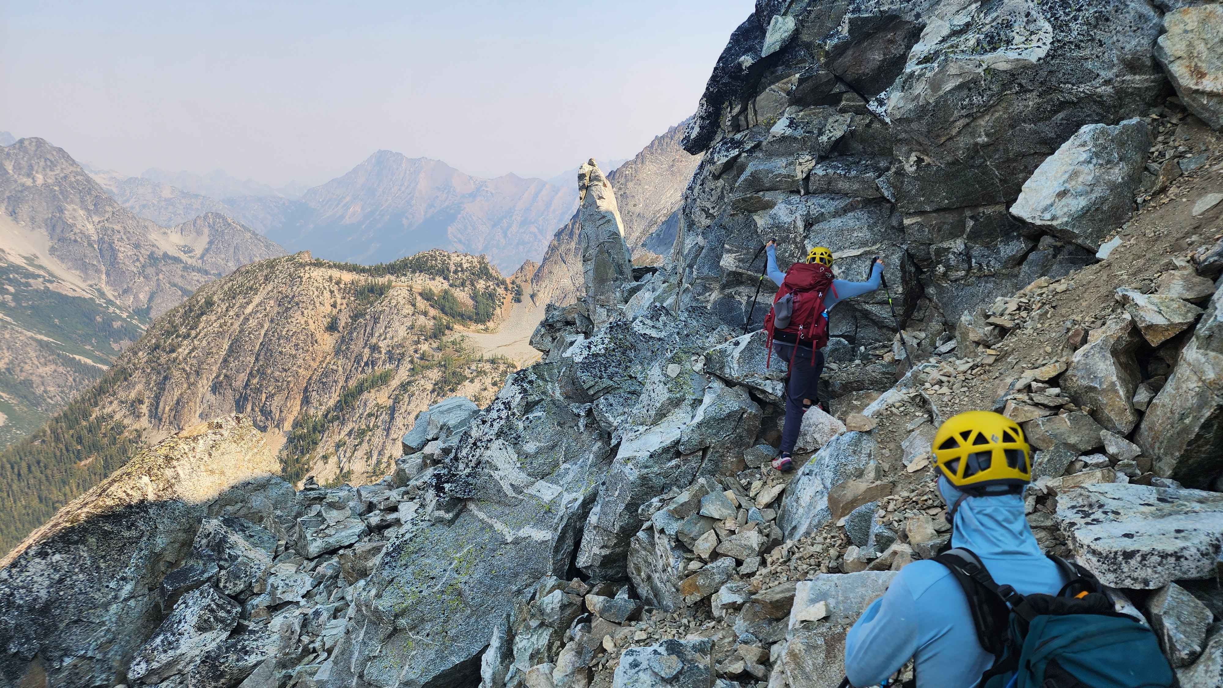
Going across the side of the slope
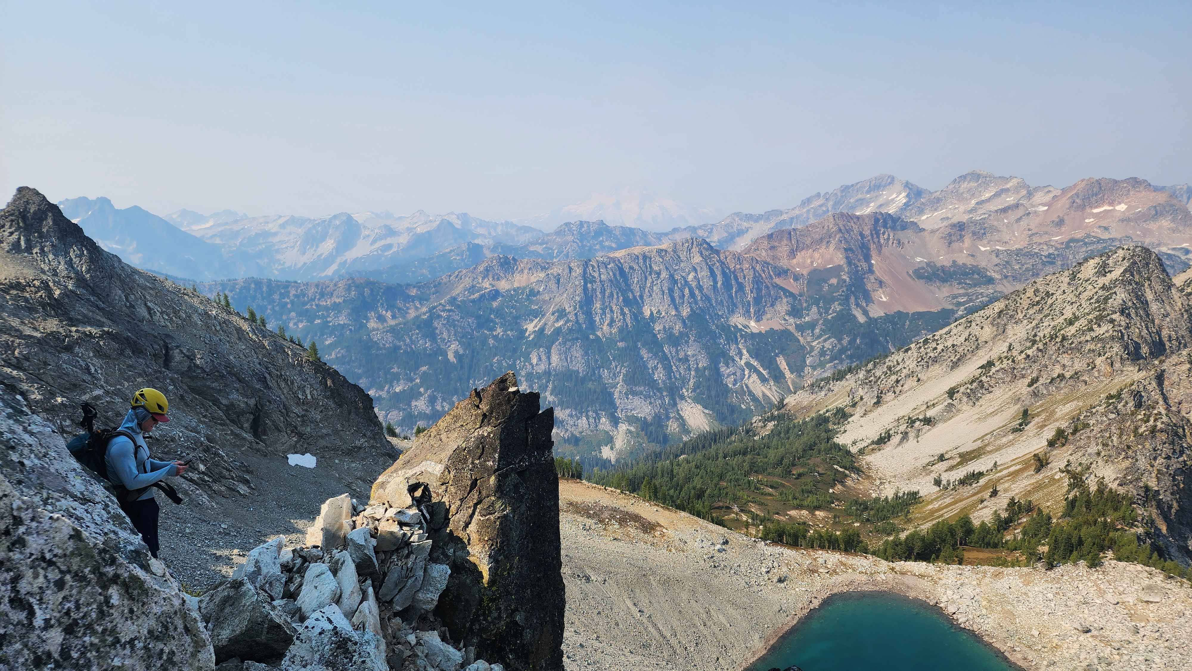
The first glimpse of Chemical Lake
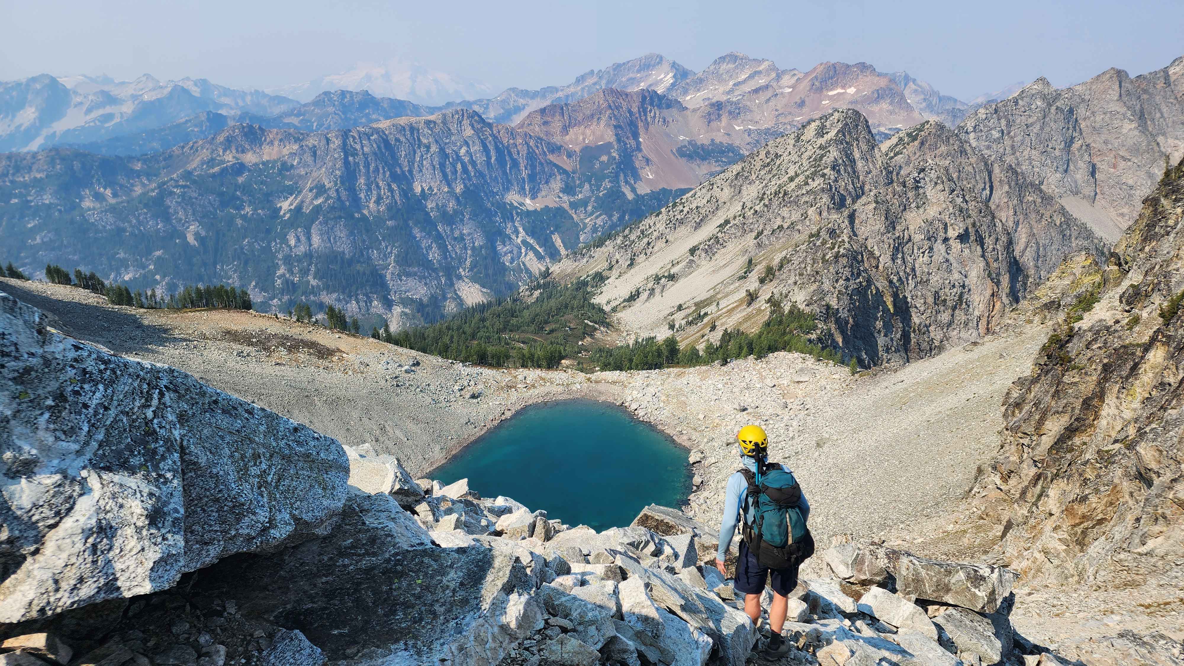
Chemical Lake
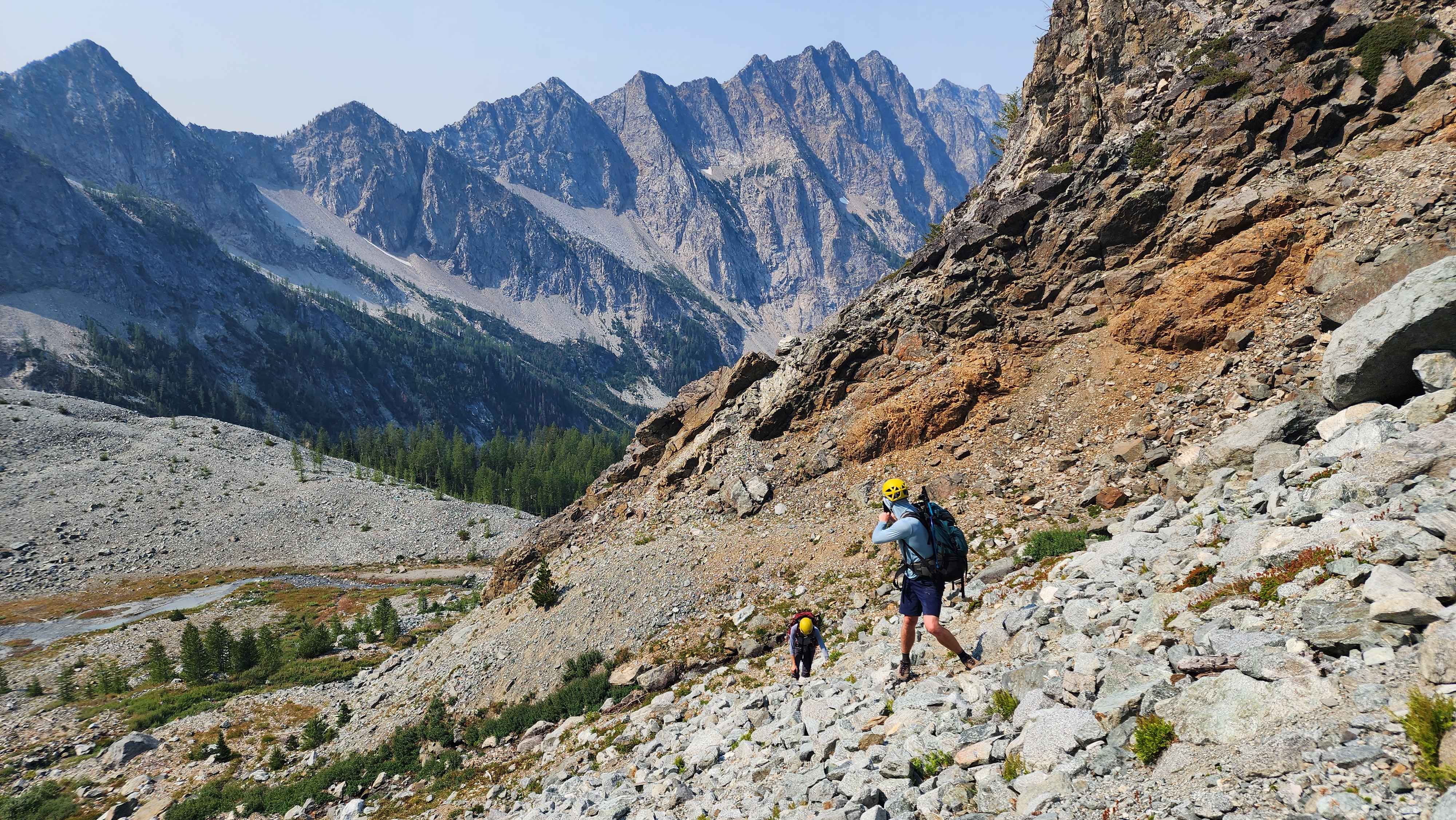
Heading down the rock field
This rock field was very loose and sketchy. We constantly heard rock falls not far away from us. I had read a trip report that some people had seen car-sized rocks falling down one of the chutes in this area. We eventually got stumped once there was a cliff blocking us from continuing down the rock field.
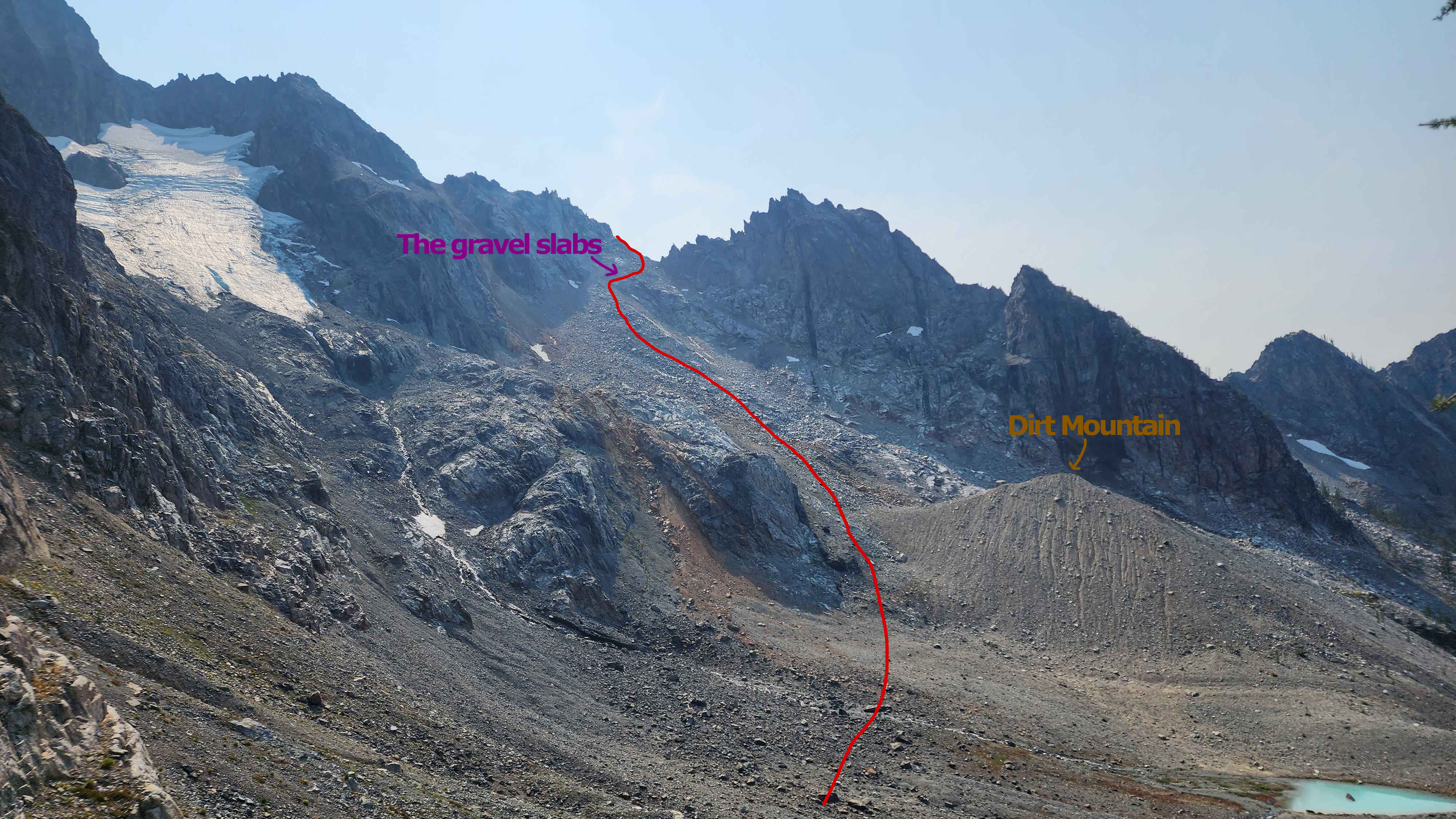
We all looked around for a way around the cliff. I eventually found a viable route that went across some slightly sloped slabs with gravel on them. I immediately knew this was the route since there was evidence of people stepping in places, and a lost water bottle near the slabs. The only other group we saw all day on route had mentioned their reason for turning around to be sketchy exposed sloped slabs with gravel on them, so these slabs fit the bill.
The drop was about 30 metres down which made things scary. The slabs being slanted with gravel on them didn’t make me feel very confident with my feet keeping grip. However, once I got on the slab there were ample good hand holds, which made me feel much better about it. The length of this section was only about 10 metres, but it felt a lot longer. After making it across safely myself, I called my group over and showed them how to get across. This section was definitely the crux of the route, despite being only class 2 or so.
The route across the slabs with gravel; the unexpected crux of the route
My group starting across the crux
Near the end of the crux
Group motivation was low after crossing this section and seeing the rest of the long rock field scramble. Time wasn’t looking good, and we weren’t going to make it back to the ridge before dark with the pace we were going.
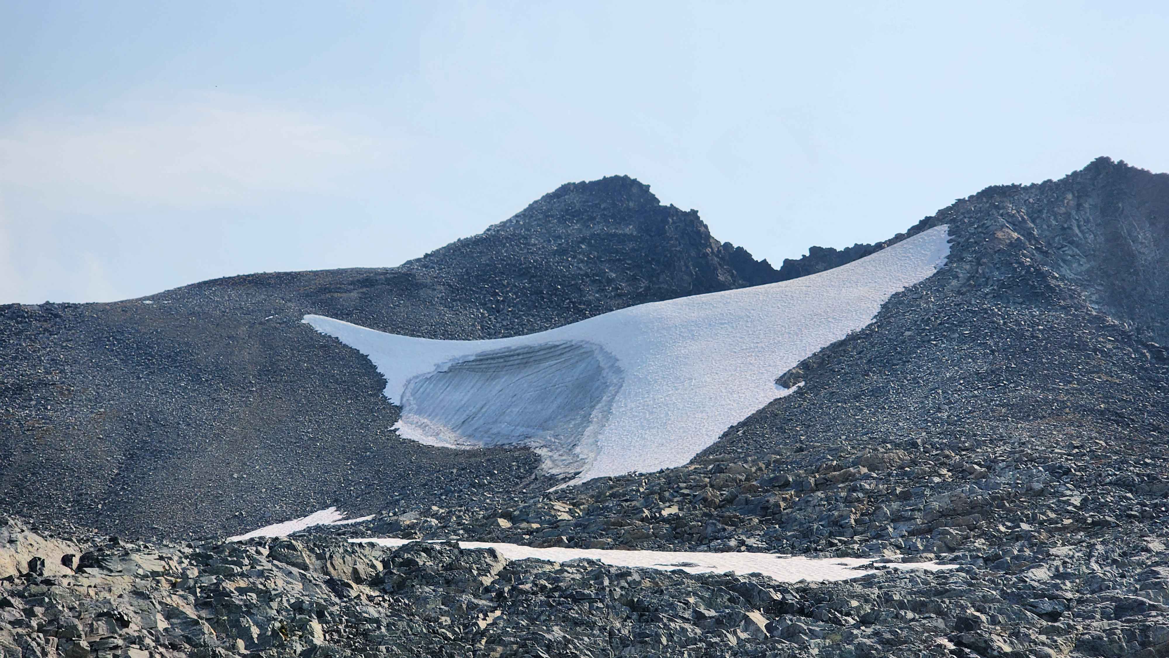
After gaining motivation again we made our way down the rock field to the plateau where the tarn was. We didn’t know while crossing this section, but there used to be a glacier than ran through this whole section not long ago. On the scanned topo map at the top of this page it shows the whole glacier how it used to be. Gaia only showed the current glacier, which sits higher up on the ridge. Under the dirt to our right while going down we could see the remnants of the lower glacier. It was mostly buried under dirt and rocks, but we could still see the ice and crevasses. What we didn’t know that the glacier also used to be under us, and we found out once we ran into a large crevasse in the rock. This scared us at first, but I figured it wasn’t an issue since other trip reports didn’t even mention glaciers.
I went and looked at some trip reports after the fact, and one did mention the old glacier below the rock. They said it wasn’t an issue or a large danger, which was also my assessment.
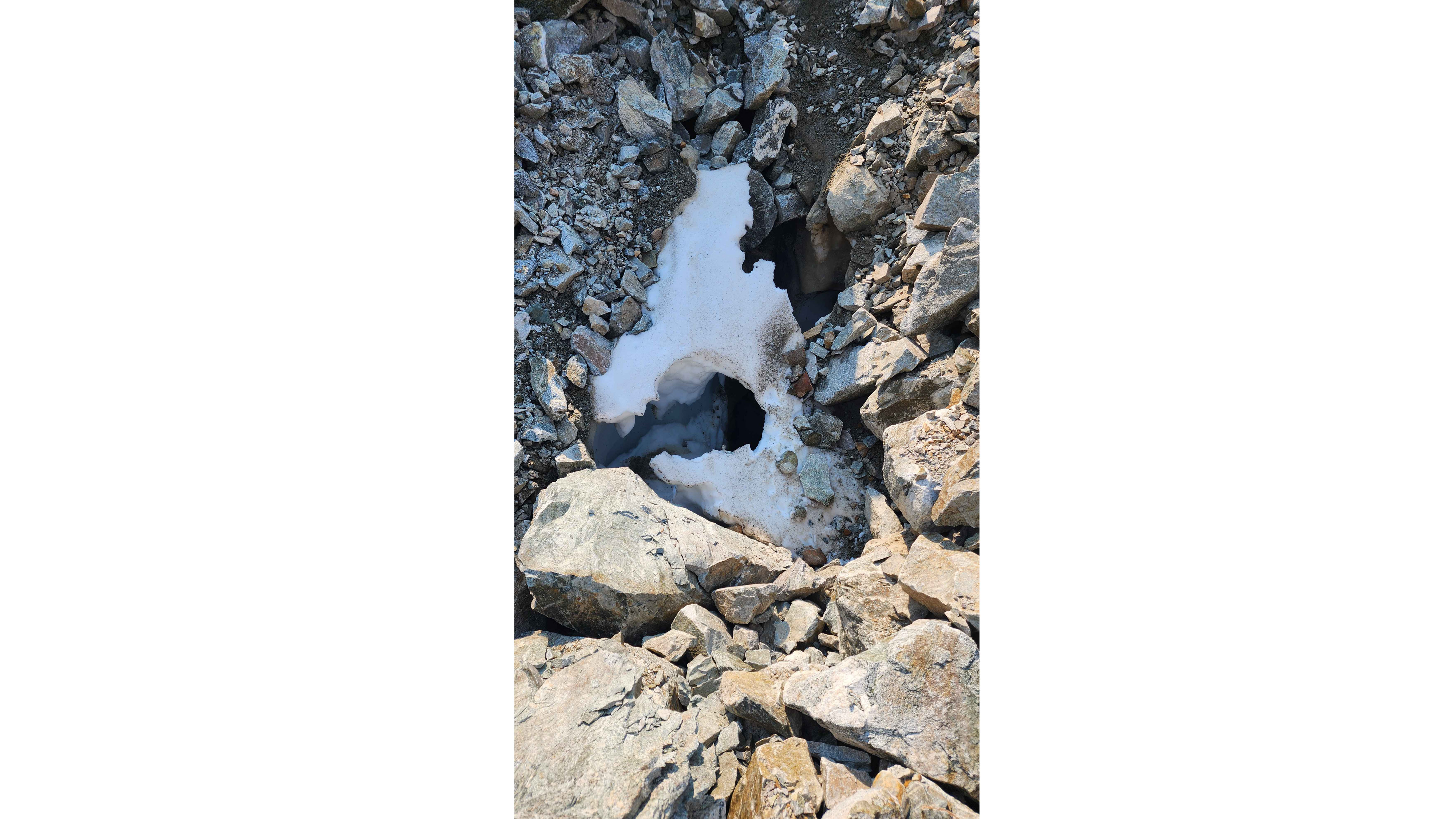
The exposed crevasse we found. Was about 2 metres across at the longest point, so well large enough to fit a human. We couldn't tell how far down it was, but it was atleast 10 metres. We were worried that it was longer than this going under the rock, which could've been the case. Be careful throughout this section.
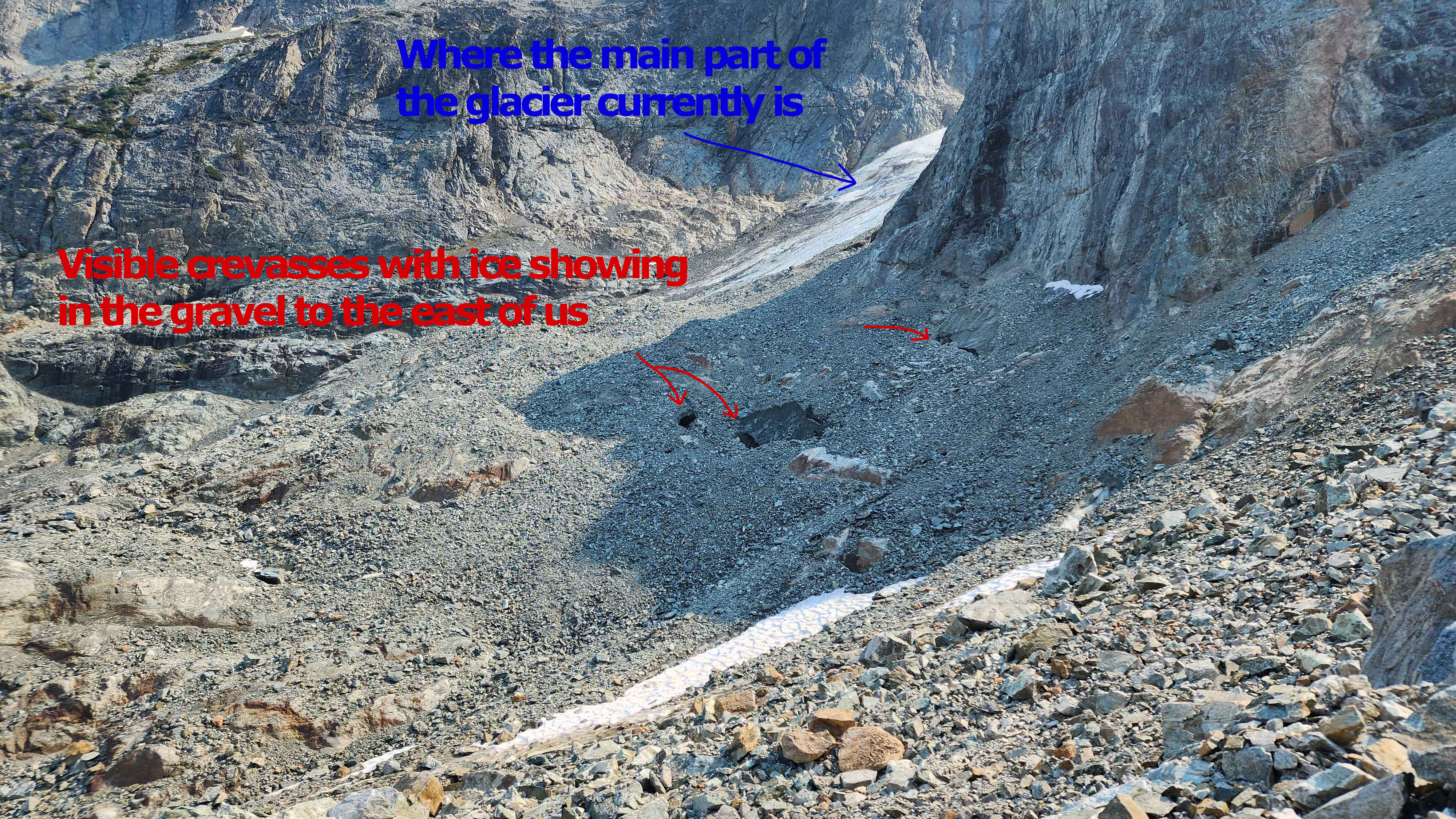
The crevasses in the gravel to the right/east of us; the reminants of the old glacier.
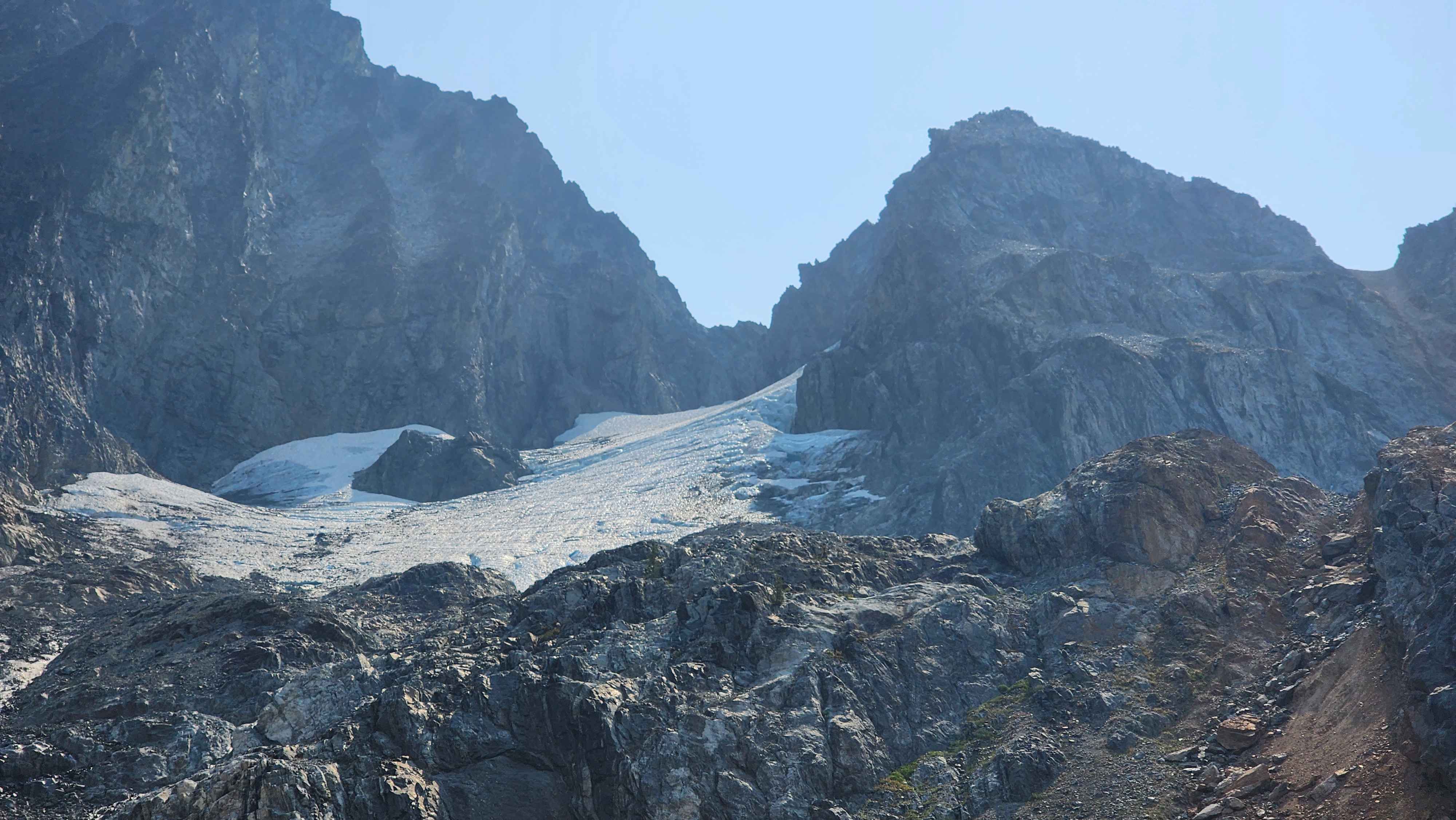
The current glacier
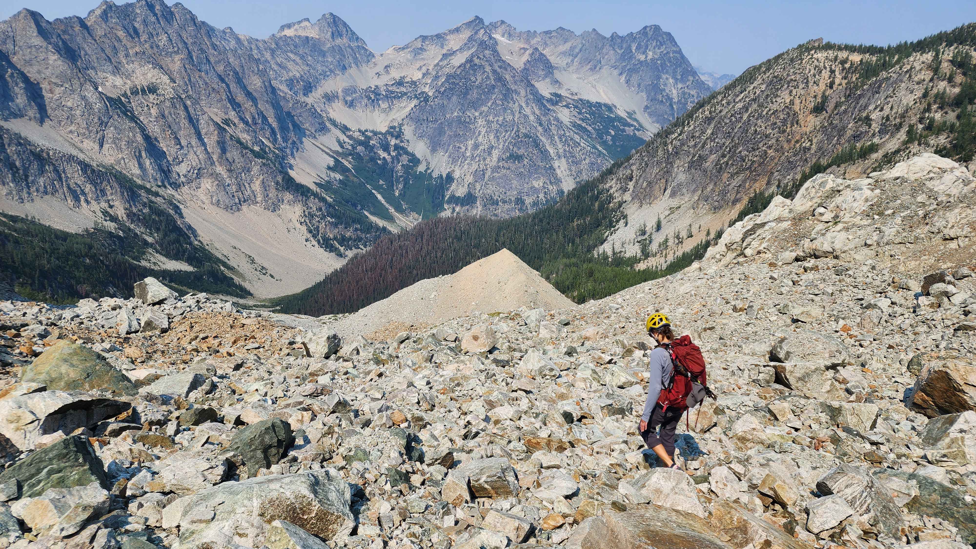
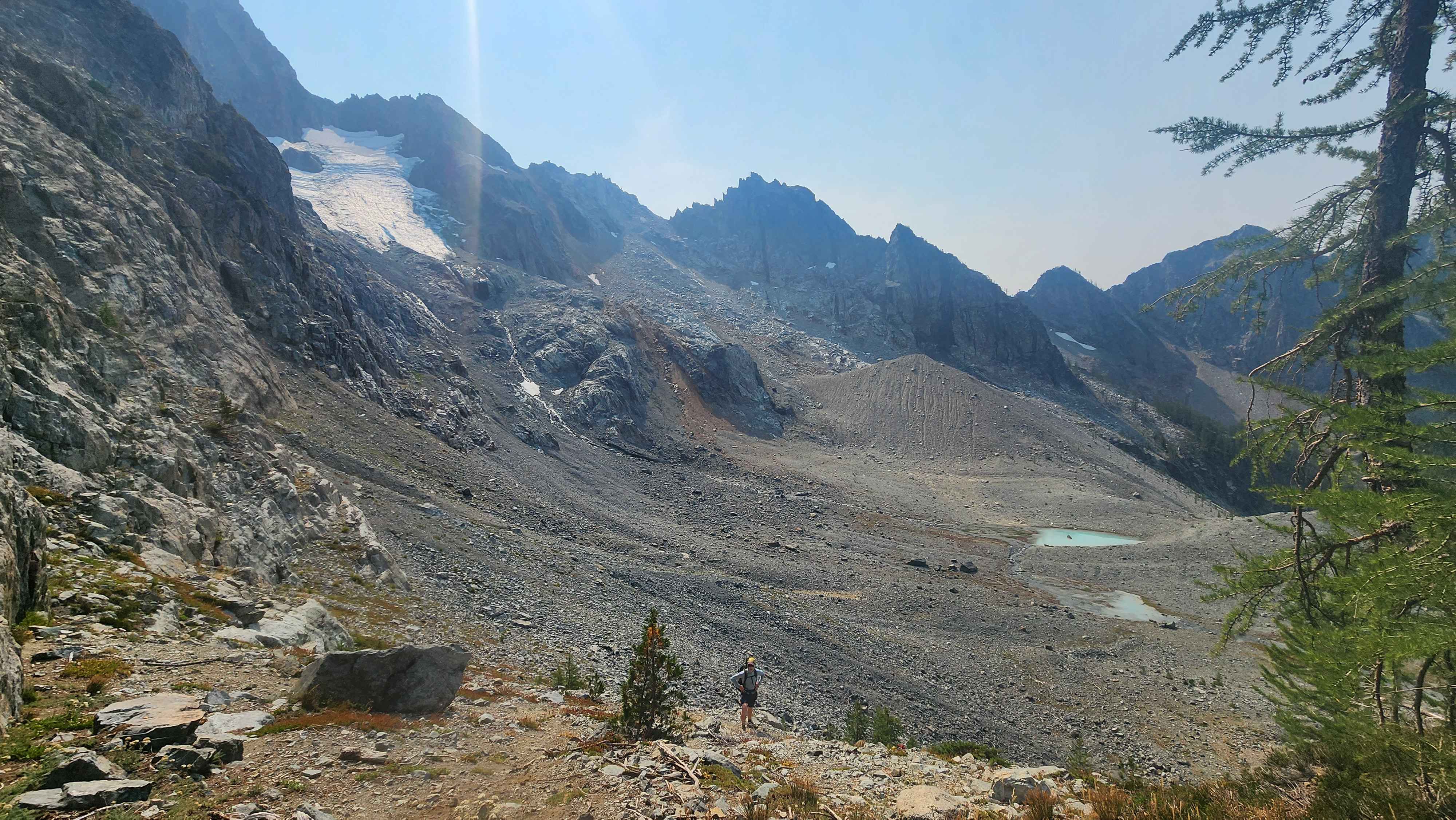
Getting close to the plateau
Eventually we had to take a right around the small lateral moraine. I named it “Dirt Mountain” on the spot. With a prominence of over 20 feet Dirt Mountain was massive. Fernow became our side goal to Dirt Mountain, but we couldn’t summit Dirt Mountain in the end. Maybe after we summit the rest of the highest summits in Washington, we will be skilled enough to climb Dirt Mountain.
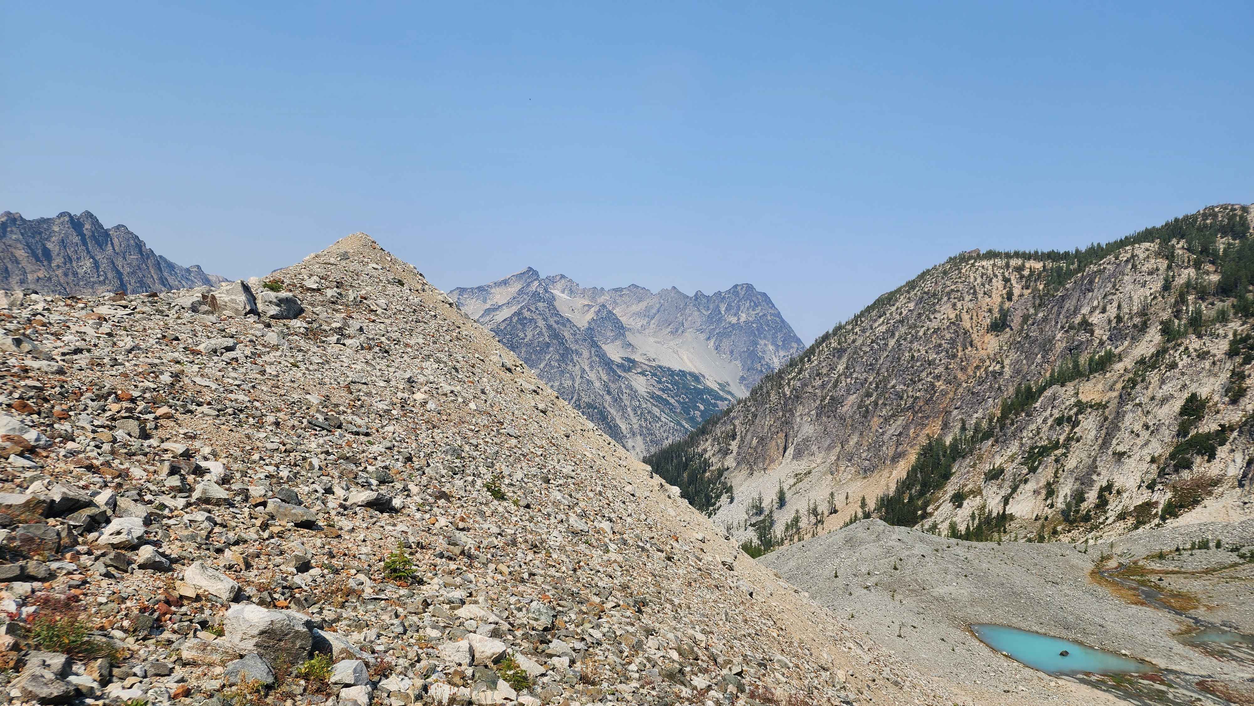
The ridge out to Dirt Mountain with the tarn to the bottom right
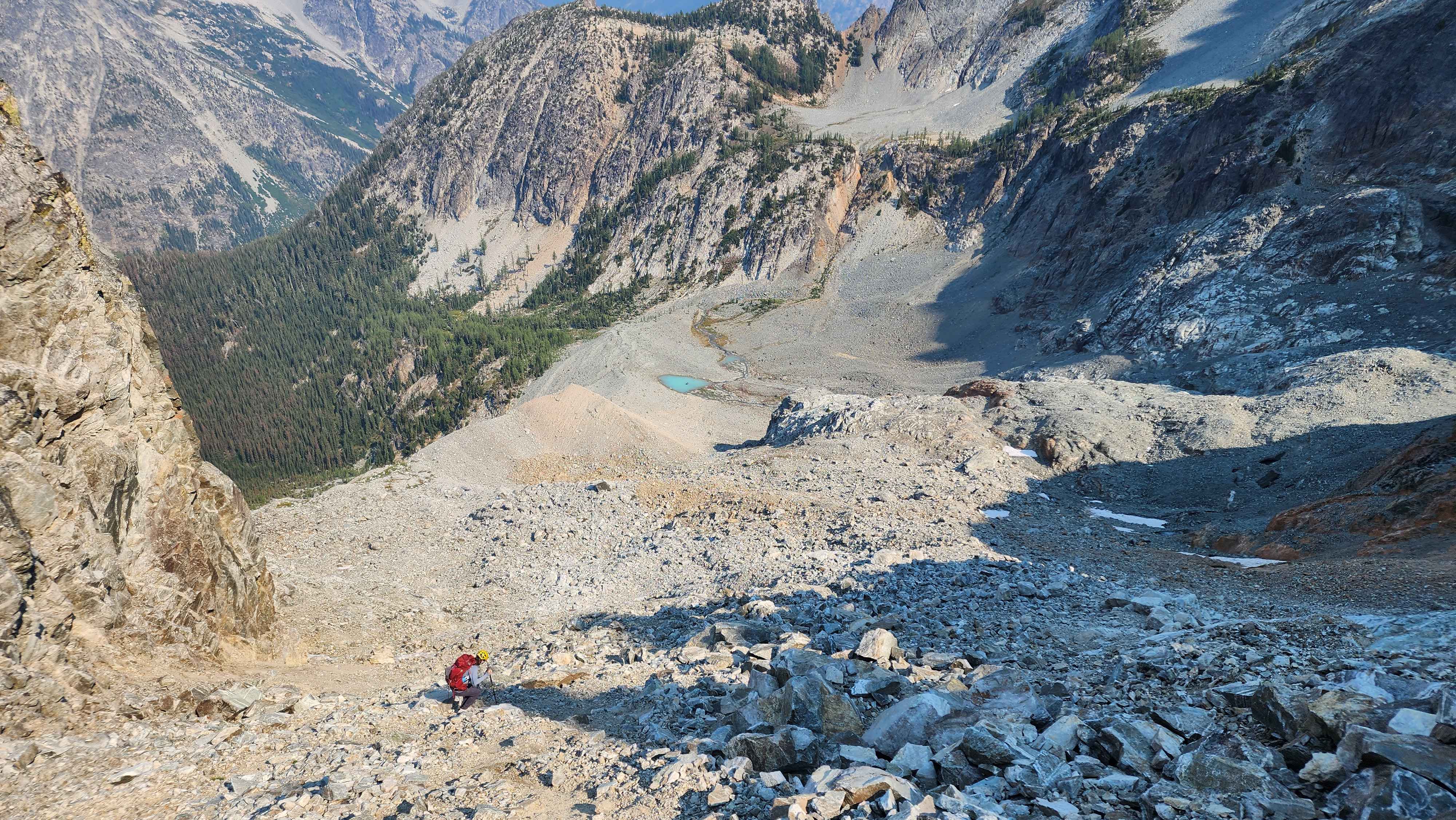
Anyways, we made it to the plateau where the tarn was. It was relieving to walk on flat ground for a while. The main tarn in this section had a much different blue than that of Chemical Lake, which was odd. There were many creeks running through this section that were coming from the glacier above.
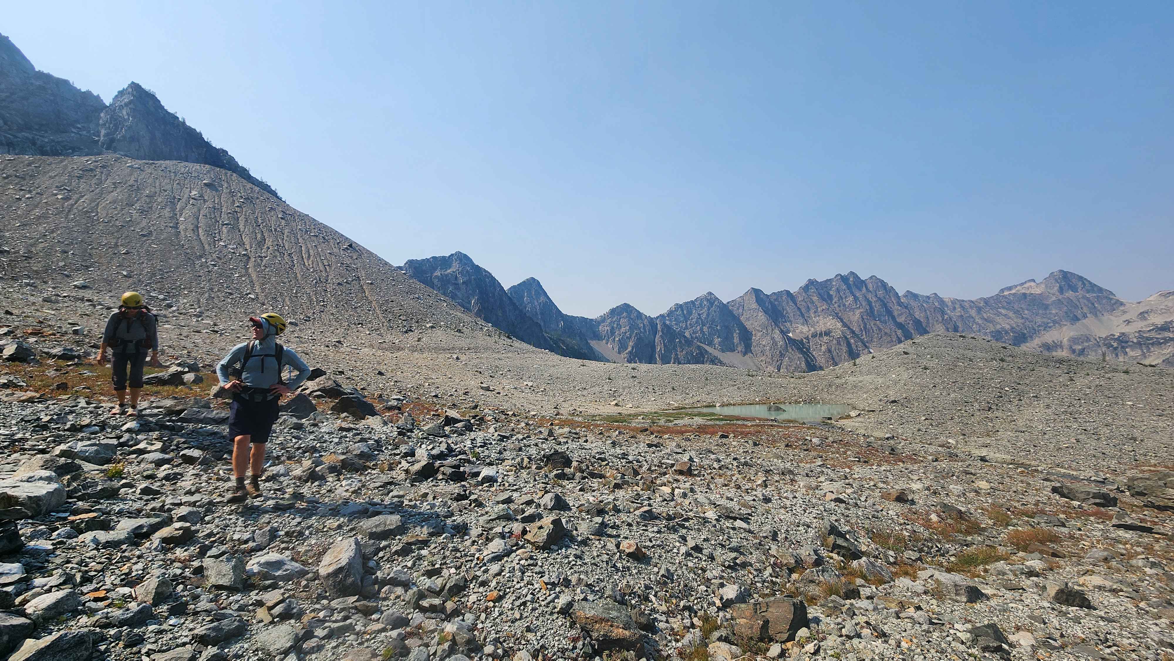
Finally on the plateau
The tarn
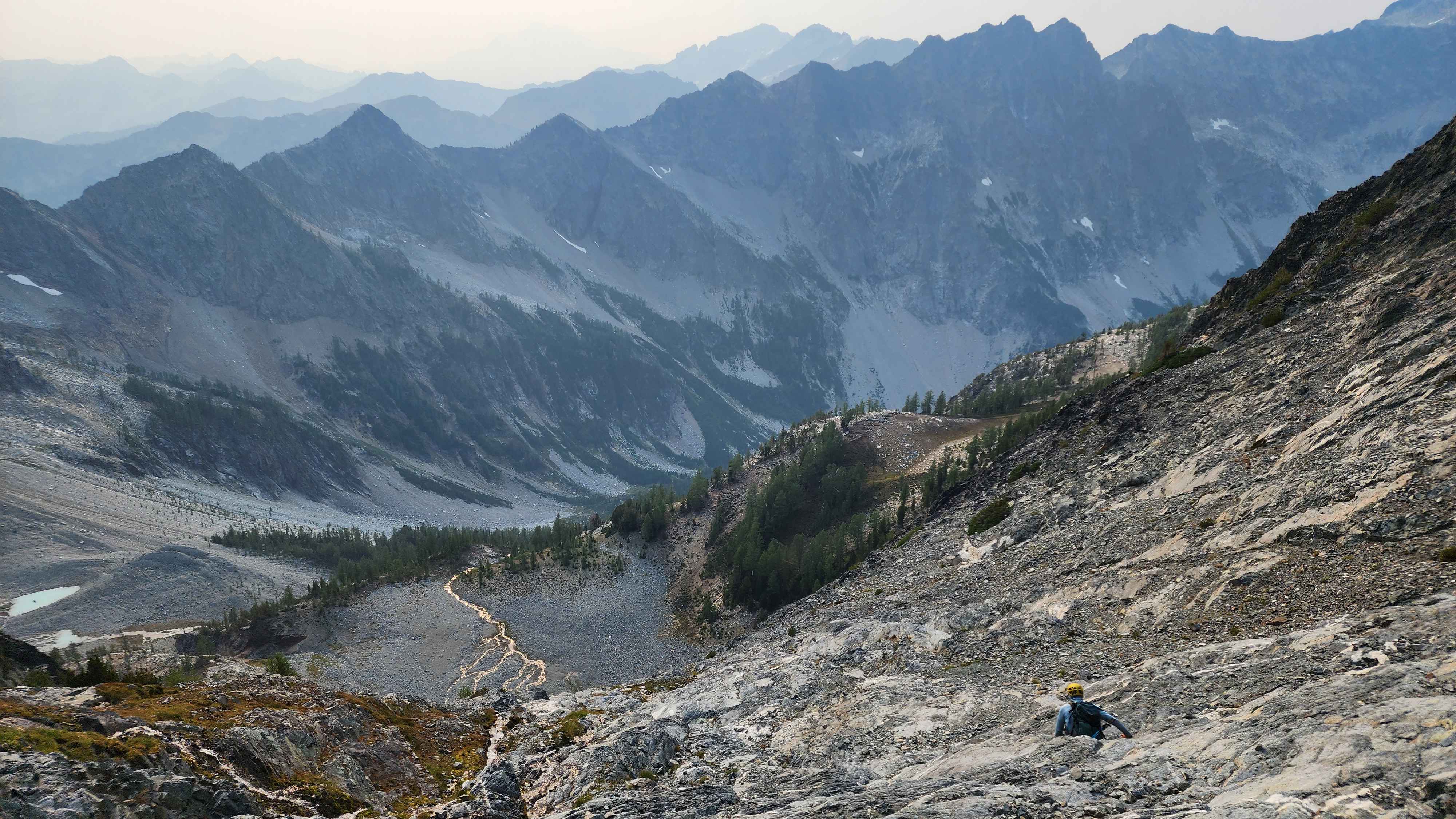
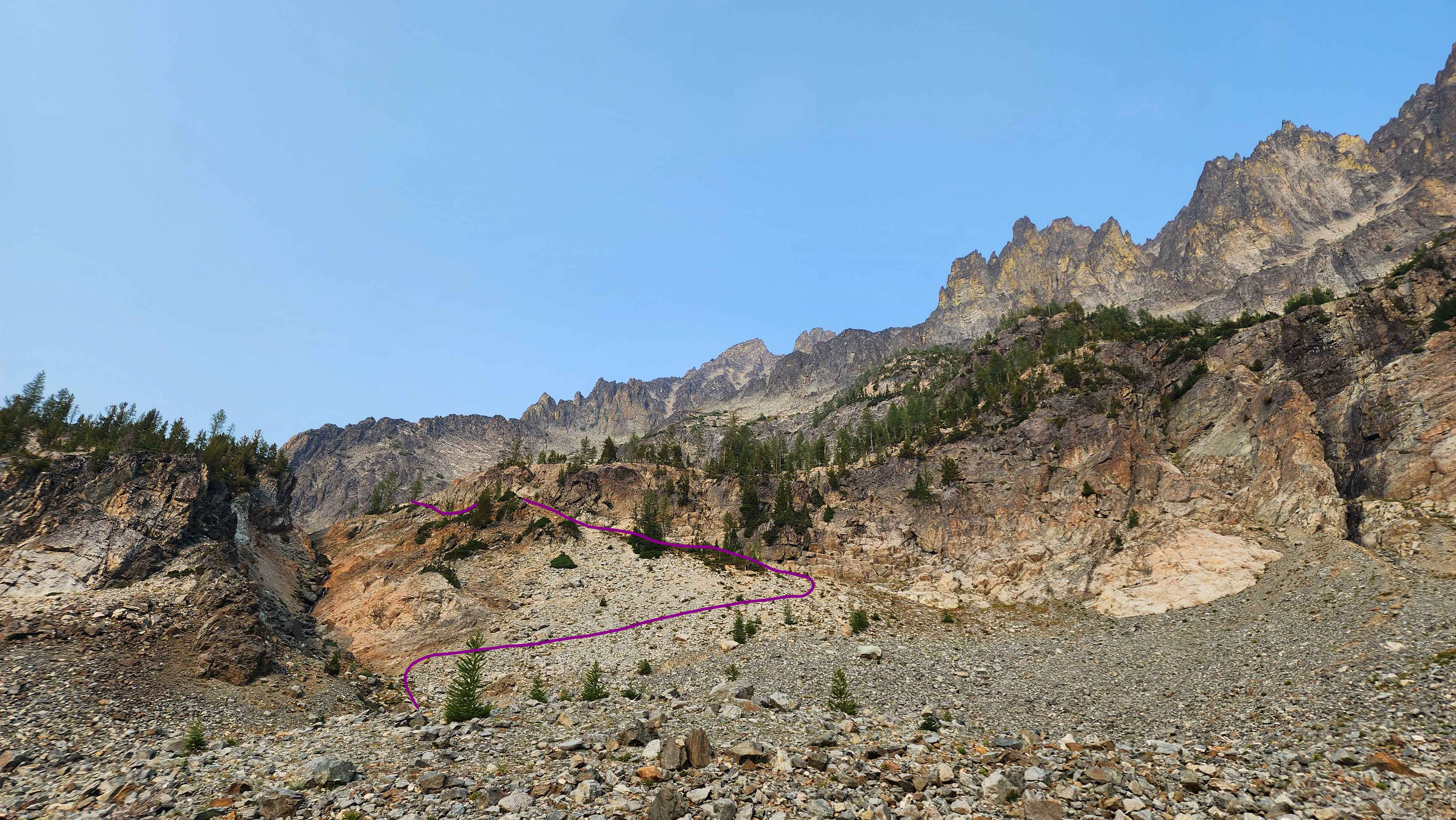
The route for this section from the bottom
After walking across the plateau, it was time to climb again. The route through this section was well marked with rock cairns and evidence of people walking up. The route went up the creek for a bit and then turned to the right across the rock field. The route eventually went up again to get us to the higher plateau.
Leaving the stream to cut across the rock field
Going up again after cutting across the rock field
At the higher plateau
The route for this section
It was already 13:30 once we got to the higher plateau. Time was going to be too close with our pace. Our goal was to make it back to the ridge before sunset, since we didn’t want to do the crux or the rocks above it in the dark. We figured our turn around time should be 16, which would let us get back to the higher plateau at 5 or before no matter how far we went. This gave us only 2 hours and 30 minutes to go 2.6k vertical feet on mostly class 3/4 terrain.
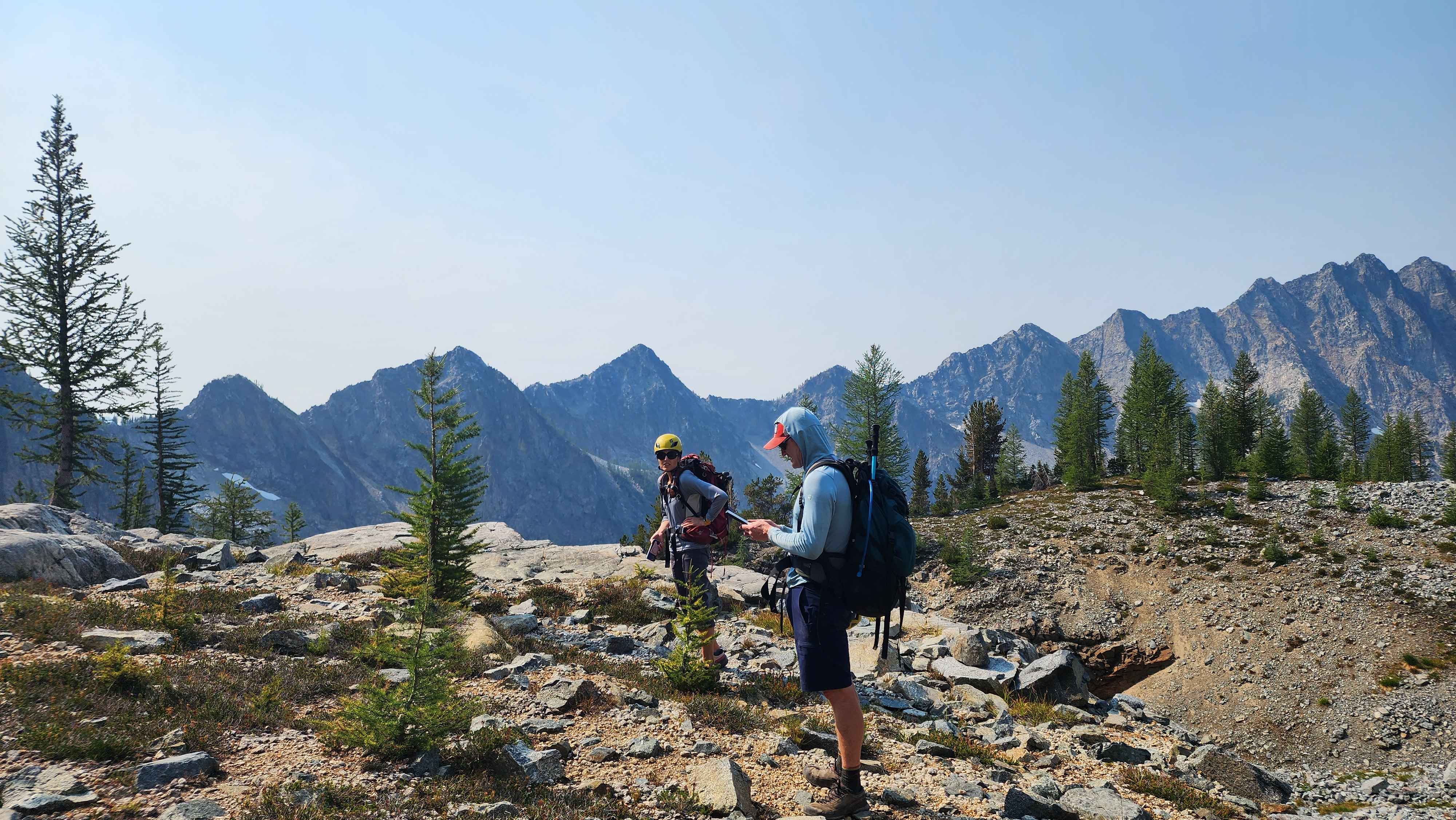
Discussing plans on the higher plateau
Our slowest climber didn’t want to continue past this point. We didn’t want to leave them behind, but we realized it gave us the highest chance of success. Even being in a duo, the time was still going to be very close.
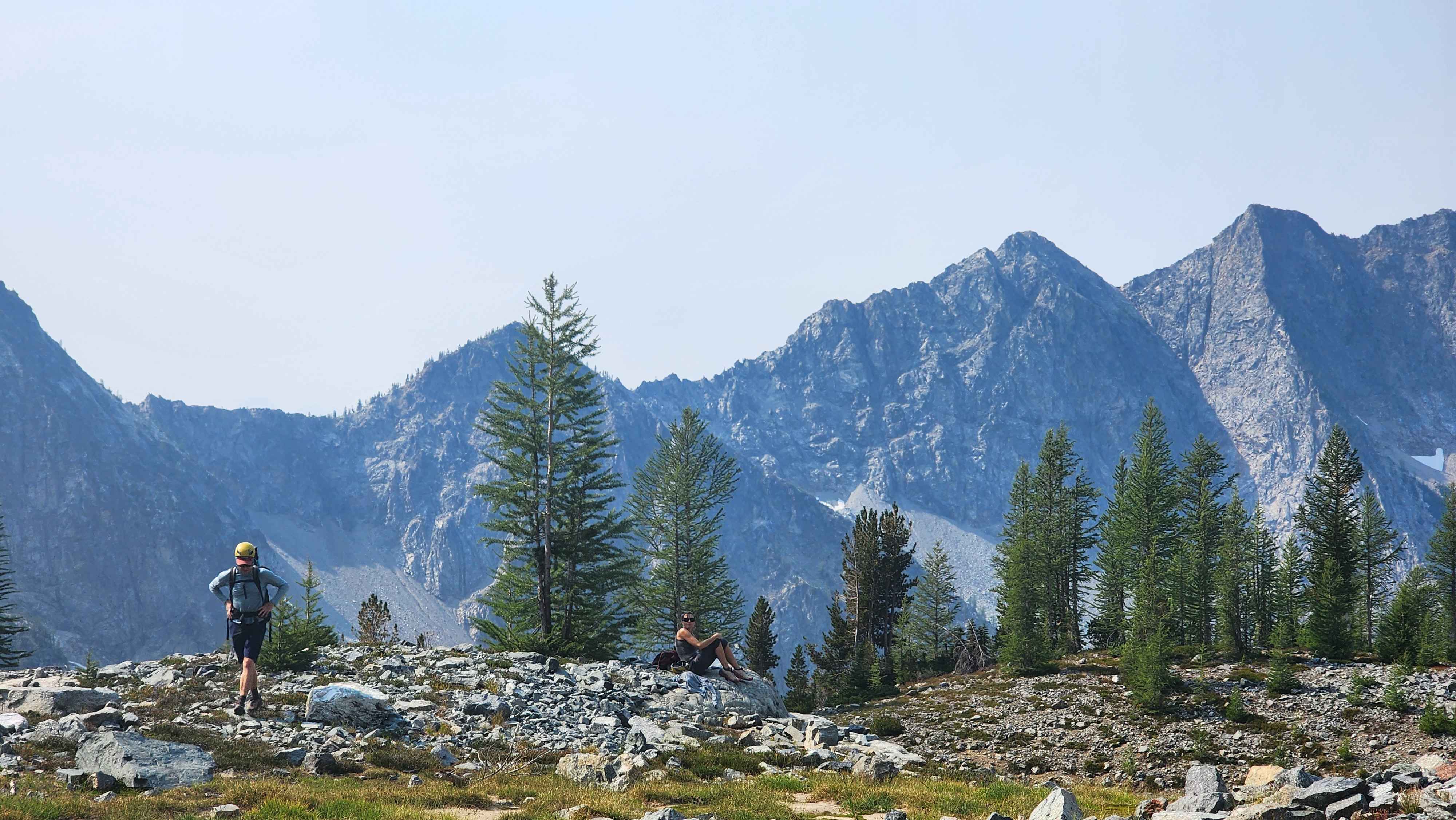
The departure
This section looked very steep, so steep I wasn't even sure if we could make it. However, once we got on the wall, it wasn’t nearly as steep as it looked.
A sketch of the route up
The only tree section on the climb. After the first wall
Climbing the second wall to get to the creek crossing
After the second wall we crossed the creek to get to the flatter section. We made it to the creek in under 30 minutes, which was insane. The creek crossing was at about 1k feet of vertical. I’ve never done 1k vertical feet in this short of a time. Past the creek crossing, the climbing was less steep and flattened out more and more as we went up. We took some wrong turns, but none of them led us to class 5 terrain.
The creek flowing off the edge
Continuing the climb after the creek crossing
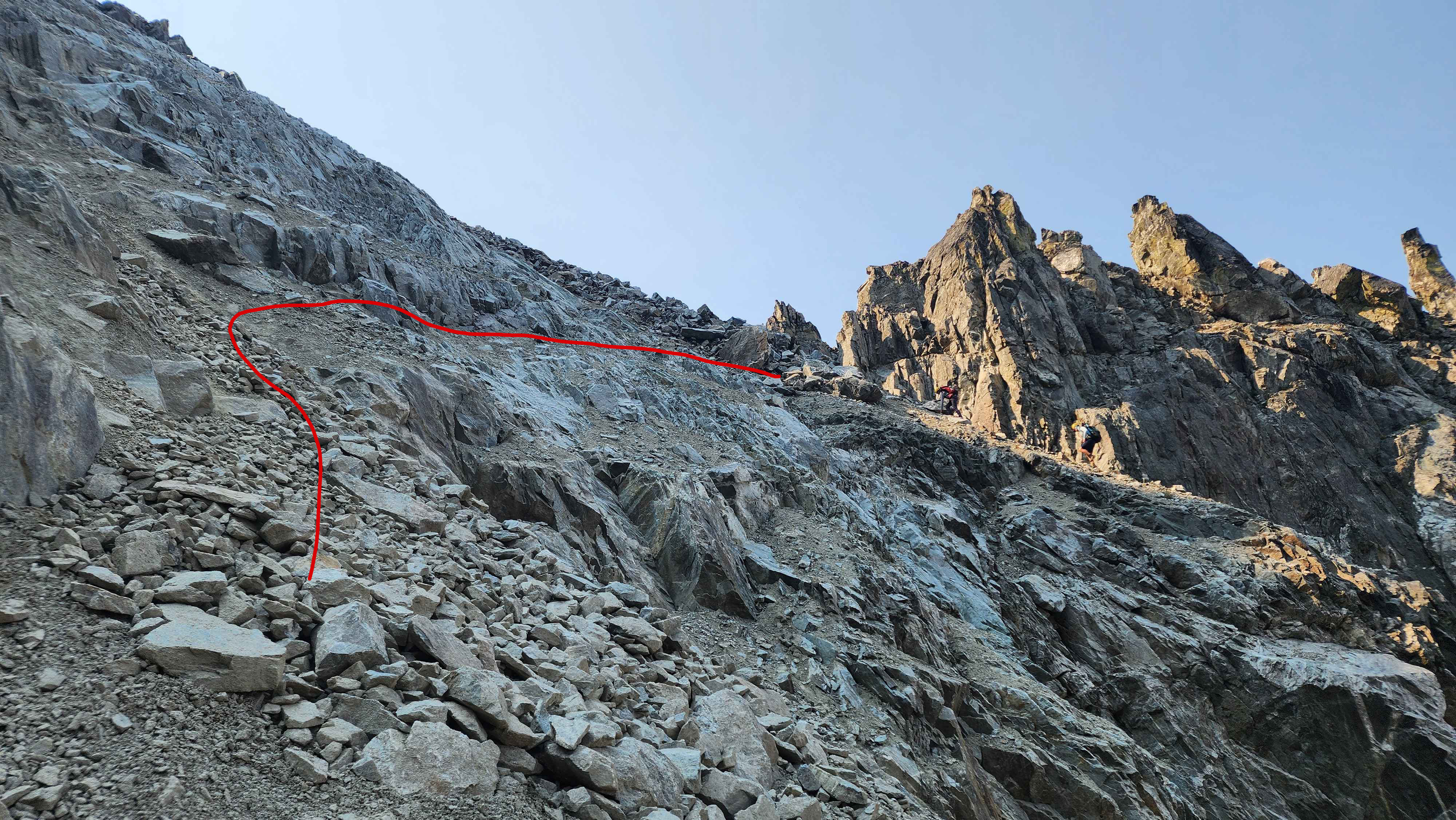
The route we climbed with the summit in the background
The route turned into a rock field. This part was way worse than the climb, despite being way less steep. The climb across this rock field was a slog. We eventually located the chute we had to climb to get to the scramble approach. We thought this section was going to be solid rocks, but it was just a steep rock chute.
Where the rock field starts. On the way down we stayed to the left by the creek to avoid most of the rock field.
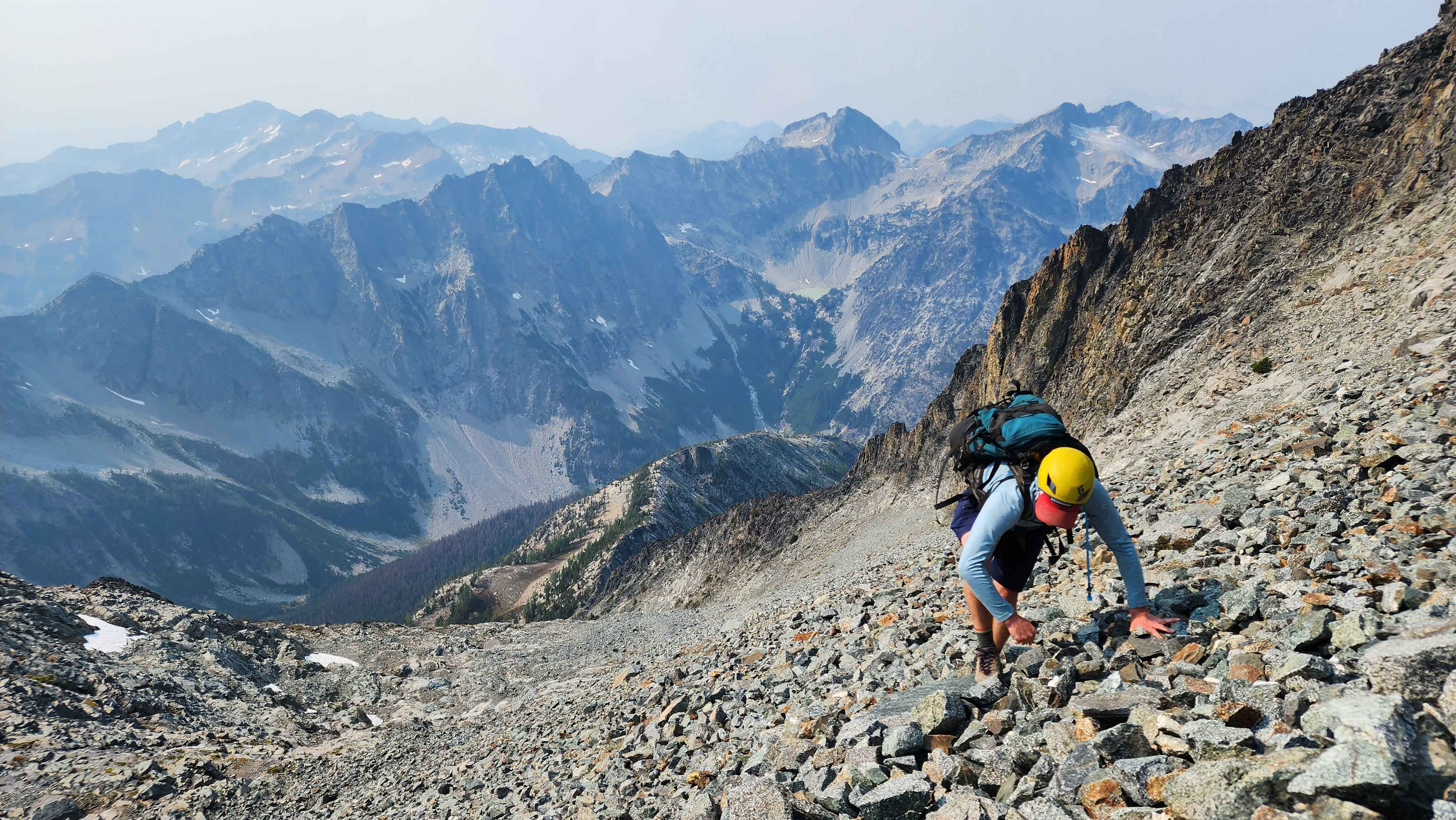
Climbing the rock field
A large snowfield on the rock field. Why didn't we bring our skis??
Just below the steep rock chute
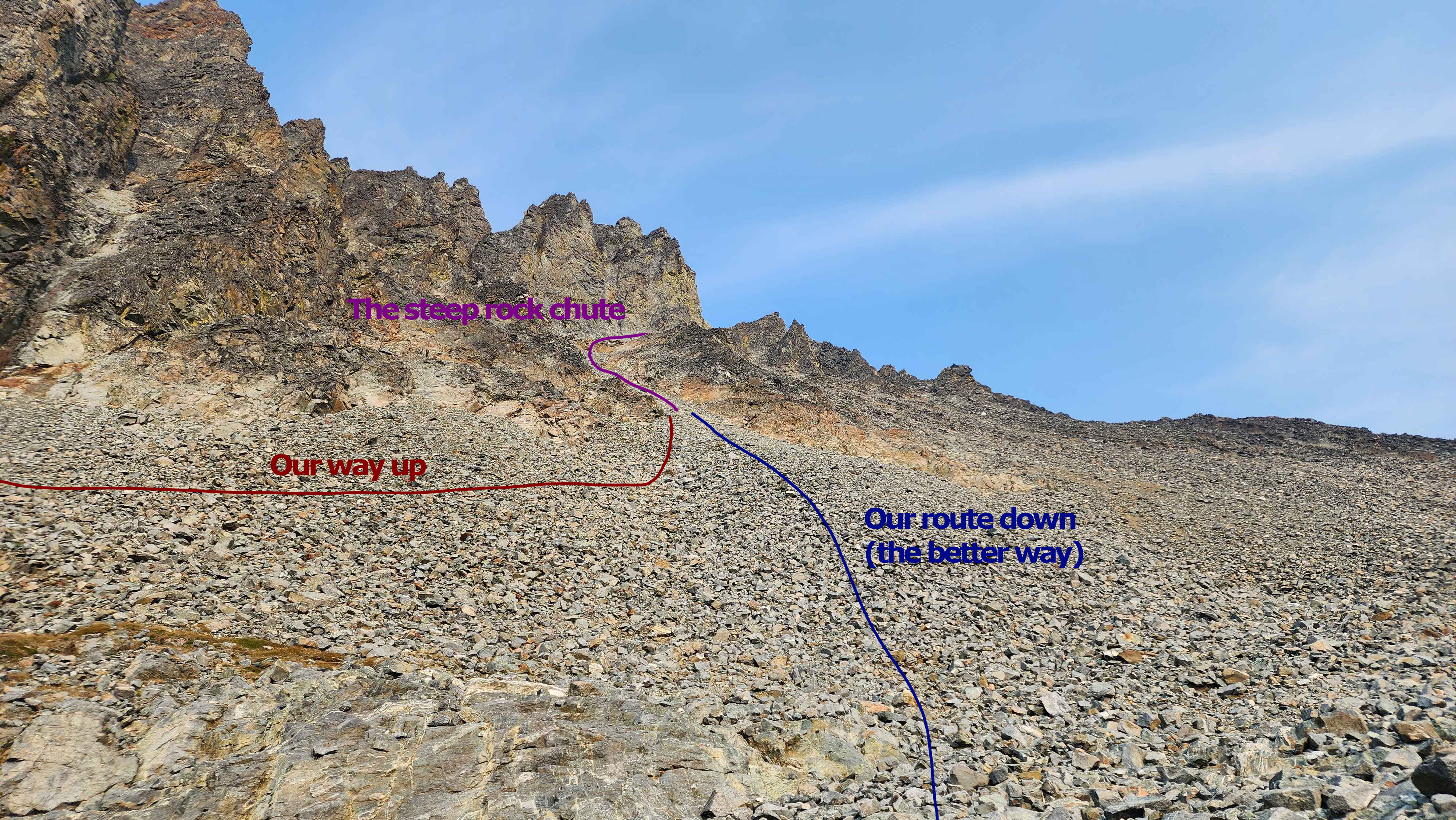
The rock field and chute
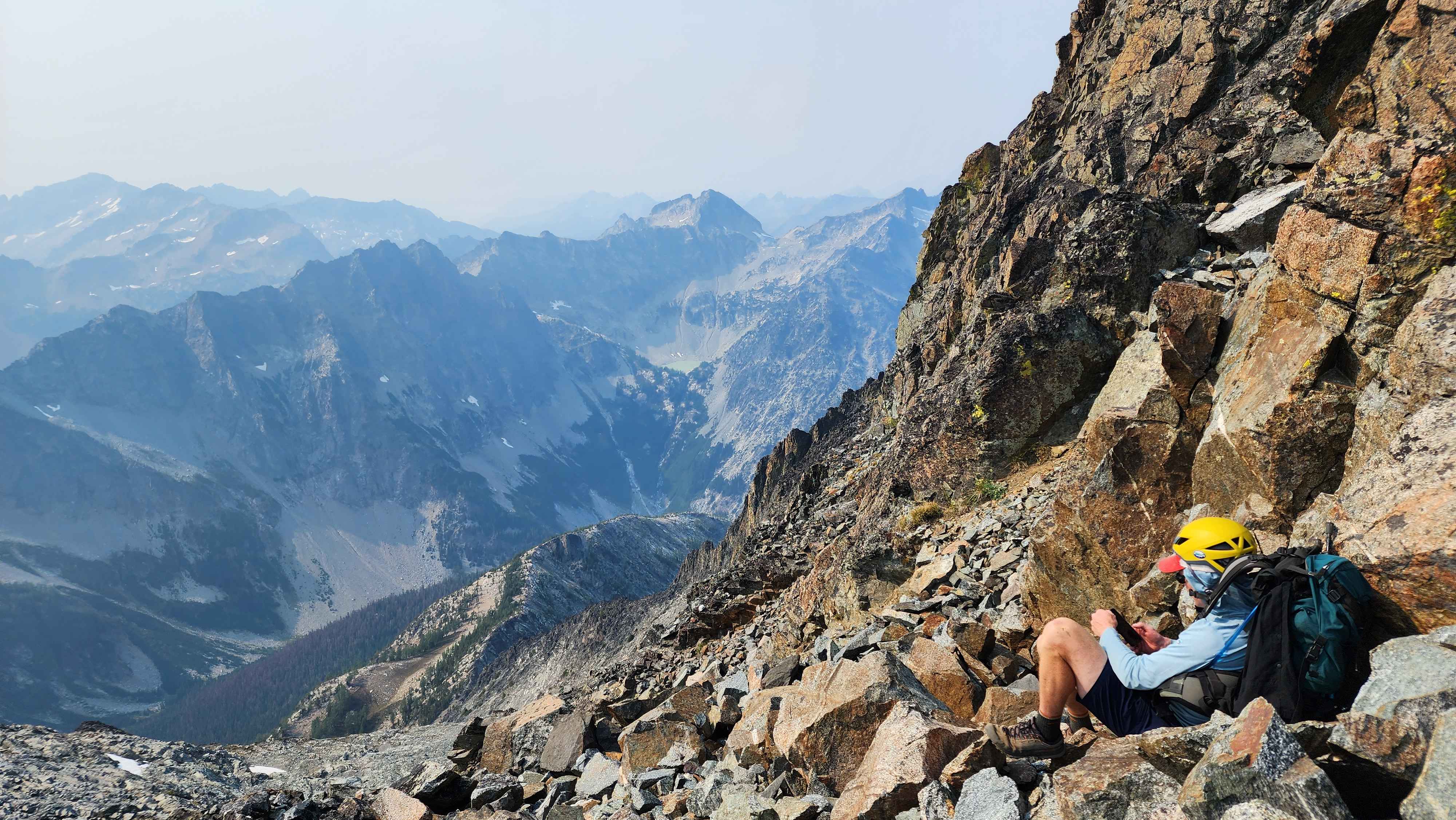
After scaling the rock chute, we ended up at a small flat section. The route continued around the back of Fernow on a ledge. I thought this ledge was going to be super exposed, but I was pleased to find out that it wasn’t awfully exposed.
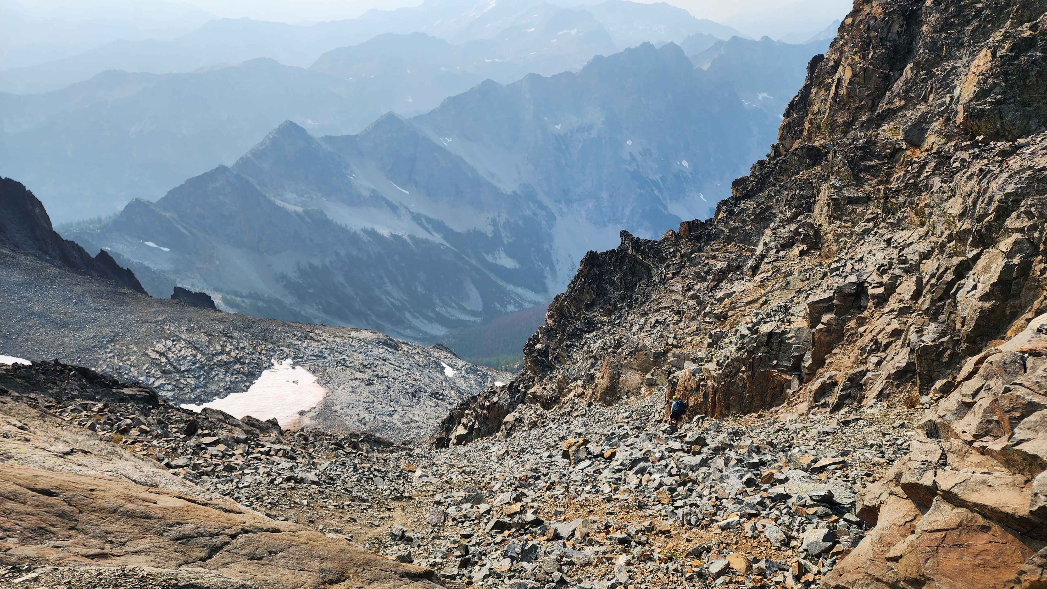
The rock chute from above when we were going down
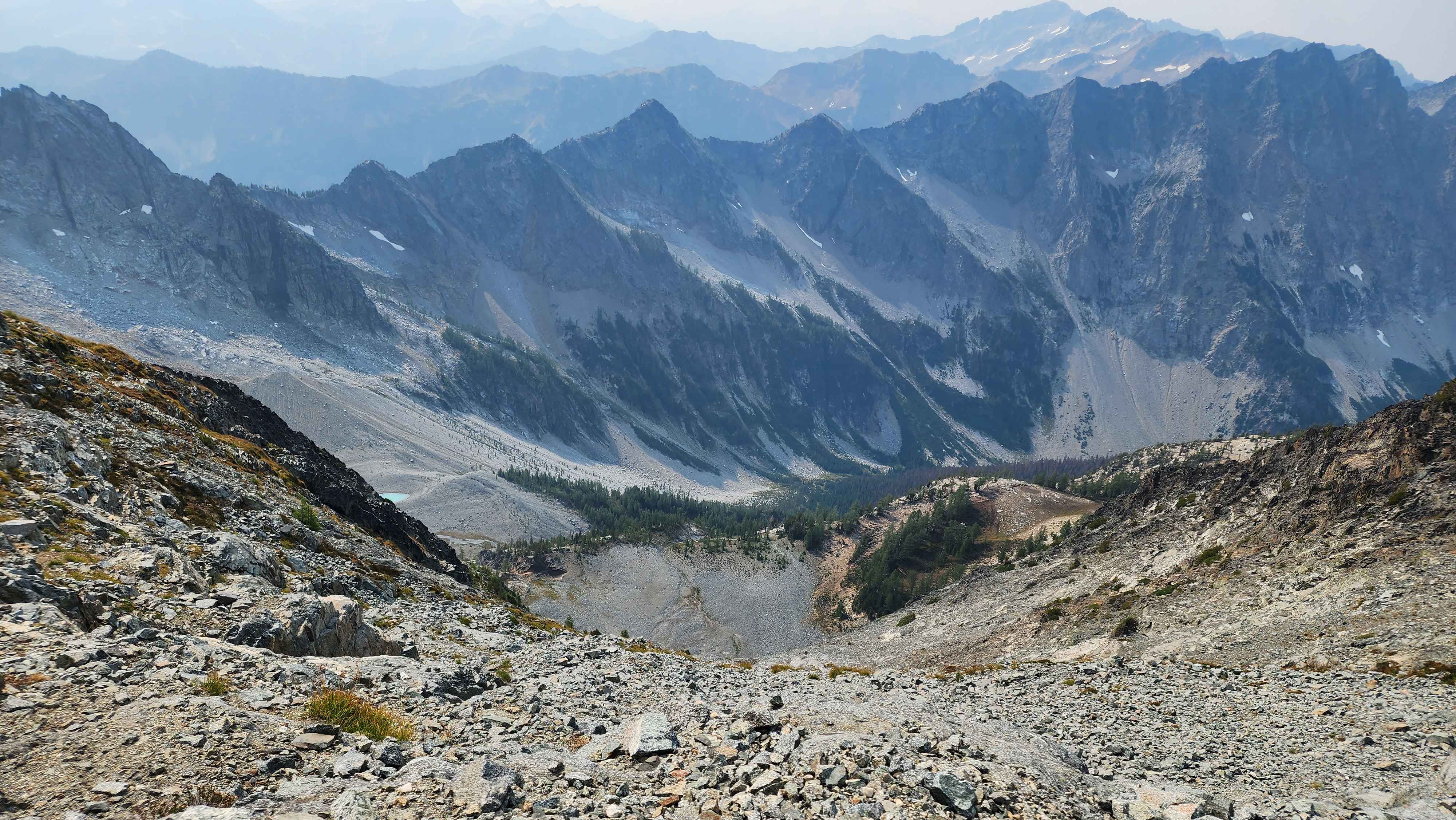
The view from the small flat section above the rock chute
Another view from the small flat section above the rock chute
The exposed ledge walk
After getting across the first ledge part, we came to another ledge. This ledge had a nice rock chute going down it a way which made this section not feel exposed. We accidentally walked all the way up to the saddle, which wasn’t the correct route. The route actually went straight up the rock.
The correct route goes up the rocks to the left, we accidentally went to the saddle up above and had to walk back down.
The rock chute in this section providing safety from the several thousand foot tall cliff below
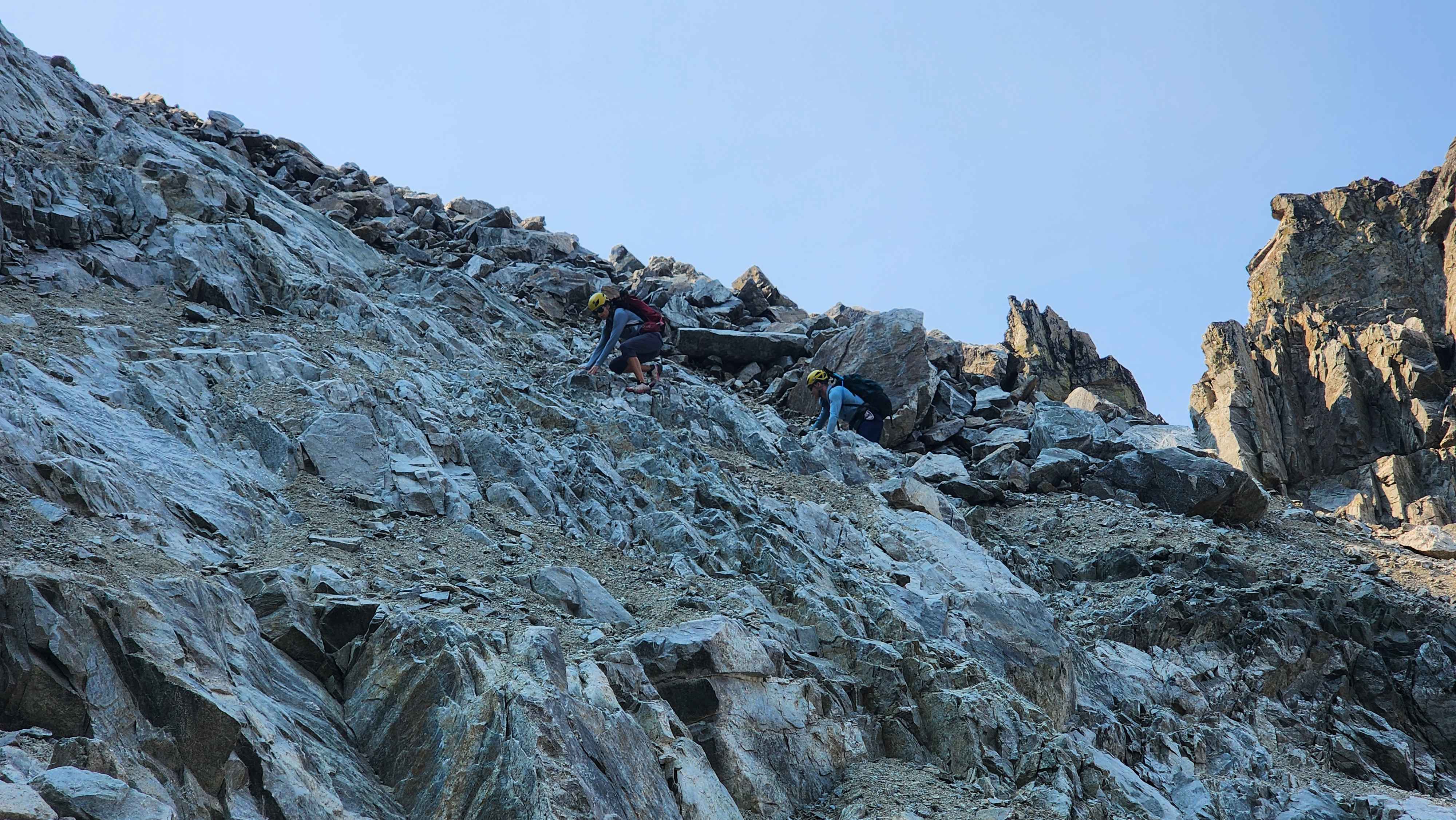
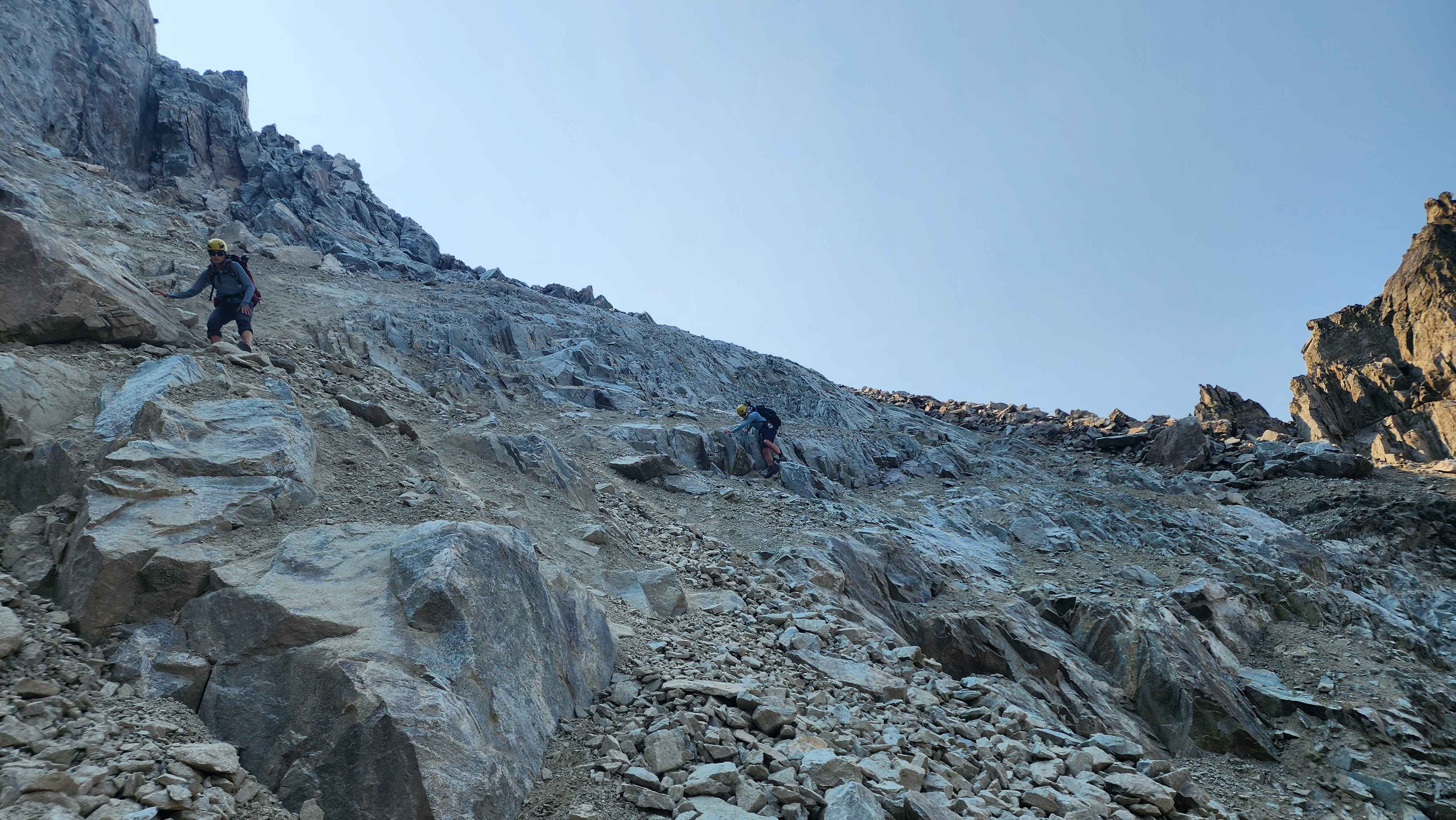
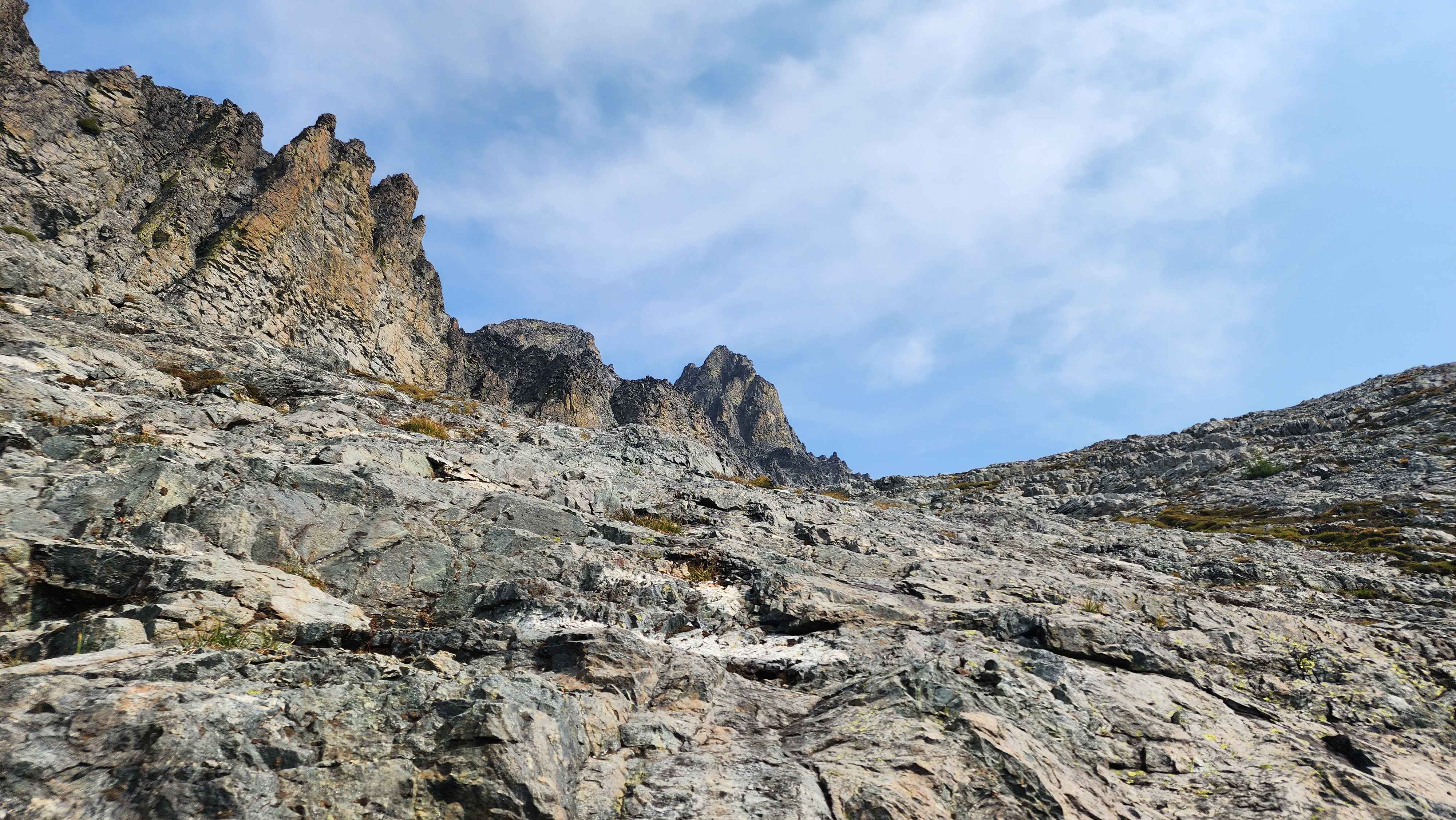
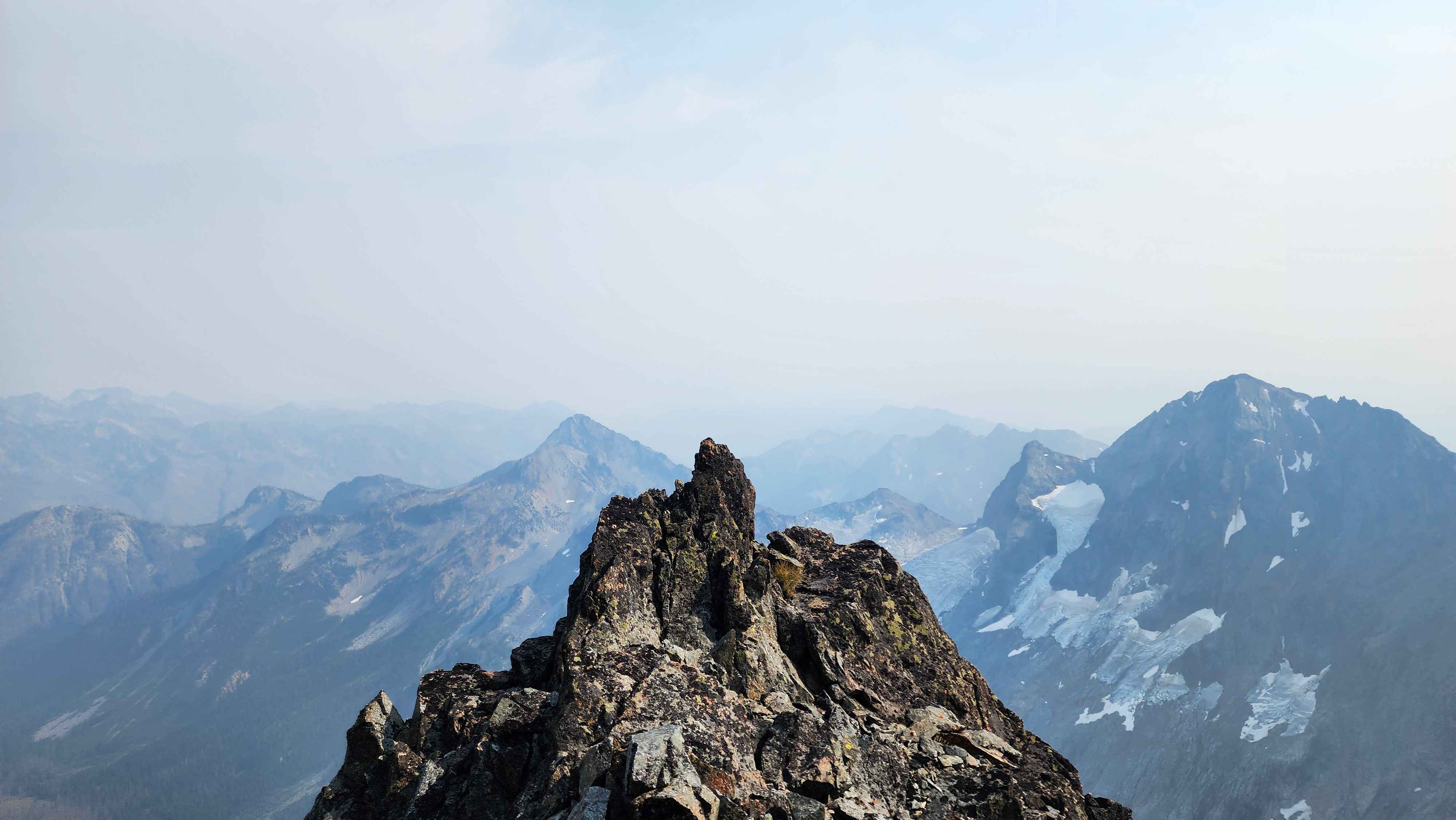
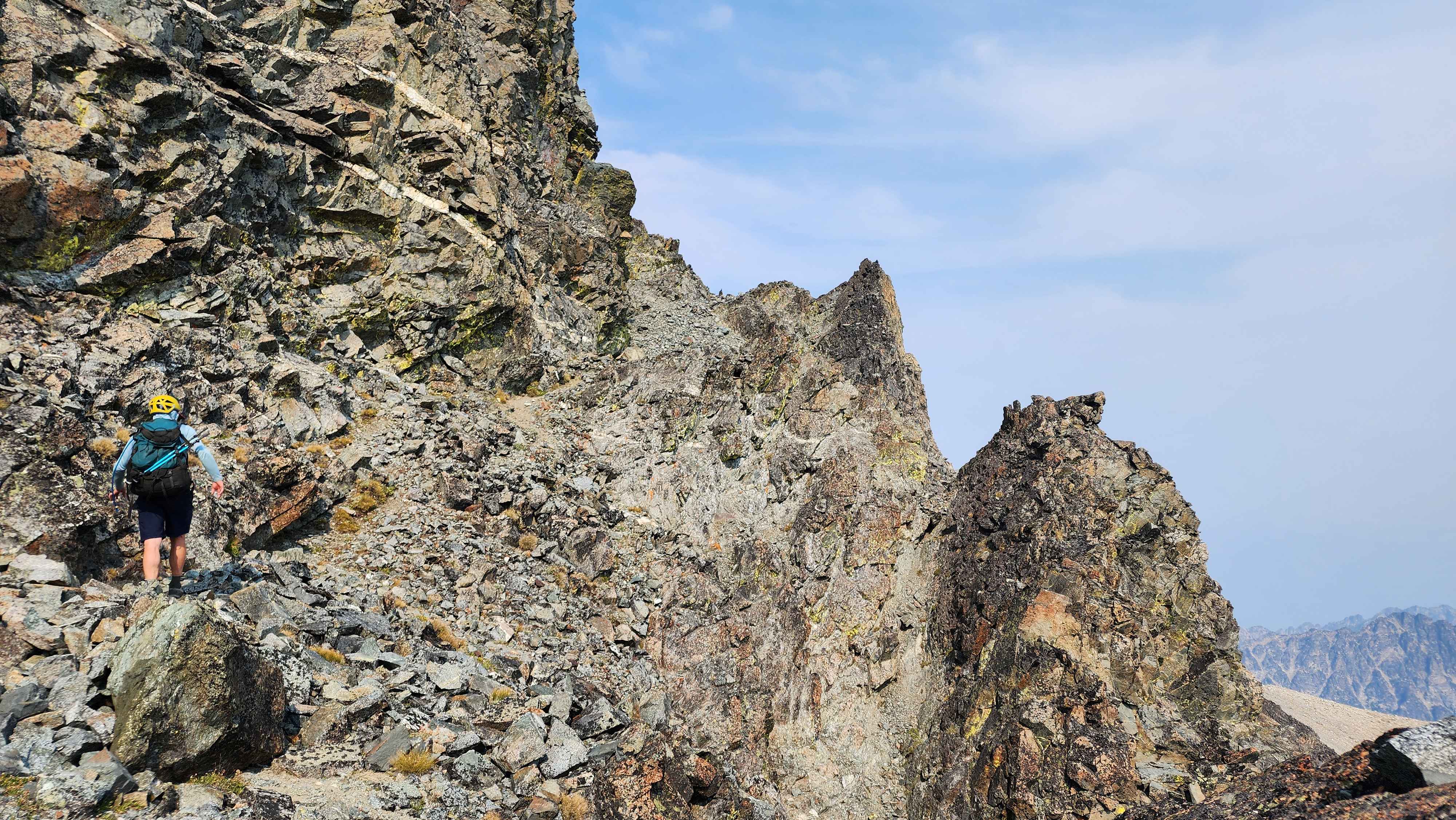
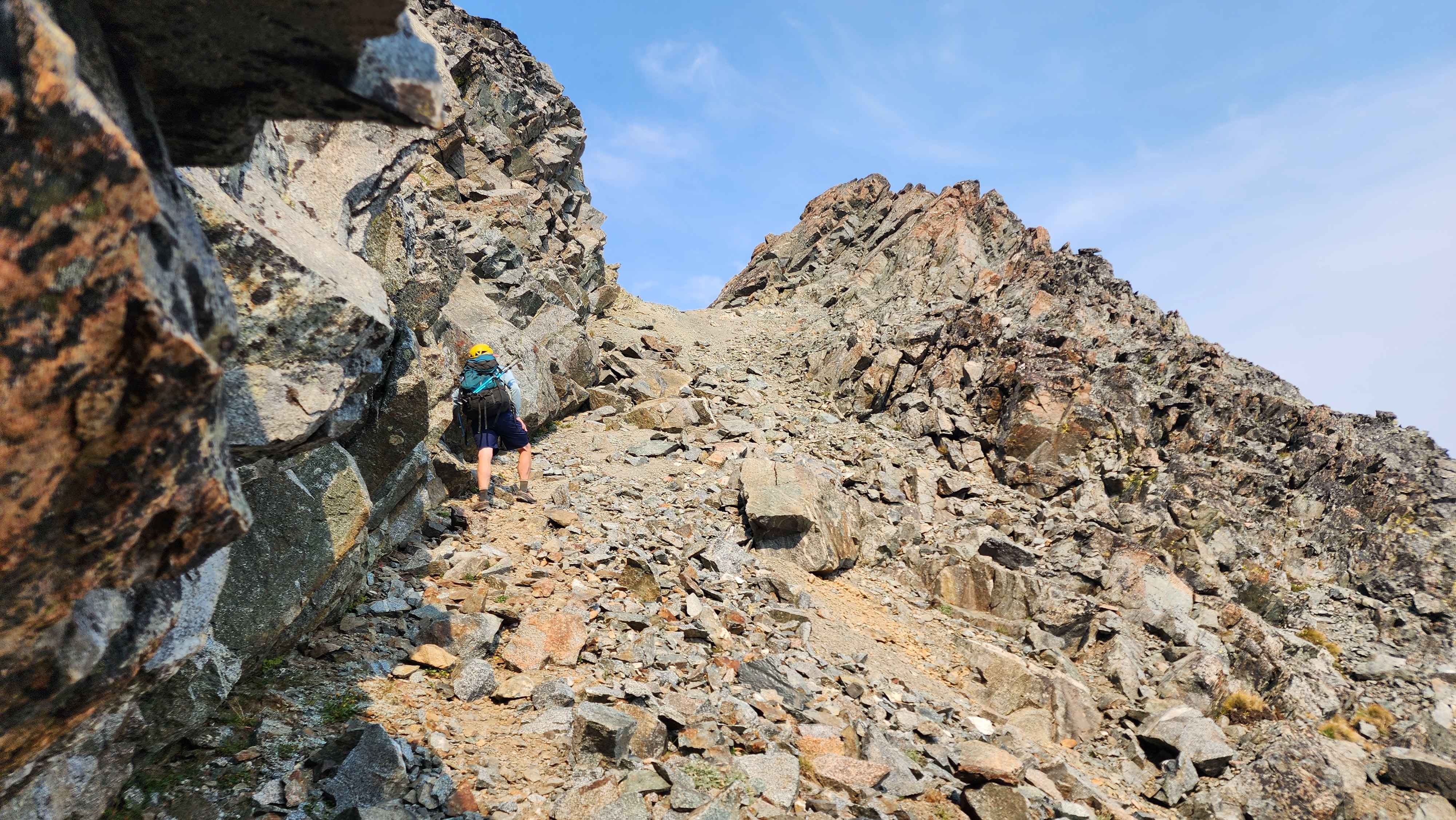
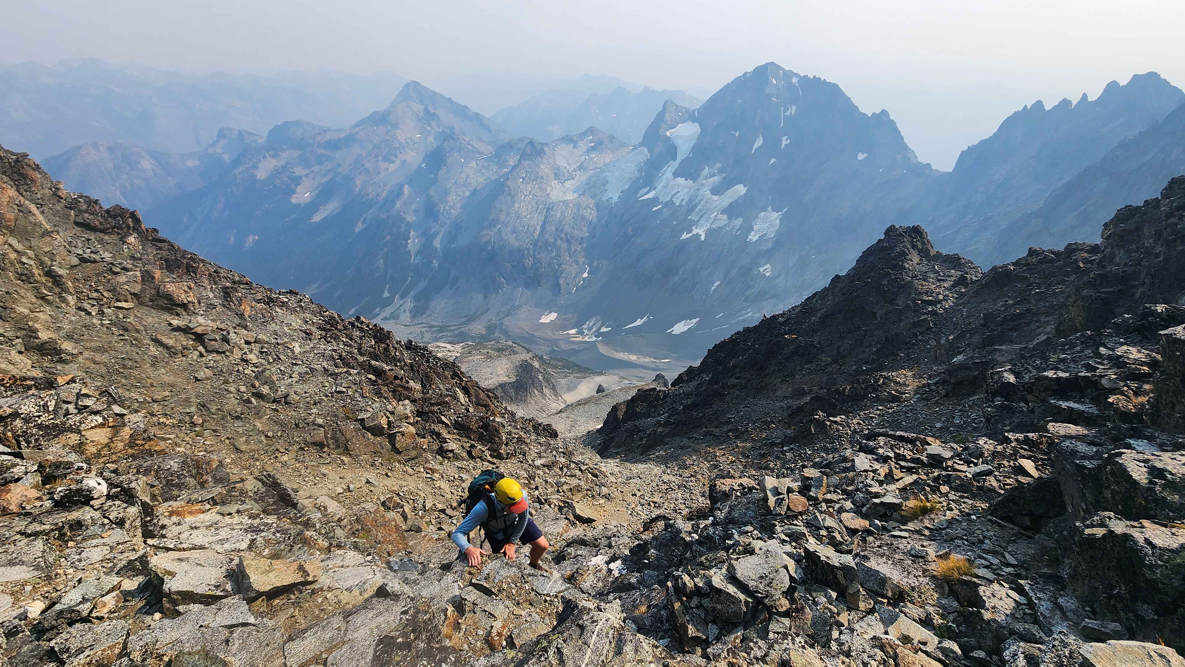
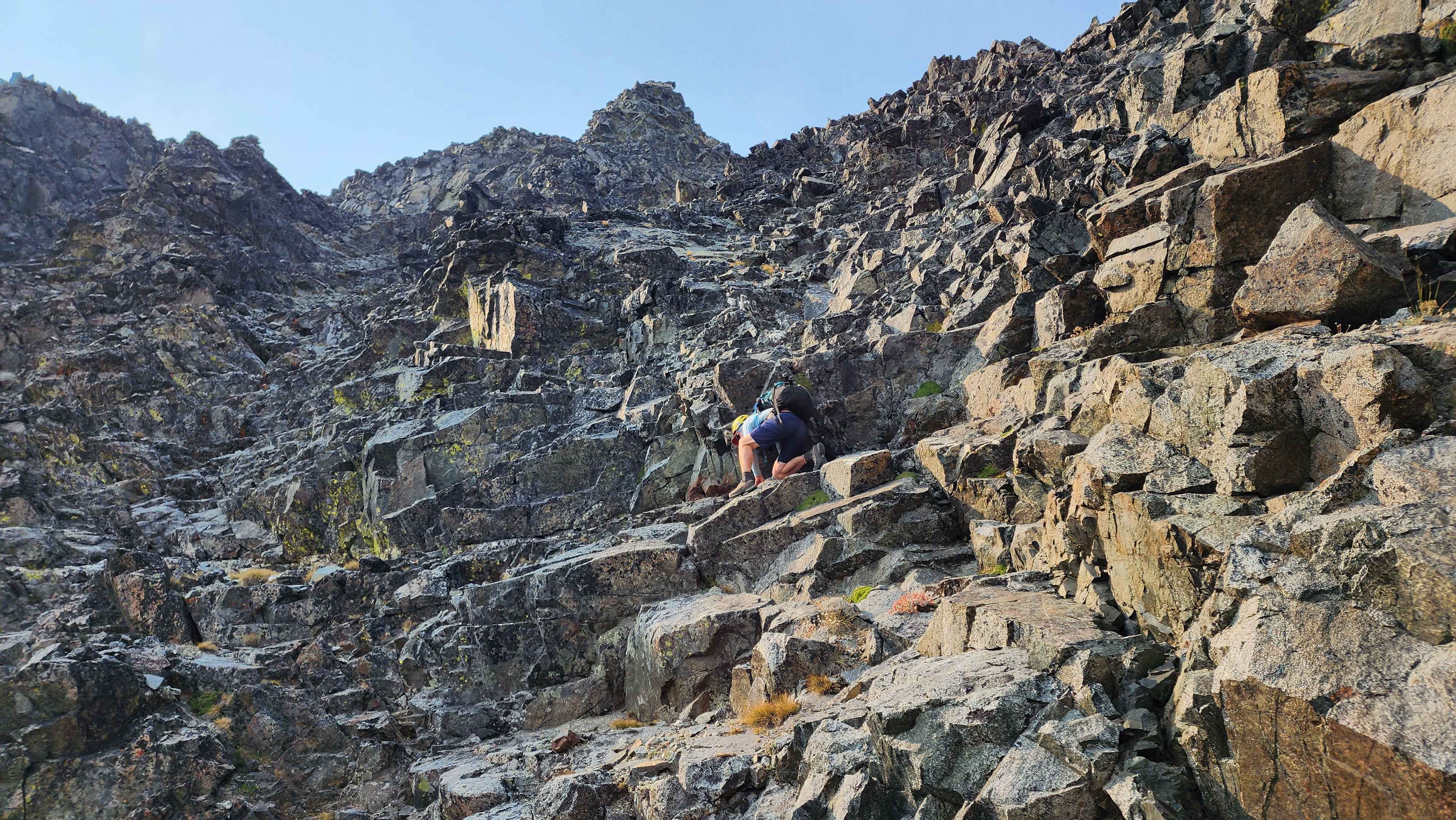
The climb up the rocks was very fun, there were many viable routes. It was a solid class 4 scramble, and a bit exposed. The rock field below made it not feel very high. After a bit of climbing, we made it to the ridge just below the summit. The final climb to the summit was quite exposed, falling bad here would’ve sent us off the cliff.
Starting the climb
The climb from below when we were climbing down
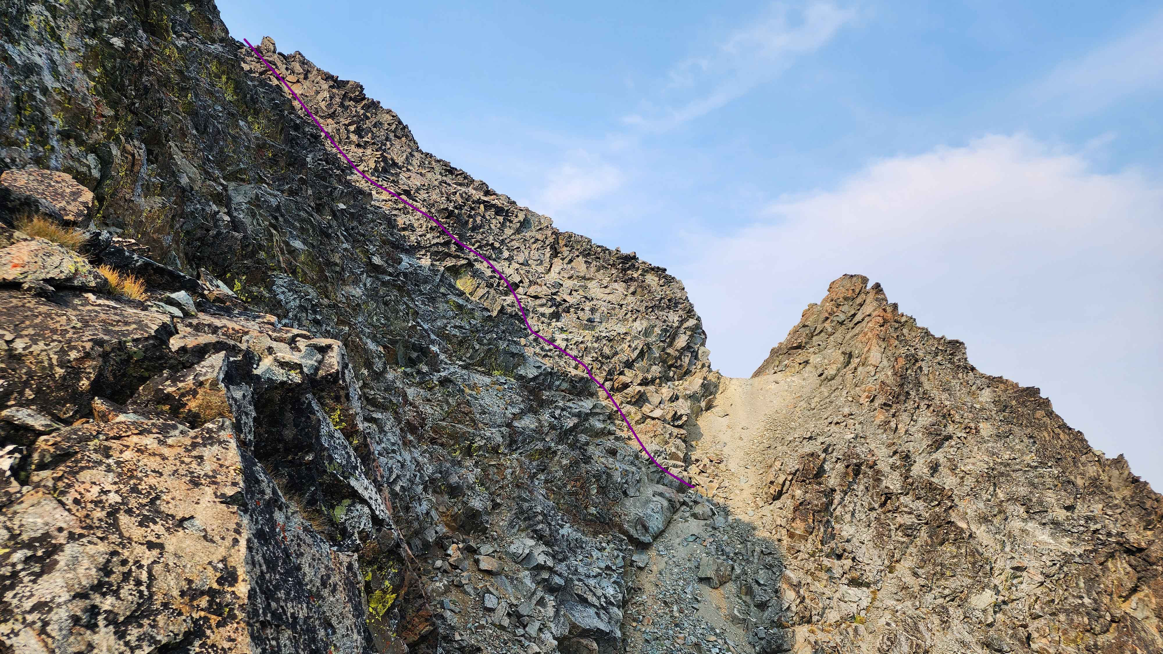
The class 4 section with a sketch of the route
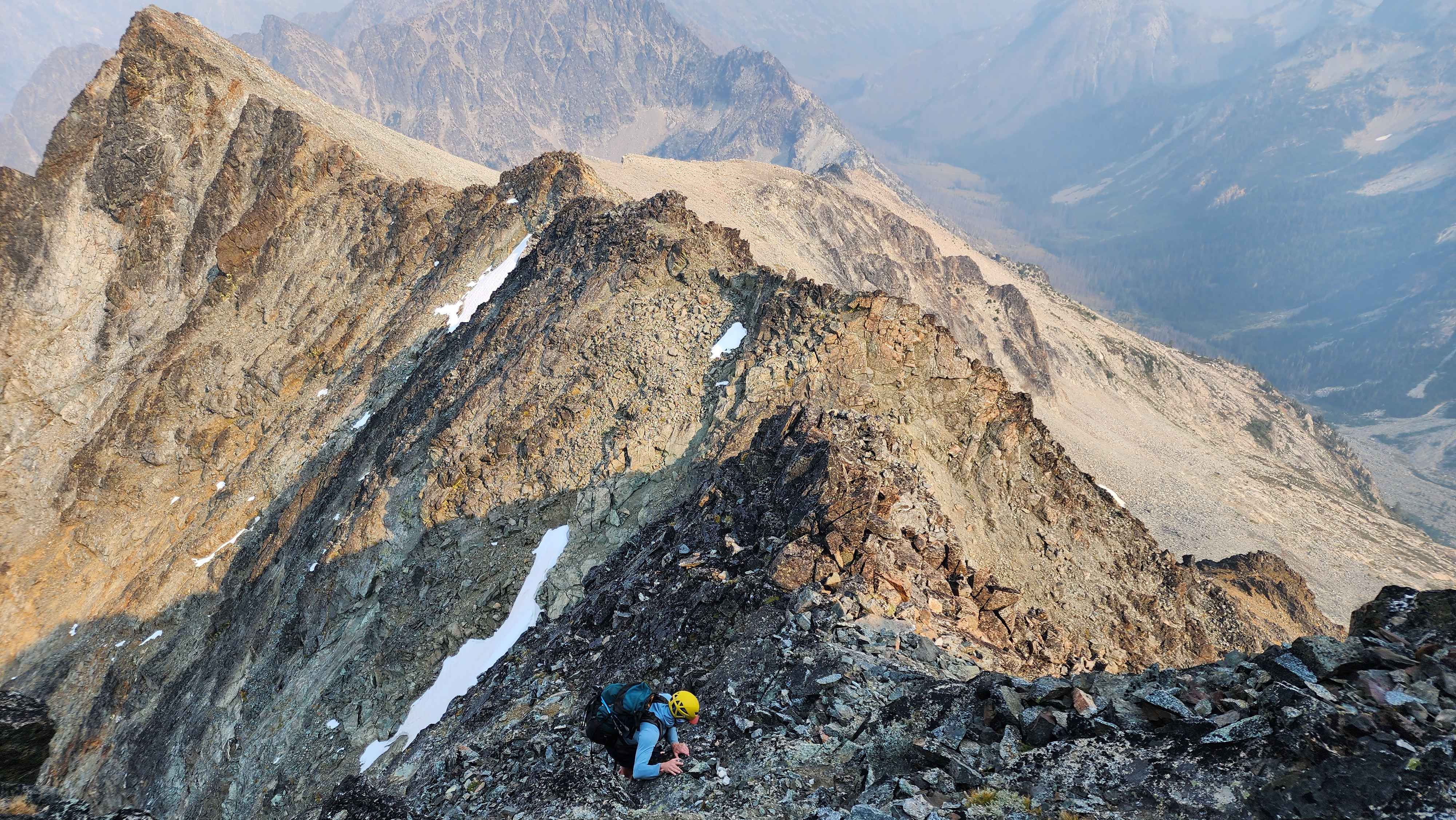
The exposed class 4 climb to summit with the cliff to the left
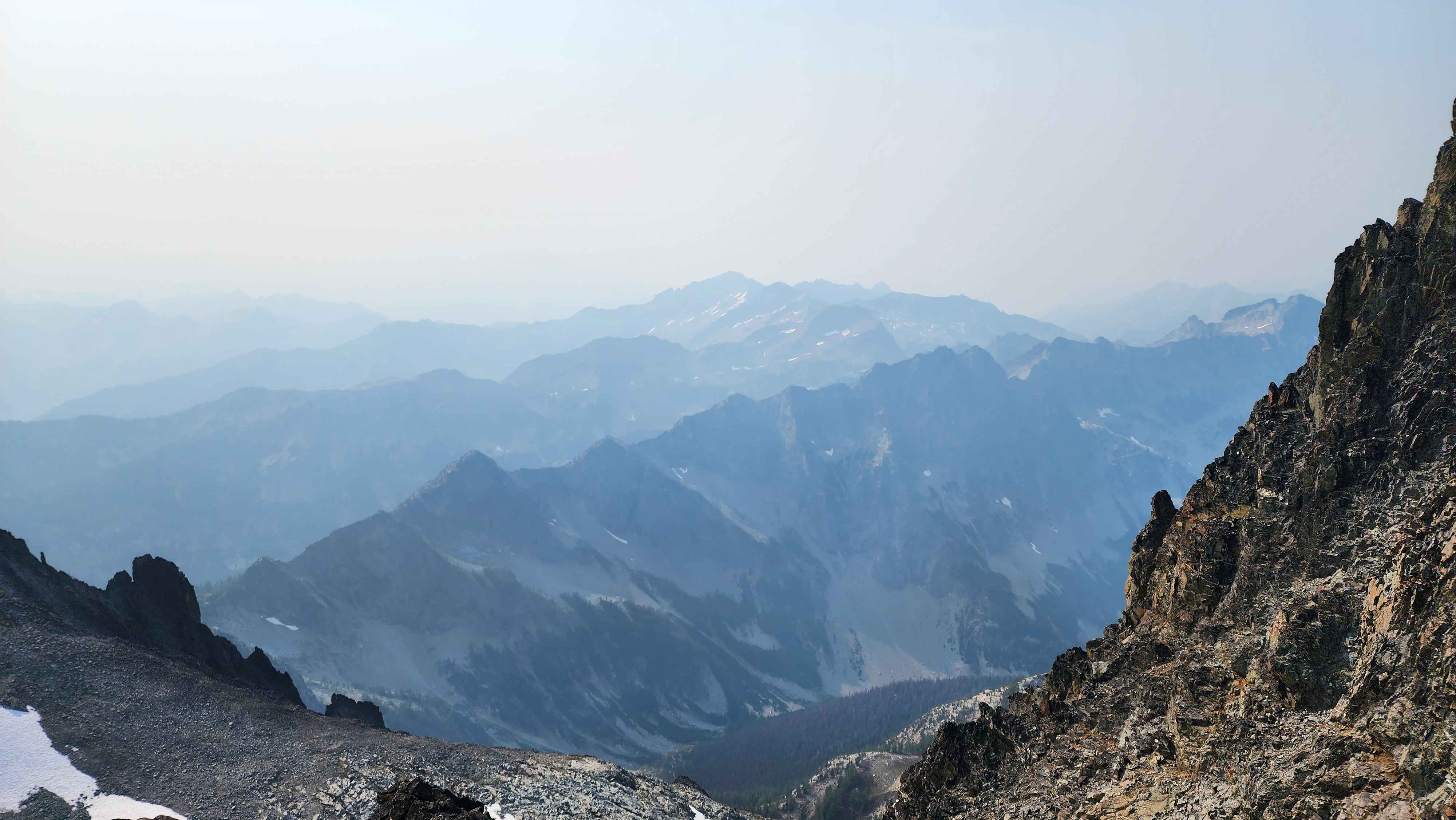
We made it to the summit at 15:23. We didn’t spend long at the summit due to our time constants. It was very smoky so we couldn’t see very far.

Only a few feet below summit (photo taken from the summit)

At the summit
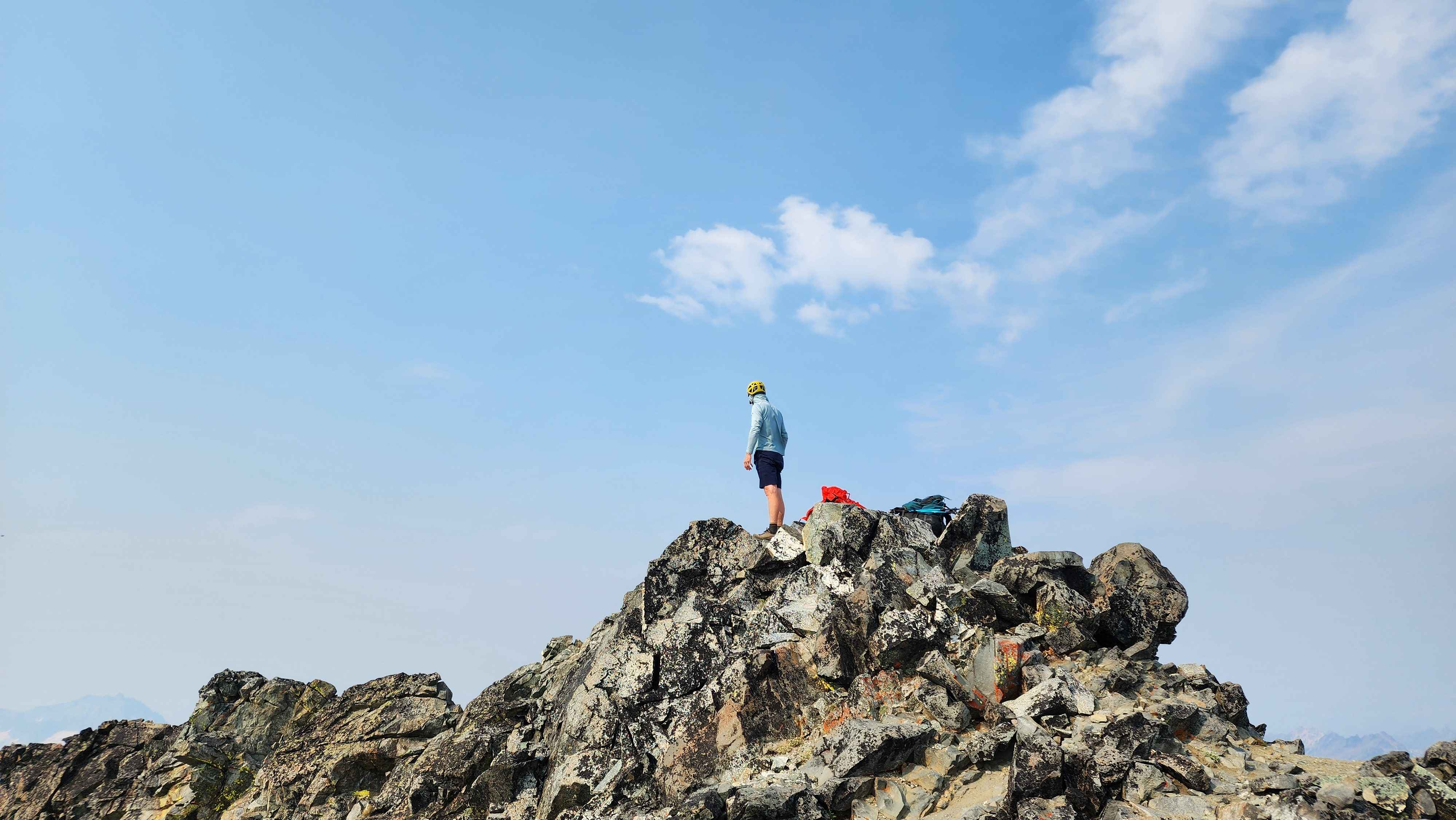
Standing on the summit
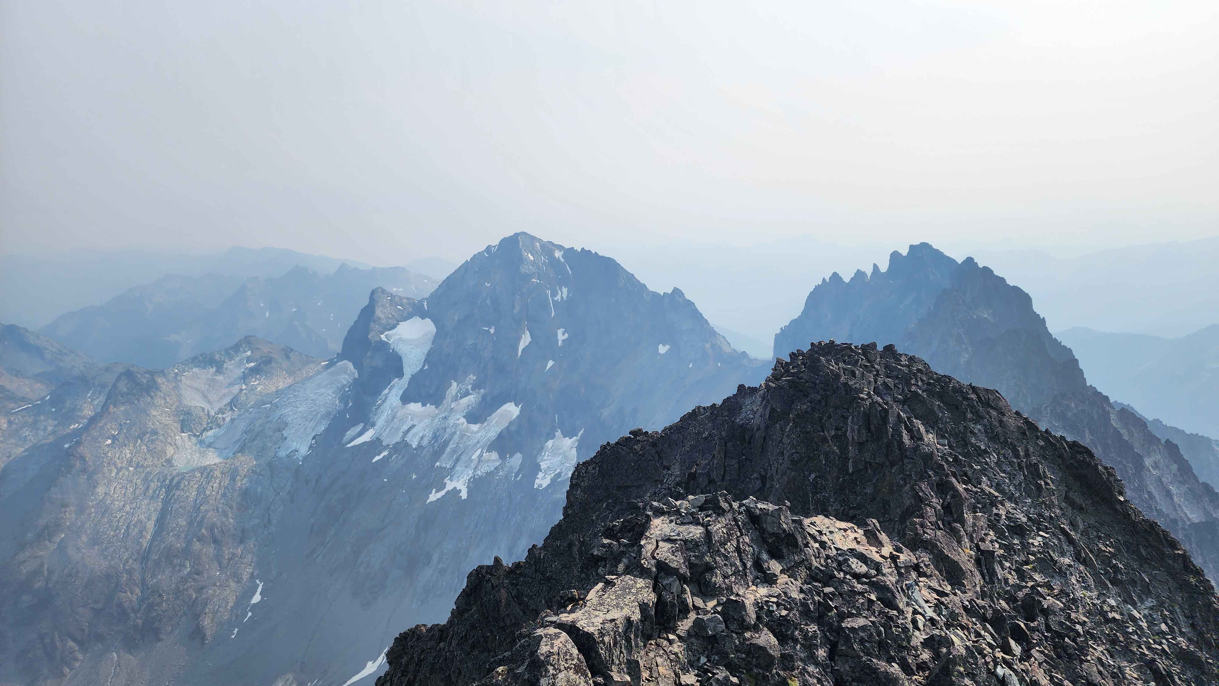
Seven Fingered Jack less than a mile away with Maude to the left
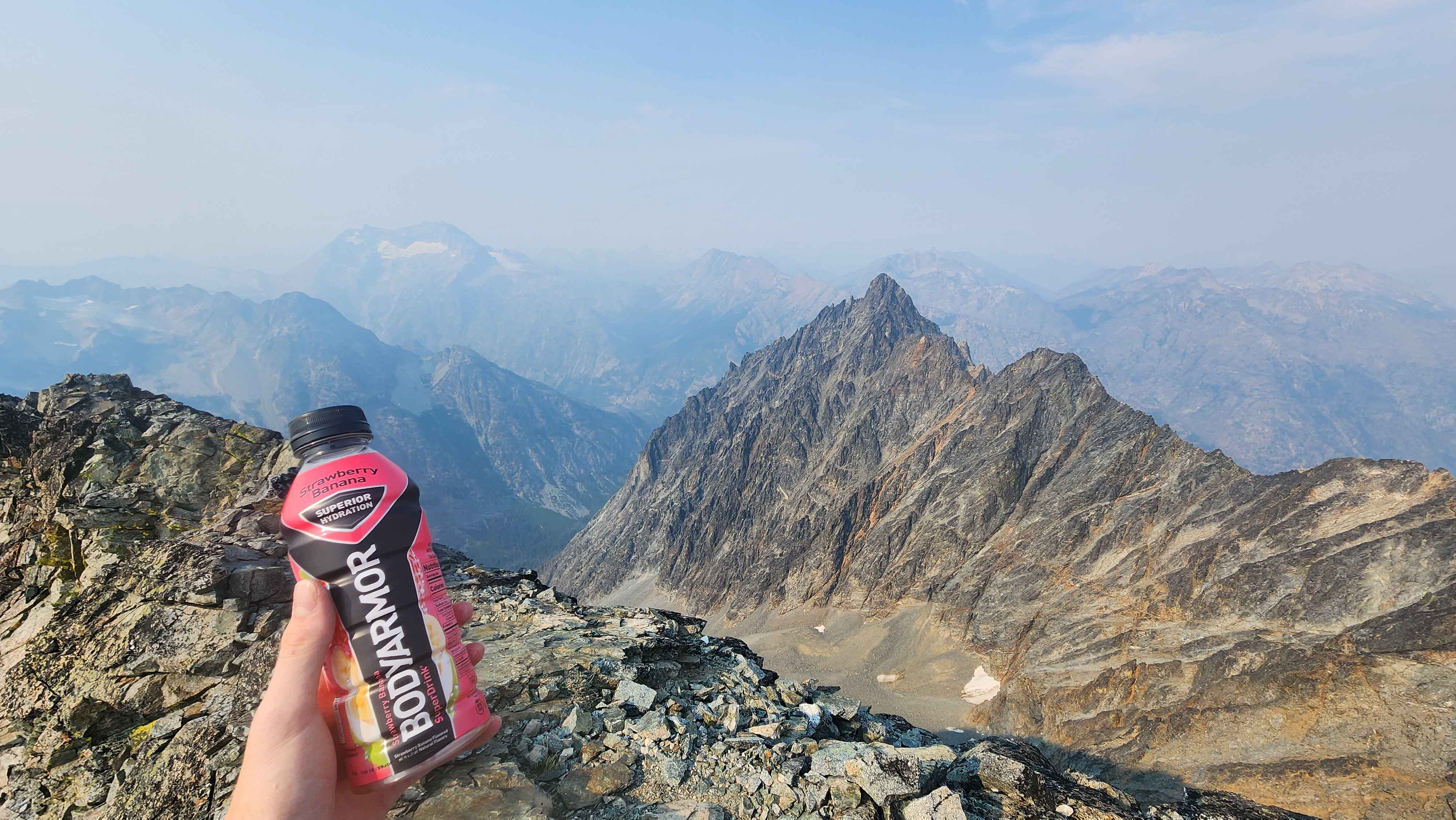
Copper Peak a bit to the right and Bonanza in the distance to the left
We left the summit at 15:41, putting us about 20 minutes ahead of our turn-around time. We made it back to the high plateau at 17:40, putting us way behind schedule. We had told our slowest climber to start back up to the ridge once they saw us climbing down. They saw us and had left at 16:30. They left us some filtered water and a note saying when they had left, which was nice. We eventually caught up to them near the crux.

Going down next to the creek to skip most of the rock field
We made it to the ridge with well over an hour before sunset. We made way better time back up to the ridge than we expected. We went back to camp and made the decision to skip Maude the next day and instead head back down the way we came in.
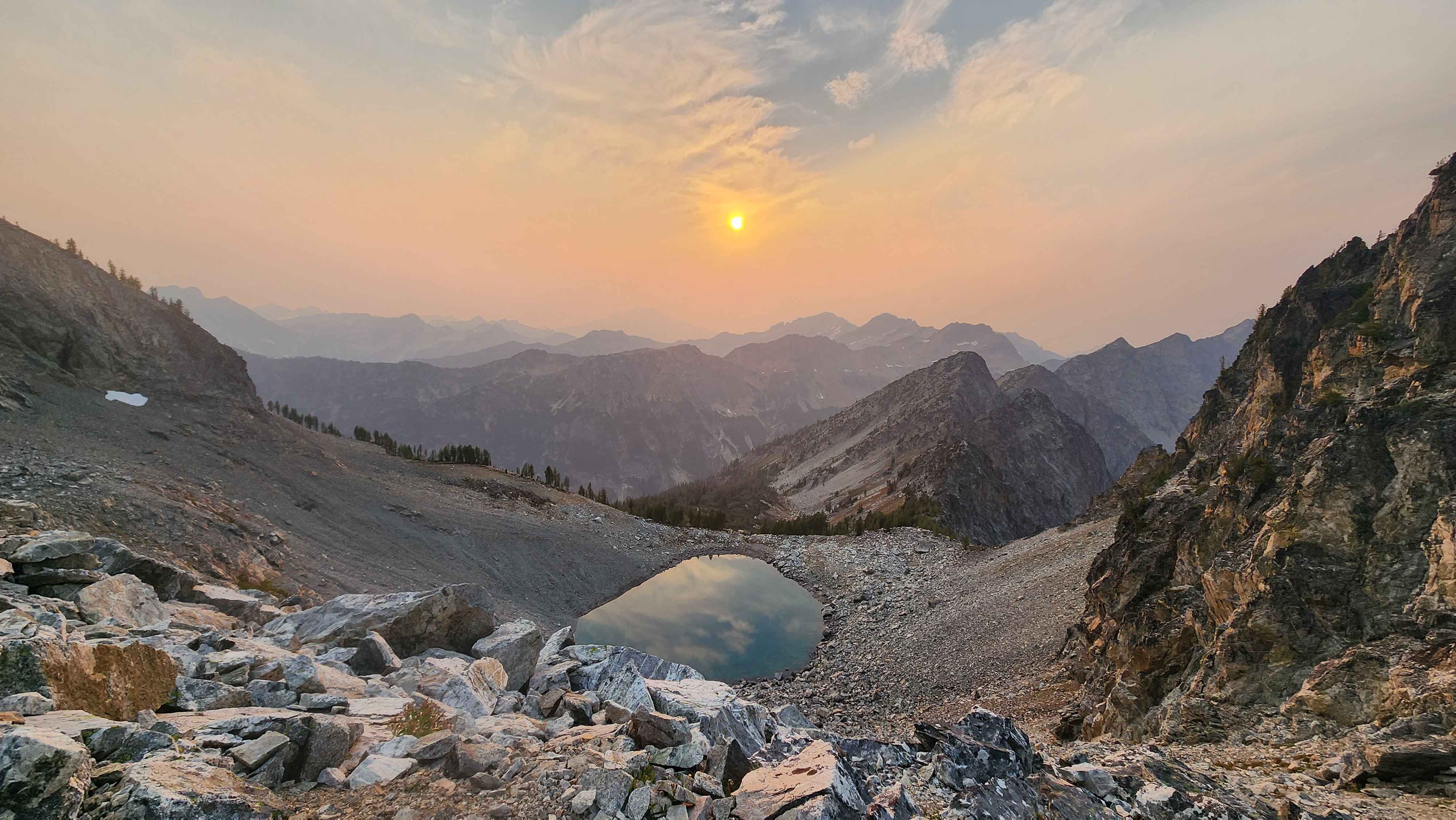
Chemical Lake as the sun is setting
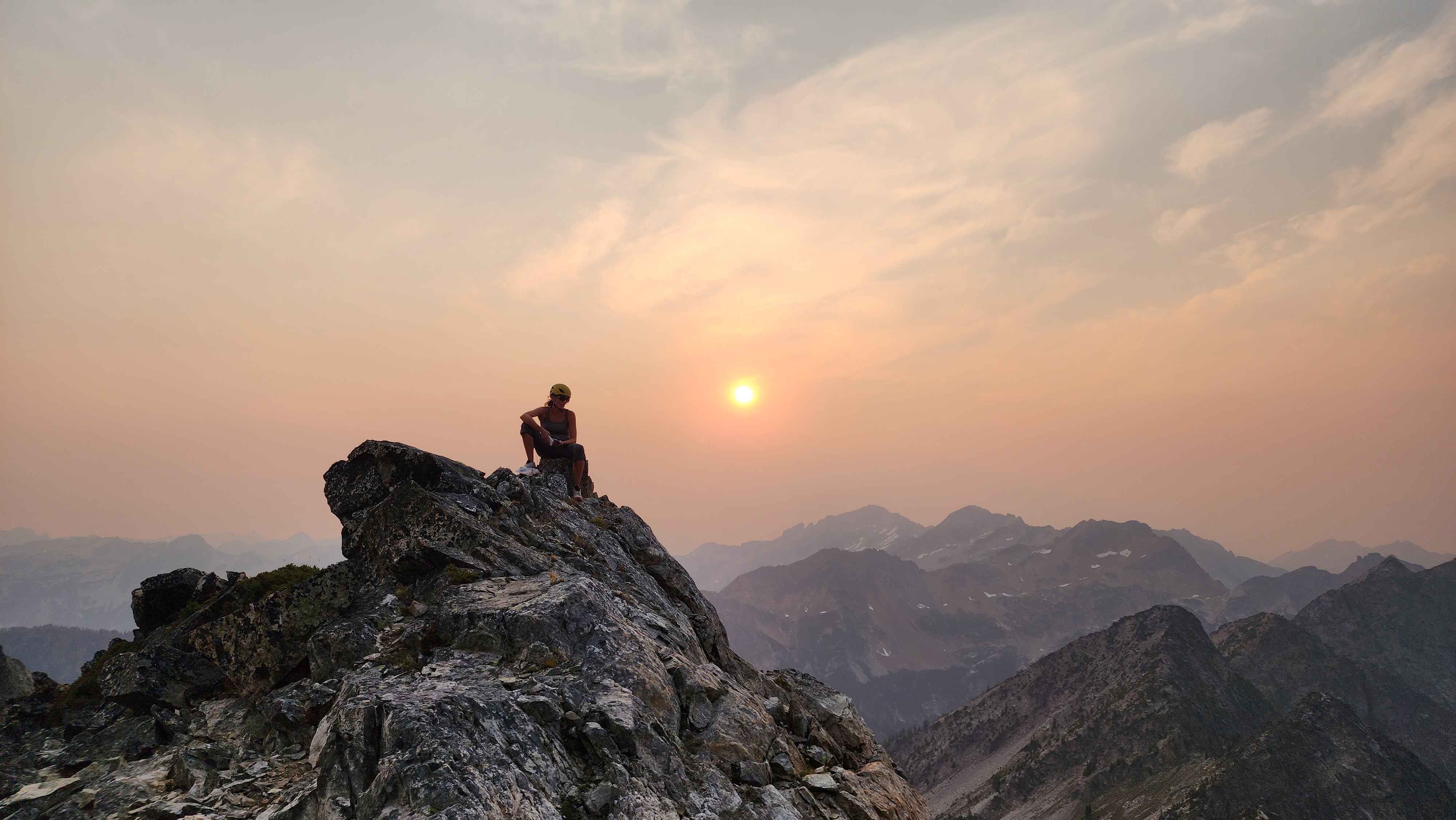
Back on the ridge