After summiting
Dragontail Peak, Mt Stuart was the obvious next major summit to go for. I decided to go with a group this time since there was no way to avoid spending a night away from home (it’s a 3-hour drive from my house in the first place), and I only like going solo for single day trips. The two options were to either spend a night in the car at the trailhead and go for a C2C or do a 2-day summit. I decided it would be best to camp just below where the climb starts instead of car camp.
We got to the trailhead late in the day at 16:50. The first day was a super easy walk up to Longs Pass and back down into the valley. After making it to the top of the ridge we got to see the goal ahead of us for the first time since the road.

Mt Stuart from Longs Pass
The ascent to the ridge was only about 2000ft, so we made quick work of it even with heavy packs. After walking back down into the valley we found a nice spot by Ingalls Creek and set up camp. The first section going down off Longs Pass was a bit steep and sketchy, which was unexpected this early on.
Going down from Longs Pass
It took us 2h 15m or so total to get to camp. I went for a short jog to scope out the route we were going to take in the morning (since there is three different routes to get to the couloir). The first route up looked like the best, so we planned on going up that one. This took about 15 minutes which was included in the final time.
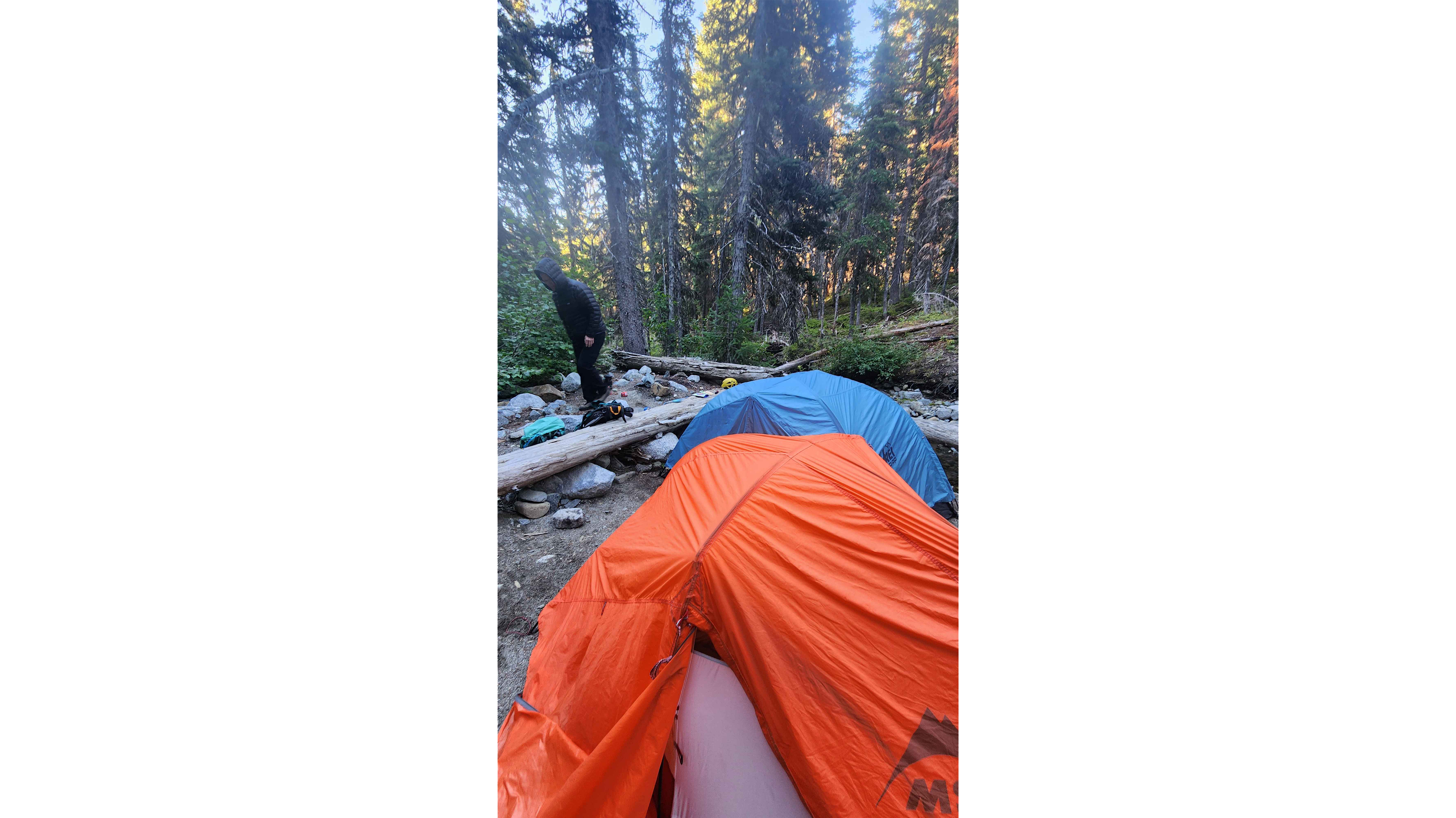
Our camp by Ingalls Creek
The next day we hit the trail at 8. We left our tents and other camping supplies at the camp; we only brought the Jet Boil and a single sleeping bag. There are no streams anywhere on the route this time of year, so each of us had about 4 Litres of water, which ended up being plenty for the trip. The ascent up to the couloir was a gradual hike through the forest. We saw a deer while going up this section which was very unexpected.
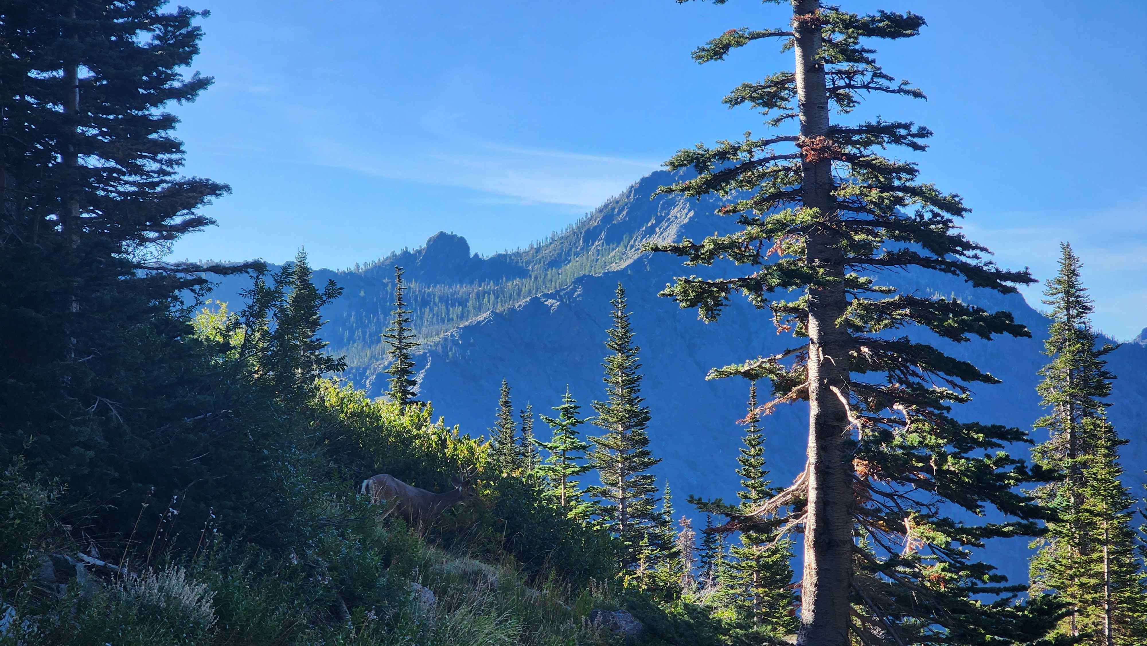
The deer in the forest
Eventually we reached the couloir which was where things got steep. The couloir was a blend of loose rocks, boulders, and sand like dirt. There were many routes that could’ve be taken up the couloir, so route finding wasn’t very difficult. There were ample shaded spots while we were going up, which made the hot day not nearly as bad. As we went up, we could see more and more of Rainier until we could see the entire mountain.
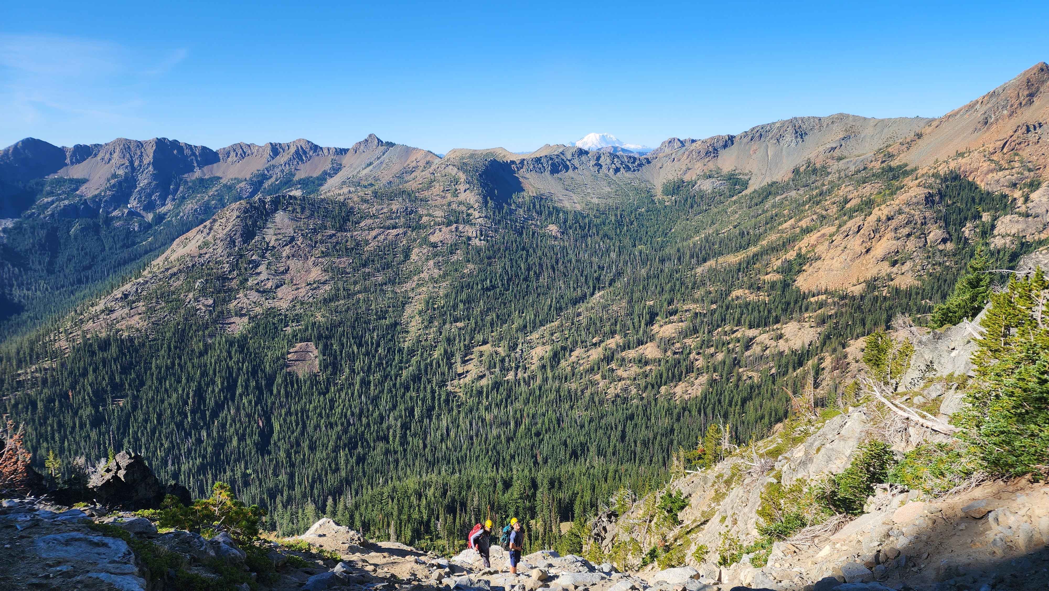
The lower section of the couloir with Rainier sticking out over the ridge
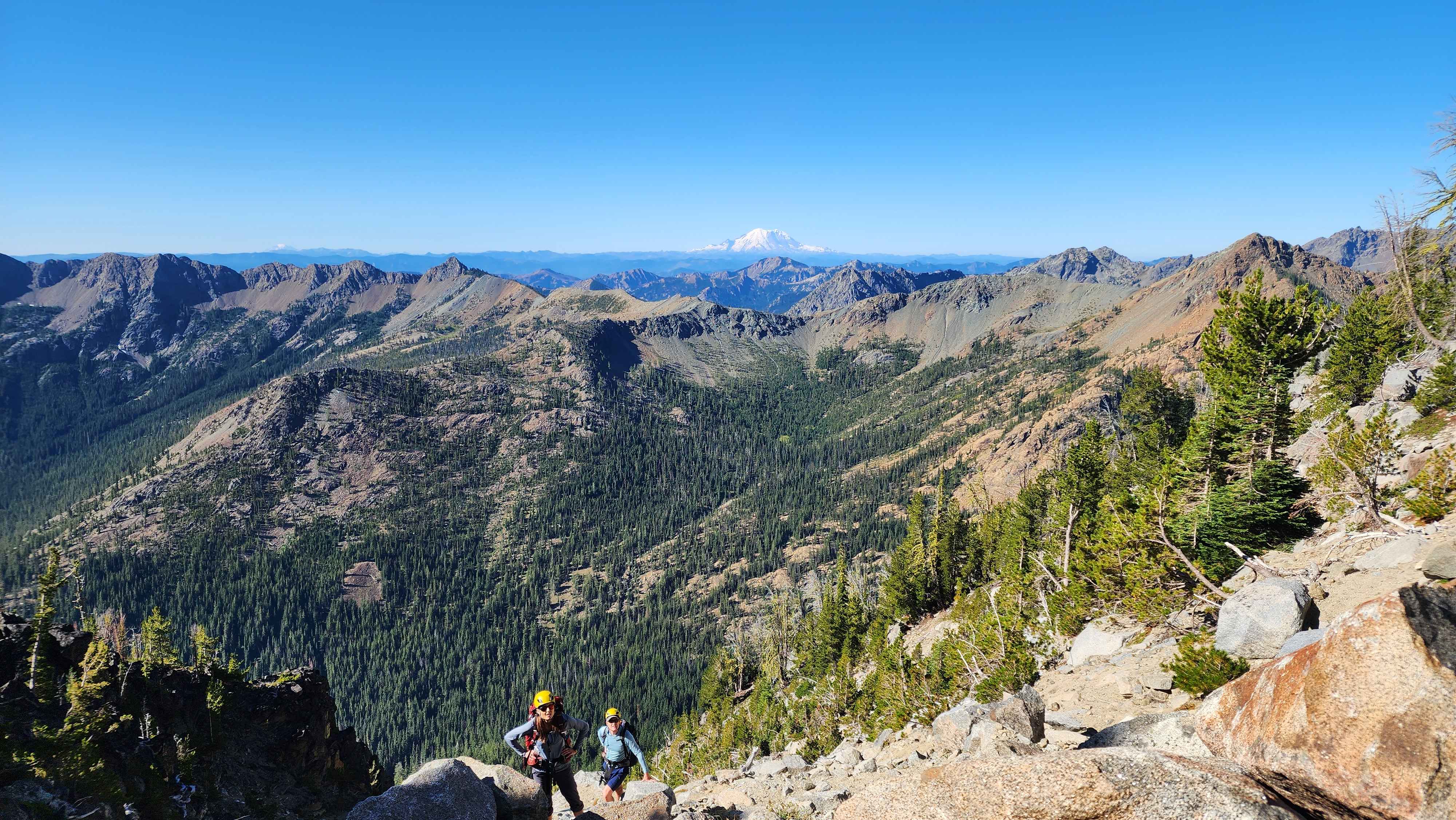
Near the top of the couloir where the entirety of Rainier is visible
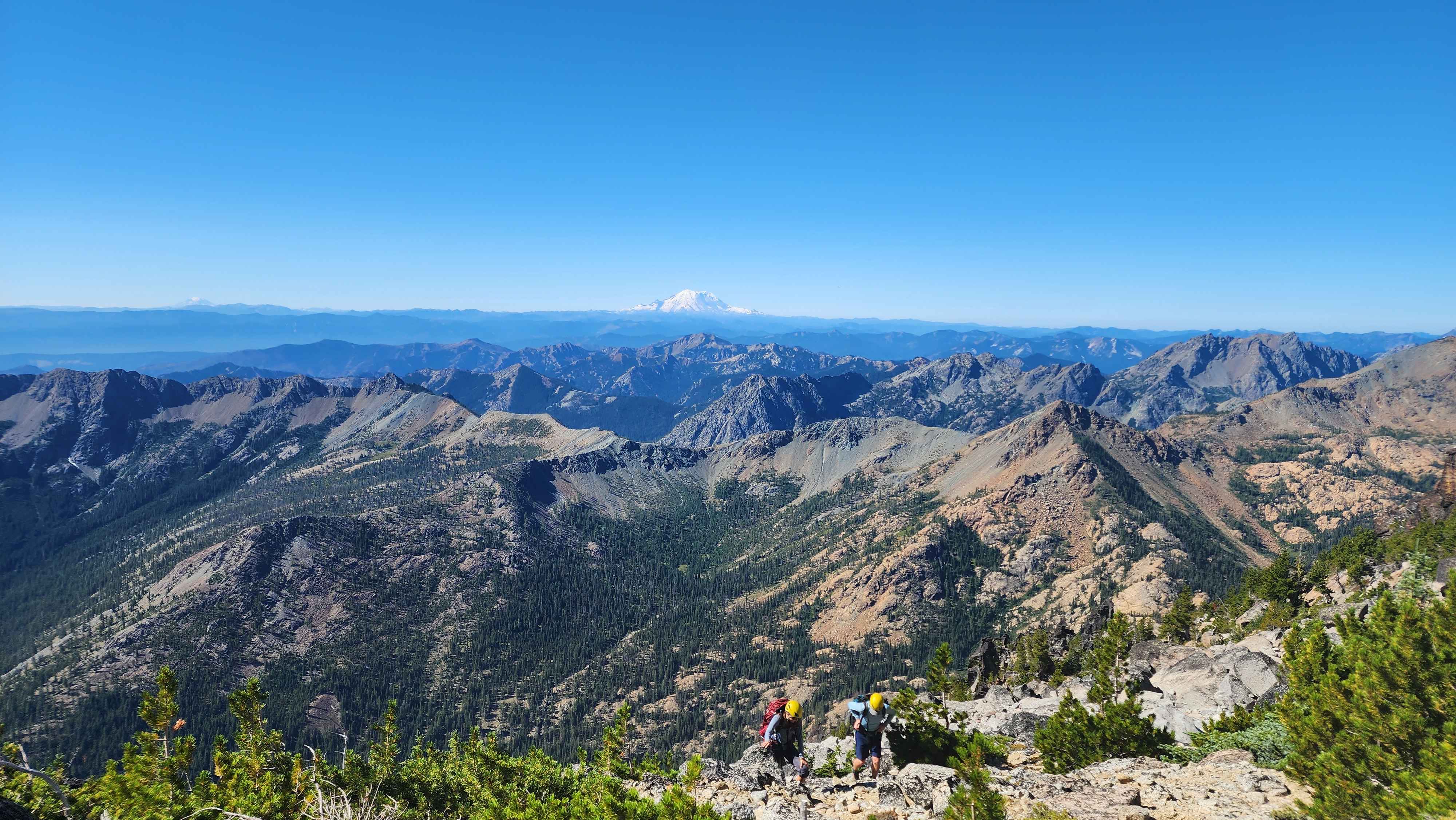
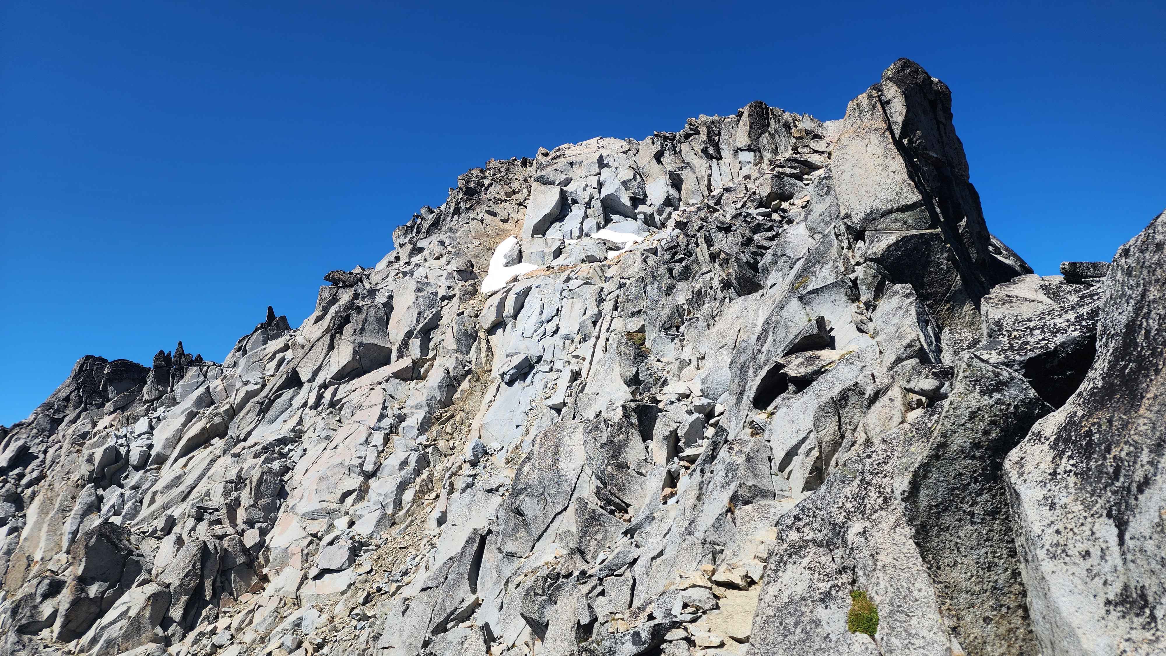
Eventually we made it out of the couloir, which was a relief. The top of the couloir was slightly angled with lots of small trees. There were two or three spots big enough for a tent in this area (so camping above the couloir is very possible). After the top of the couloir the trees ended, and it was another long slog up to the southeast slope. This section had much larger rocks but still had the same sand dirt as the couloir. At this point I left my group behind as they were being far too slow for me. I opted to climb the rocks instead of walking the eroded switchback trail in the sand dirt for most of this section.
The top of the couloir
Going up the route to the southeast slope. The top of the couloir to the right where the small trees are. The couloir continues down the mountain to the right.
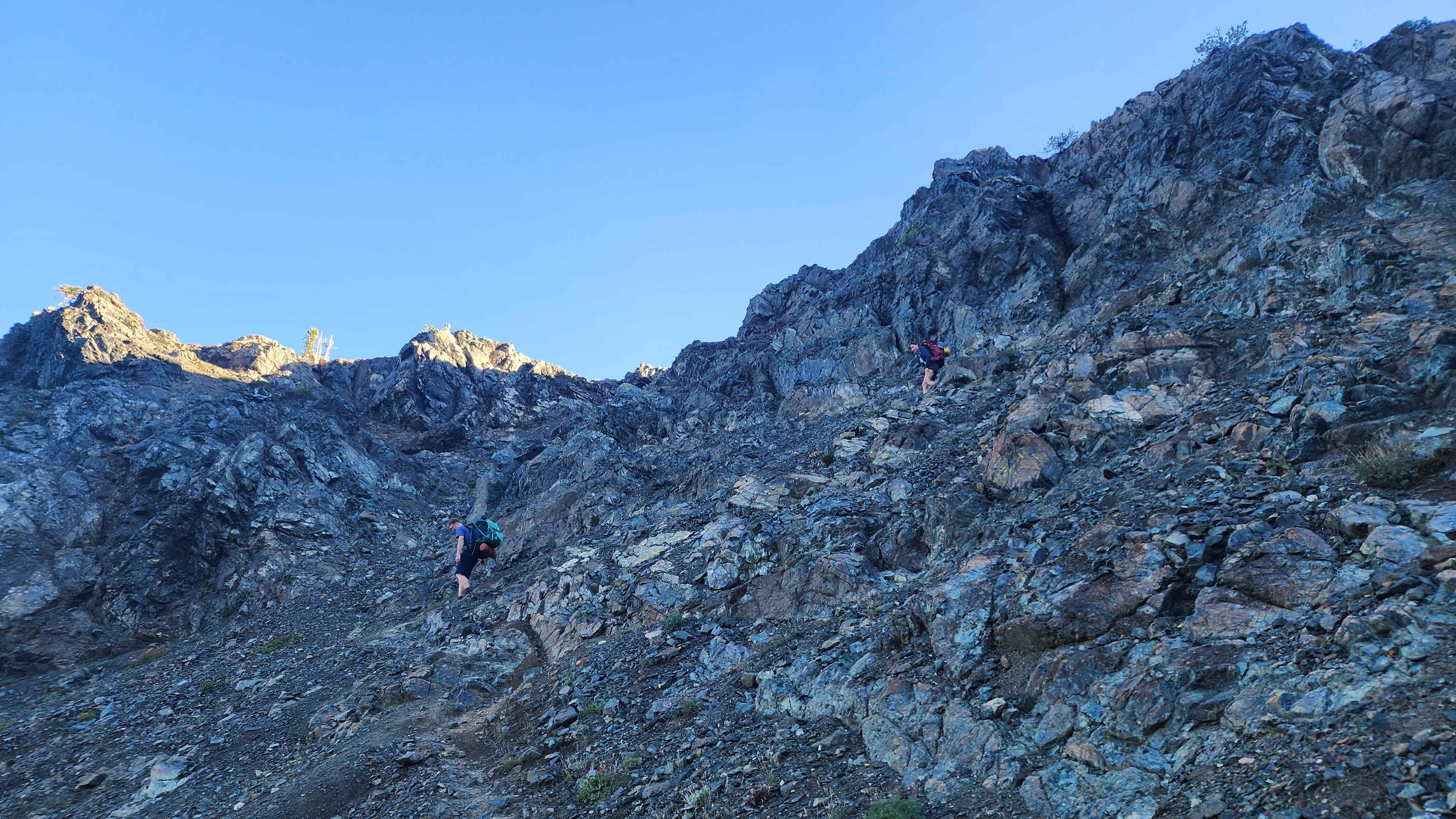
Eventually I made it to the southeast slope, which posed the first real problem. This slope had the permanent snowfield on it which forced me to go around it. This wasn’t an issue; the real issue was that the slope was comprised mostly of the sand dirt, which made it very hard to climb when combined with the steepness of the slope. There were some rocks to the left which were better to climb on, but they were just as sketchy as the main slope. After making it to the top of the slope, I decided to go up the chute to the left as it seemed the easiest. The climb up the chute ended up being easier than the slope, but the rocks were very loose, and I sent a few down the chute by accident.
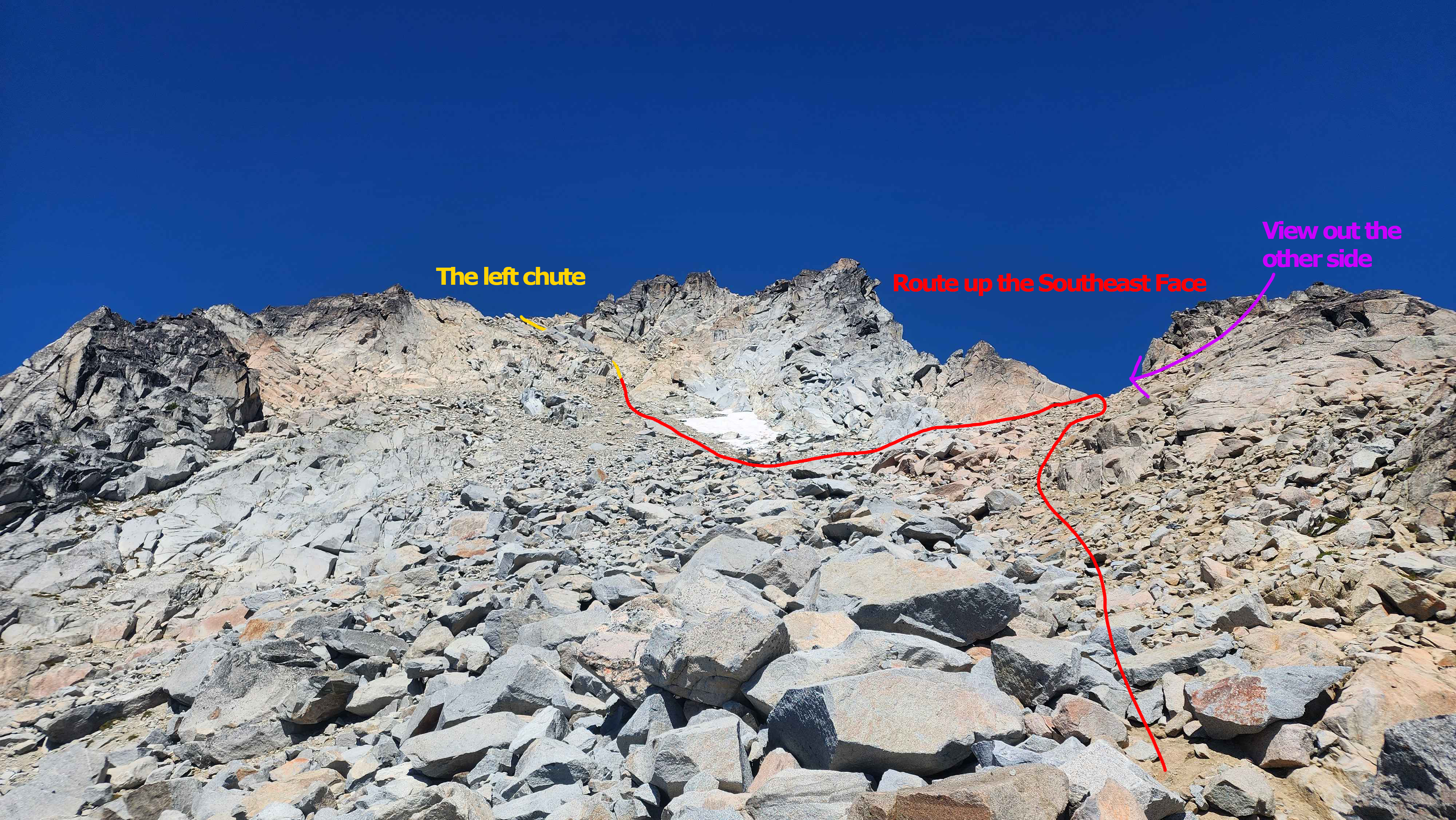
The route up the southeast slope and the chute
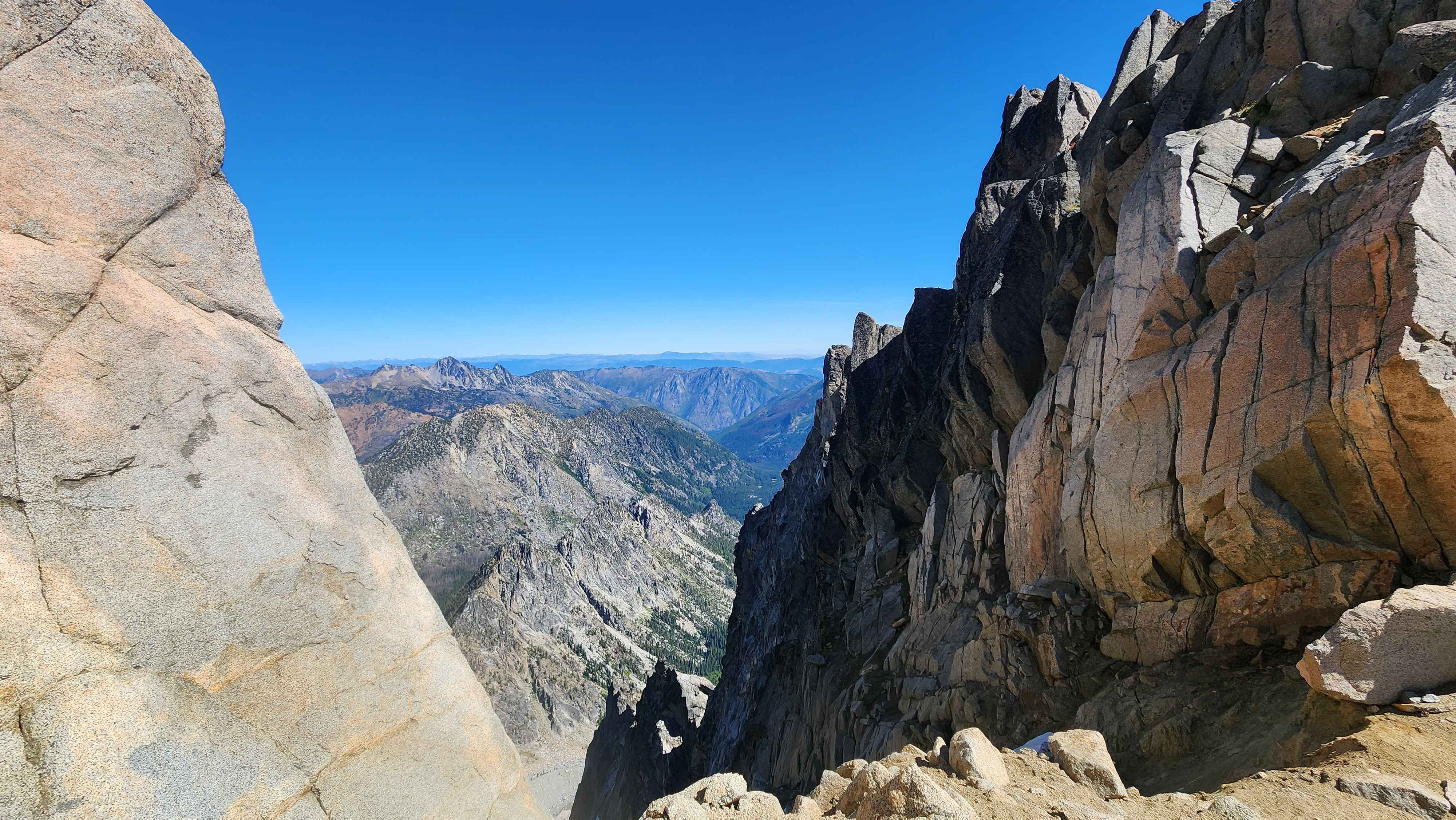
The view out the other side
After making it up the chute I could finally see the true summit. I first went on the path going up, but this one eventually hit a cliff face, so I turned back to the main trail, which was lower down. I walked the trail up to the ridge and walked across on this route. This clearly wasn’t the main route, but it was much more interesting than the main route with being able to see out the other side. The last 300 vertical feet to the summit was the hardest part for route finding. I went the wrong way a few times, and still ended up climbing up a small 5.4 or so slab section.

The first sighting of the true summit
A rock cairn marking the route with Rainier in the background
The summit block
Throughout this whole final ascent I took many long breaks, yet I still didn’t see my team at all till I was about 50 vertical feet from summit. Turns out they had taken a different way up the southeast face which took them much longer. After getting a sight on them I continued up to the summit. There was a small climbing section to get on the summit block, but it wasn’t a problem. I made it to summit and registered my name in the summit box.
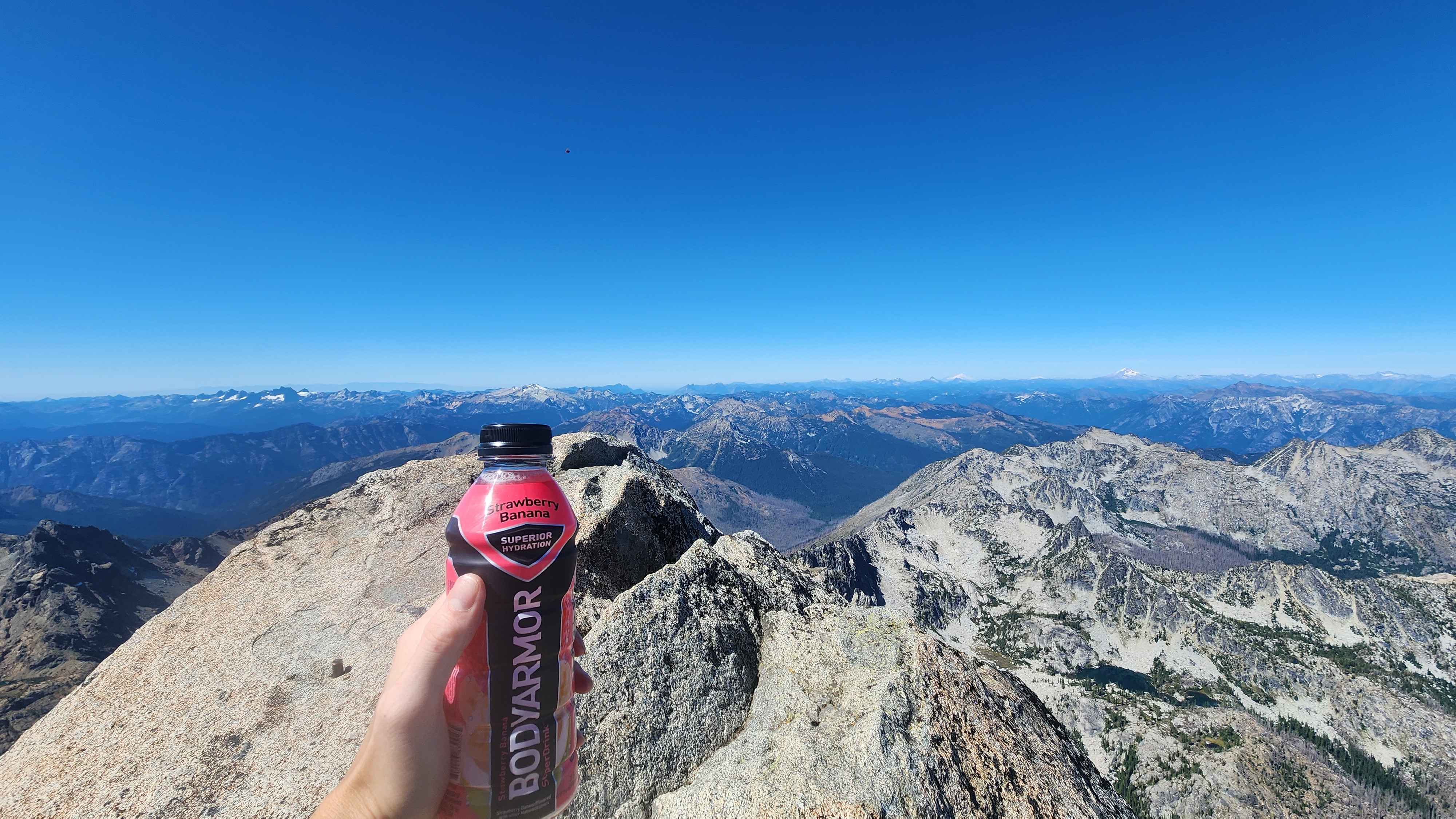
At the summit
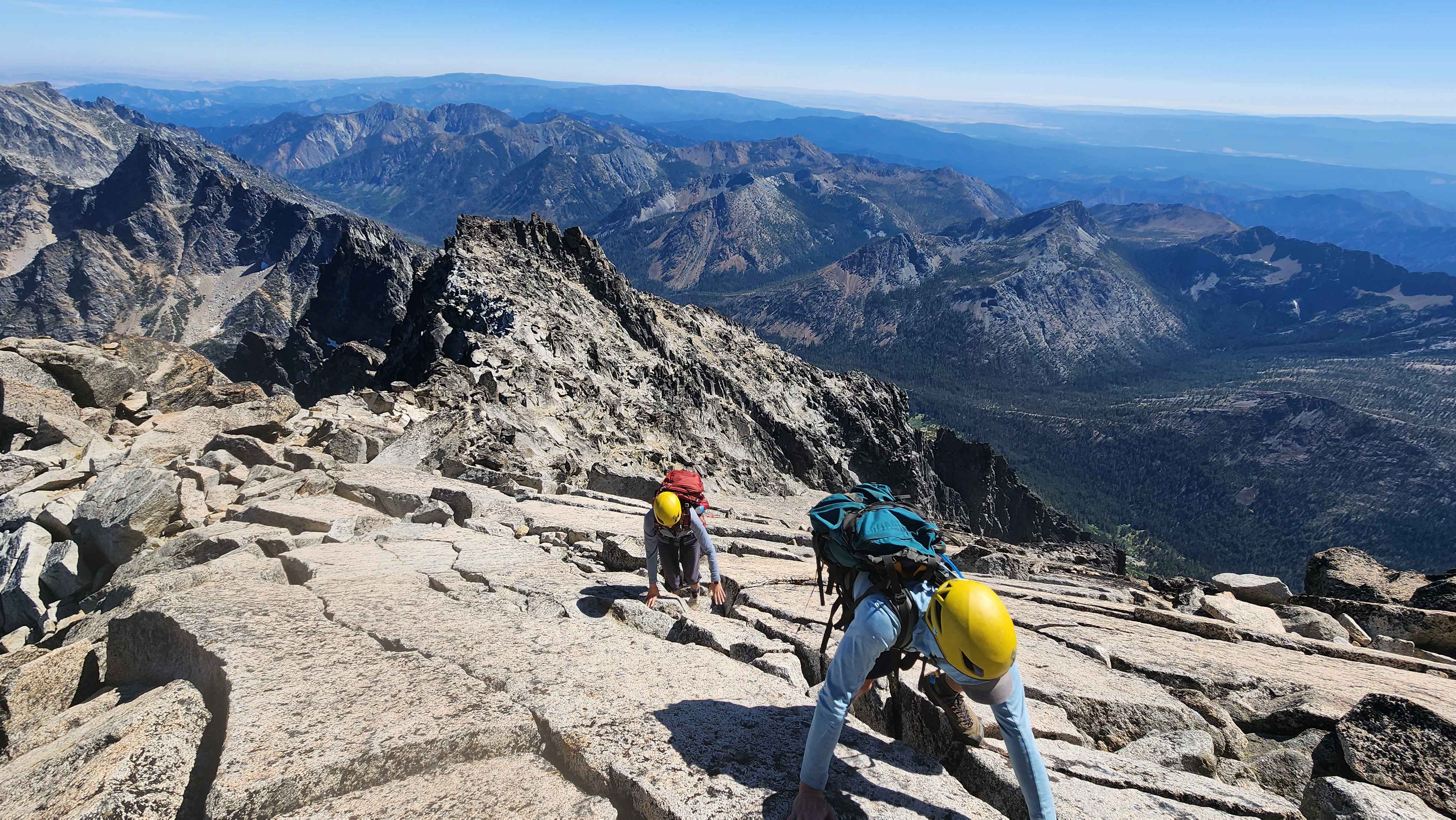
I lost sight of my team, but I assumed they were fine. After about 30 minutes I heard them talking just below the summit block. They couldn’t find the route up the block and had been looping back and forth looking for a route. I helped them find the route up and guided them across the ridge to the summit. All three of us made summit by about 13:20.
The final slab climb to the summit
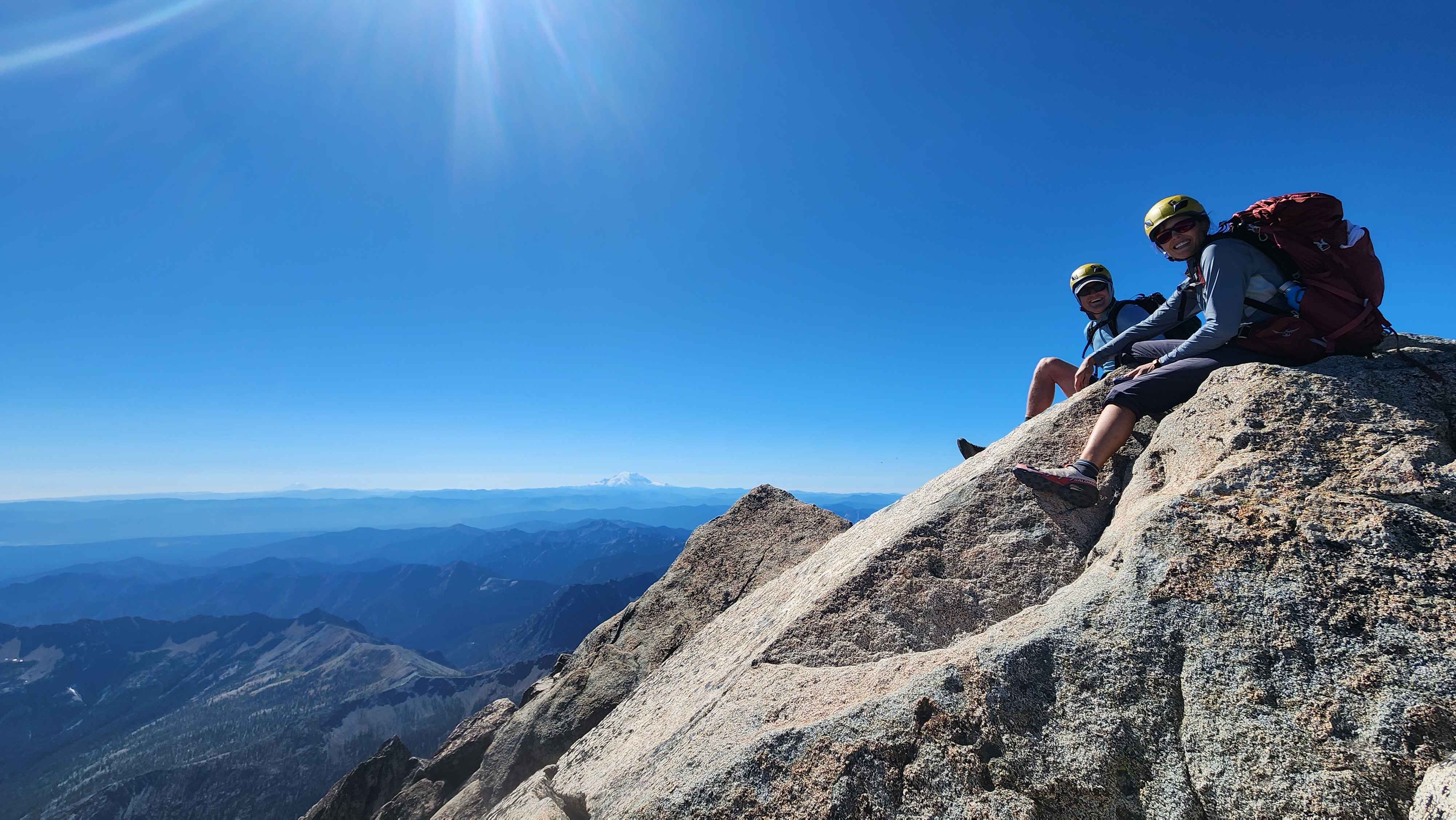
The whole group finally at the summit
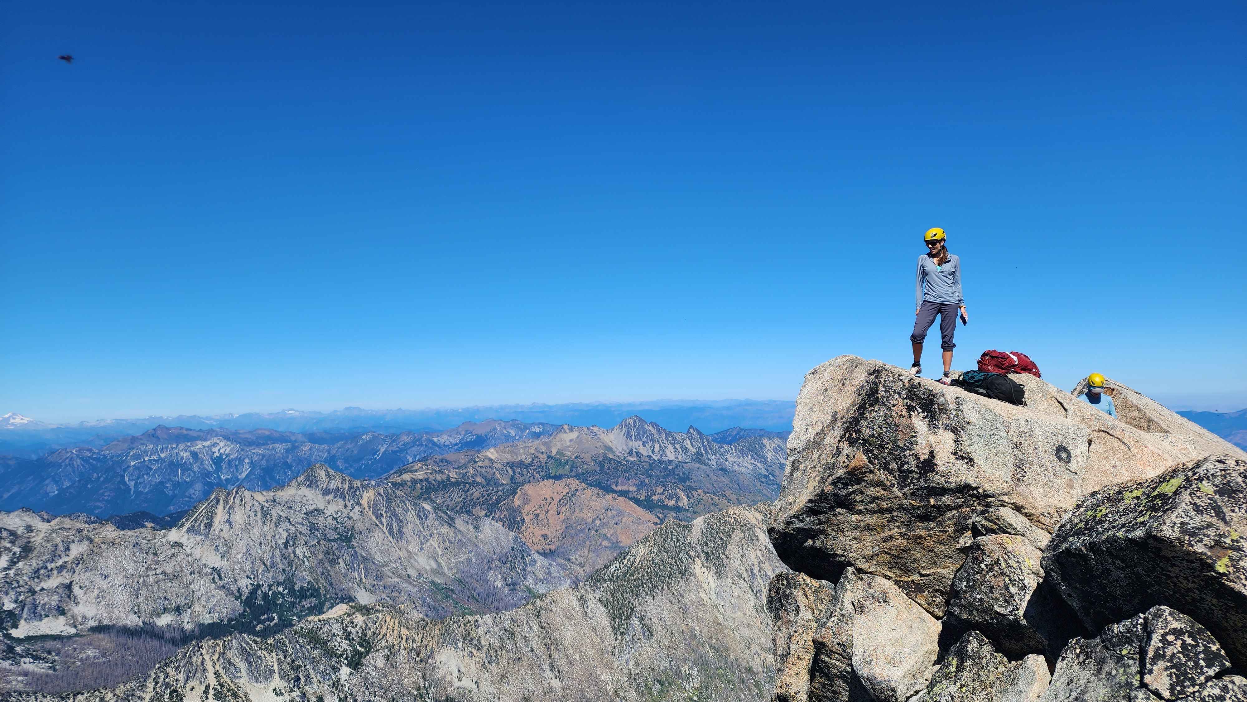
Photo at the summit
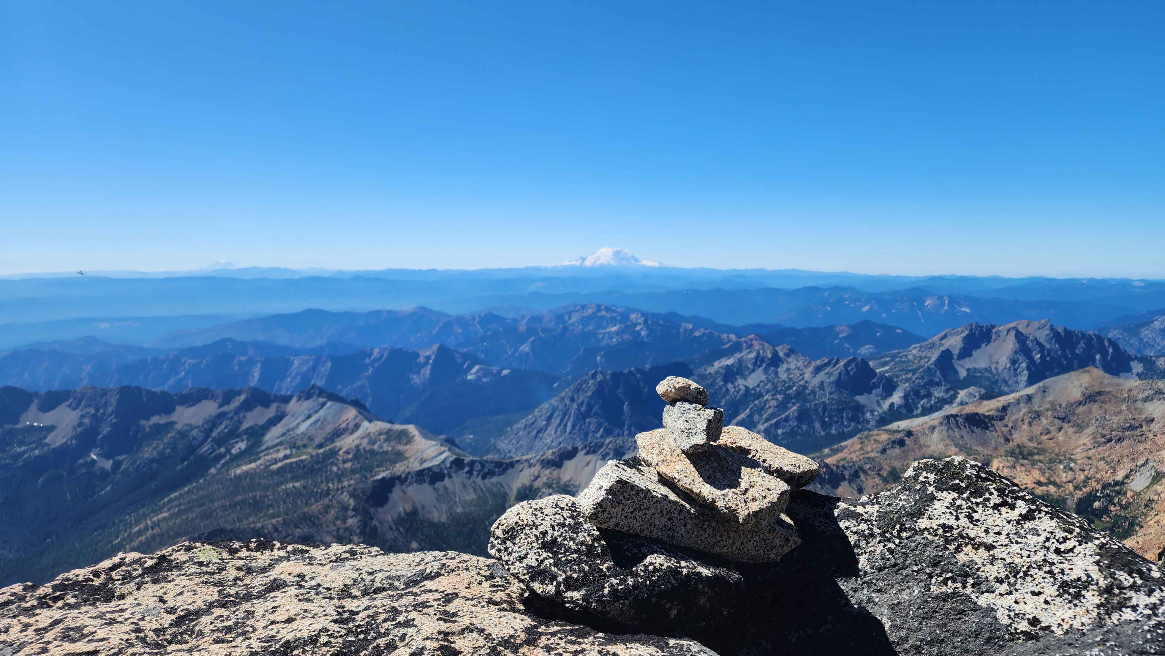
The views from the summit were immaculate. We could see pretty much every tall mountain from the top. It’s crazy how much bigger Rainier is than Adams, despite only being 2000 feet or so higher; Adams looked like a hill comparatively. We could even see
Baring Mountain from the summit, which is in my valley.
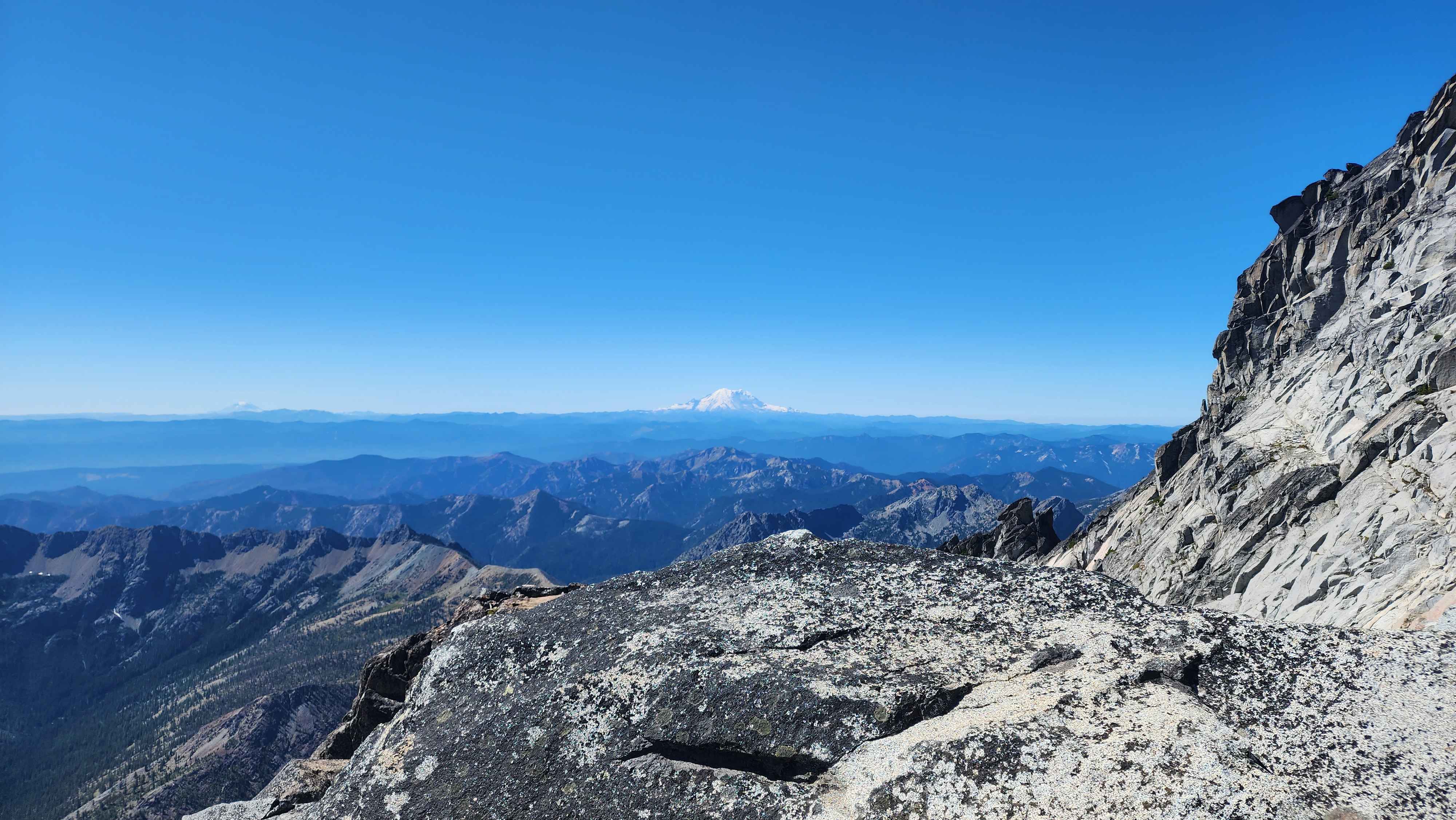
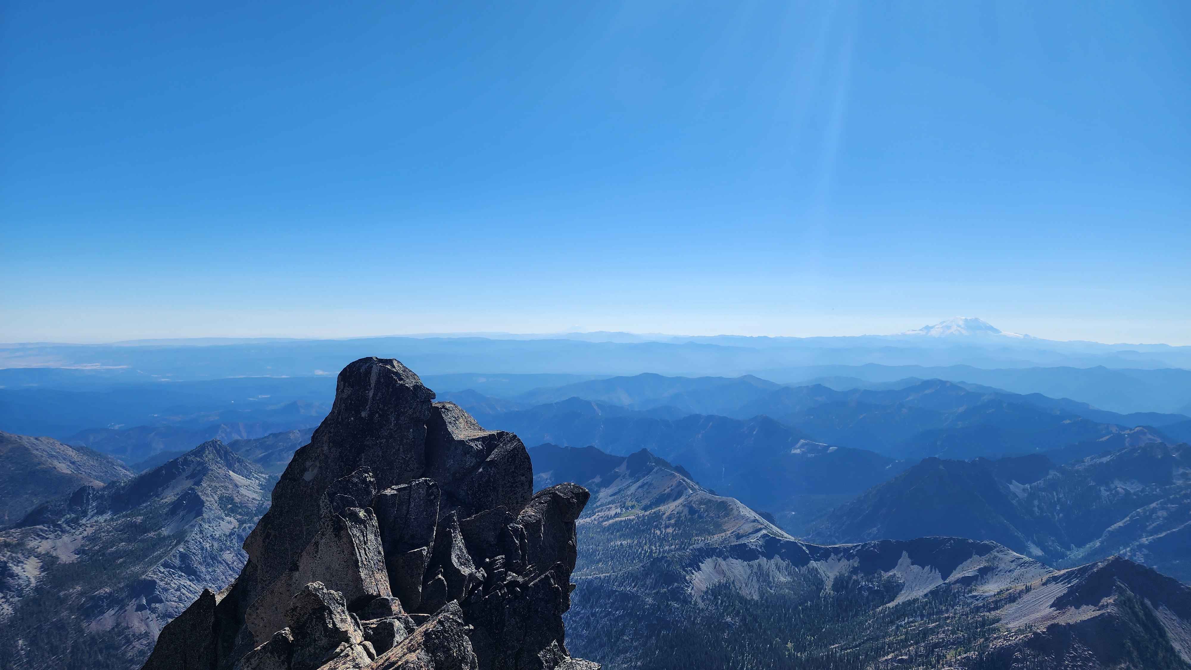
Mt Adams (to the left) and Mt Rainier (to the right)
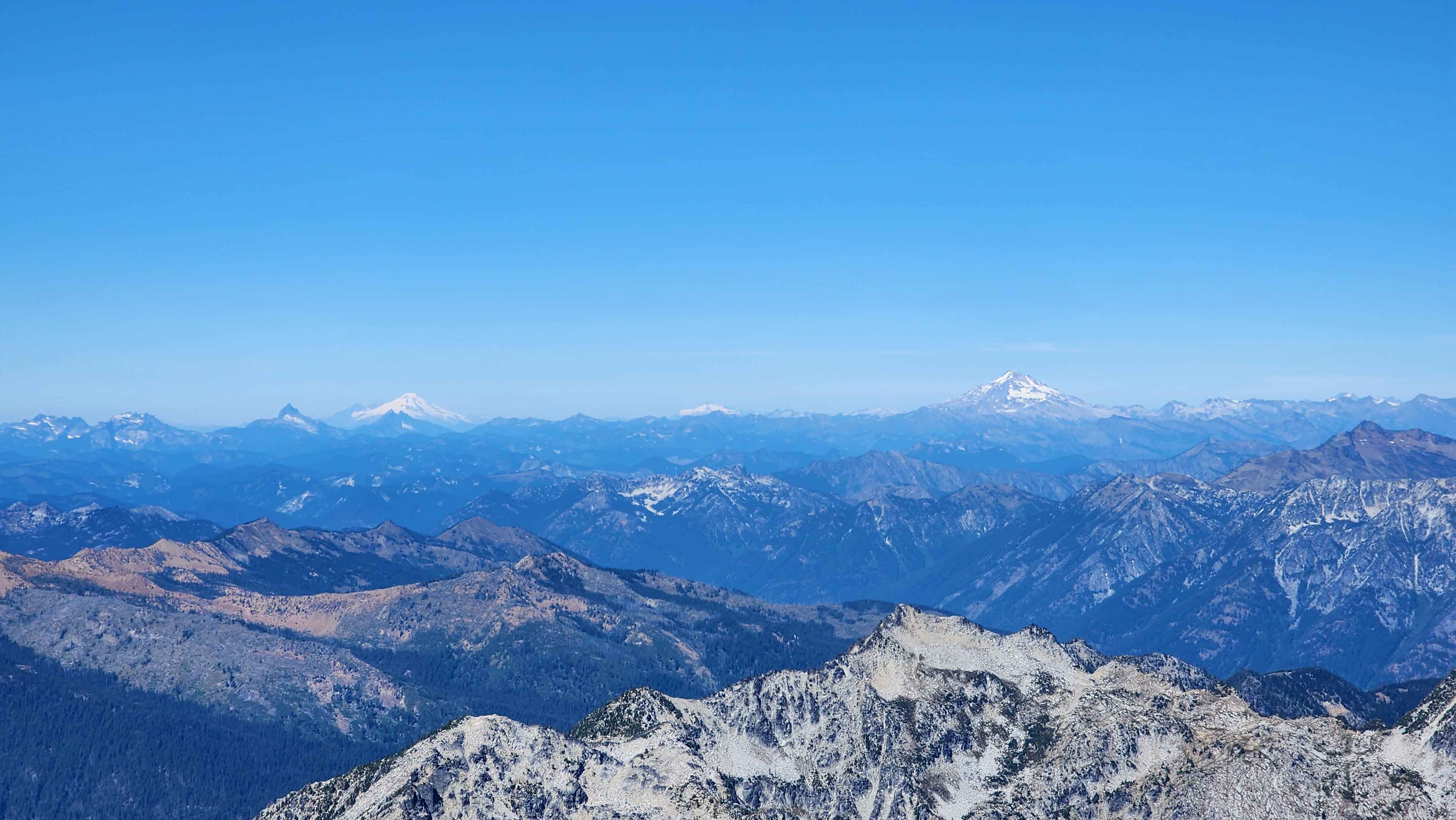
Glacier Peak (to the right) and Mt Baker (to the left)
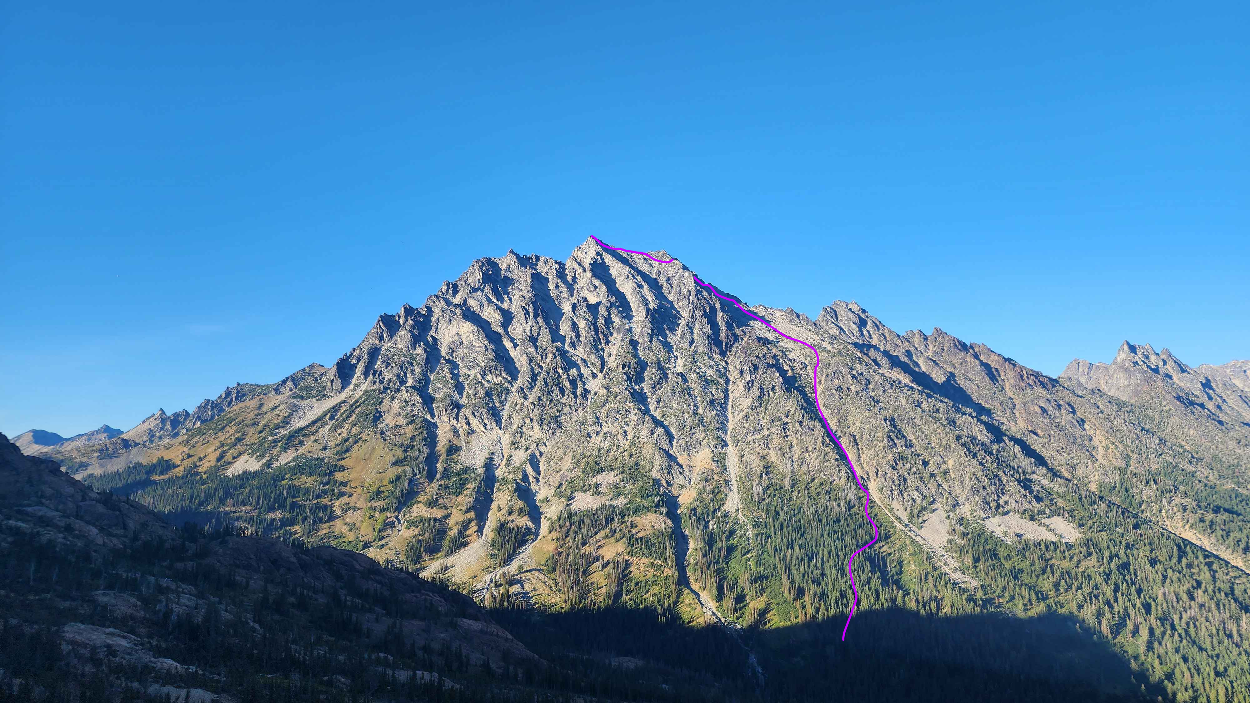
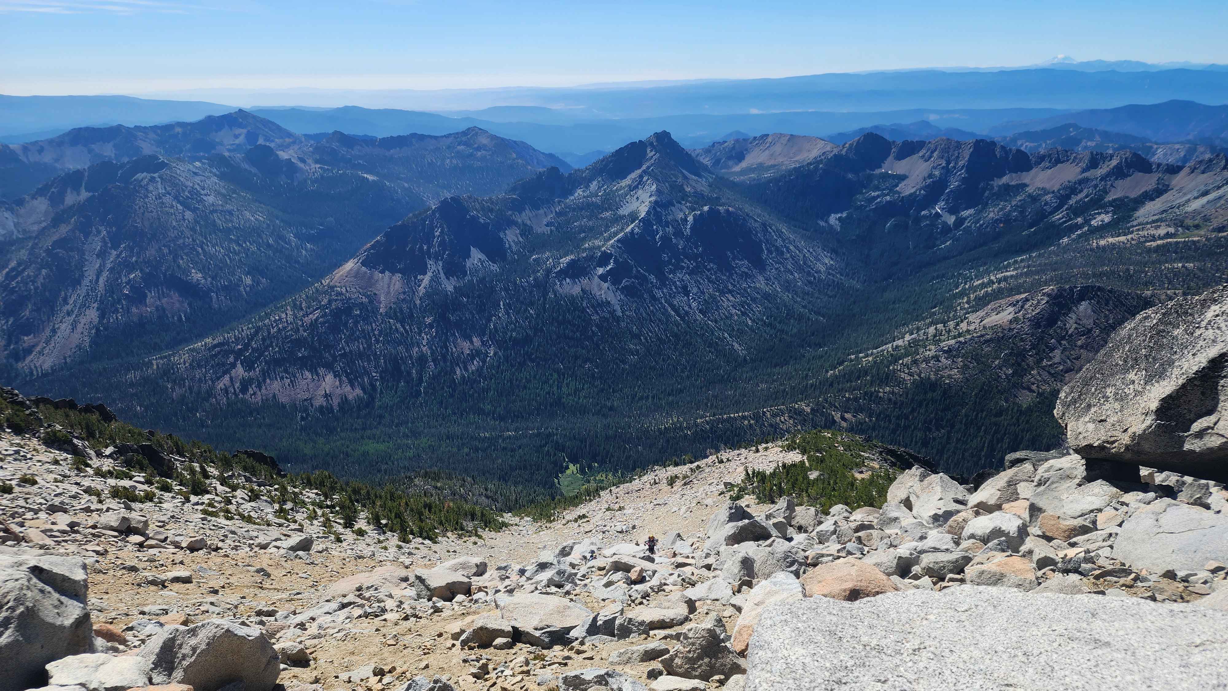
The entire route up the mountain
The descent didn’t have many issues. On the way down I accidentally got on a ledge above a small dirt patch and had to do a bit of climbing down it. I walked out to the false summit while I waited for my team to catch up. Once again my team went the wrong way and ended up too low, so I had to help them navigate back up to where I was. I guided them down the intended route of the southeast slope. At one point I accidentally loosened a large boulder and sent it down the slope. Fortunately, nobody was down below.
Dragontail Peak just across the valley
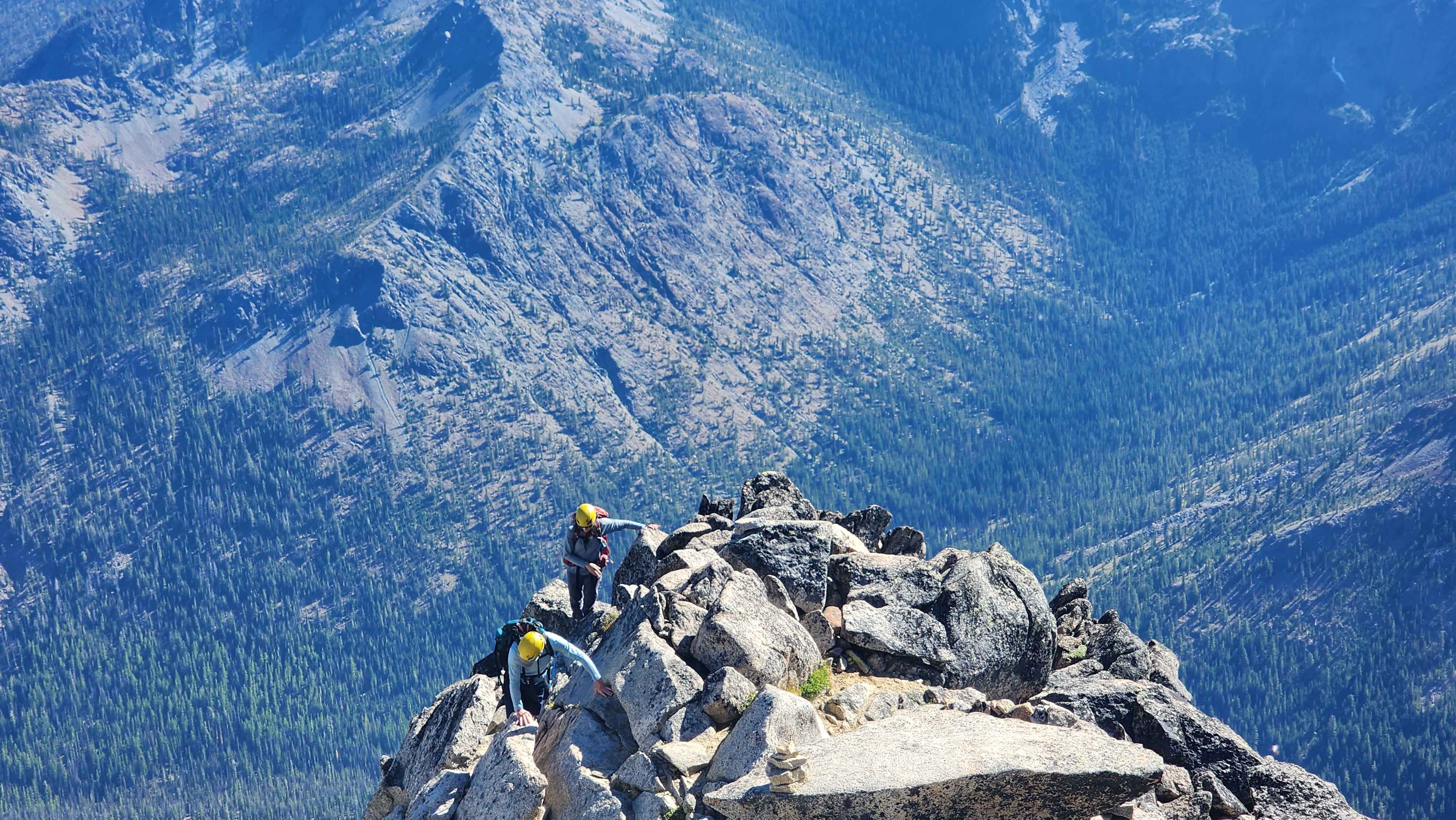
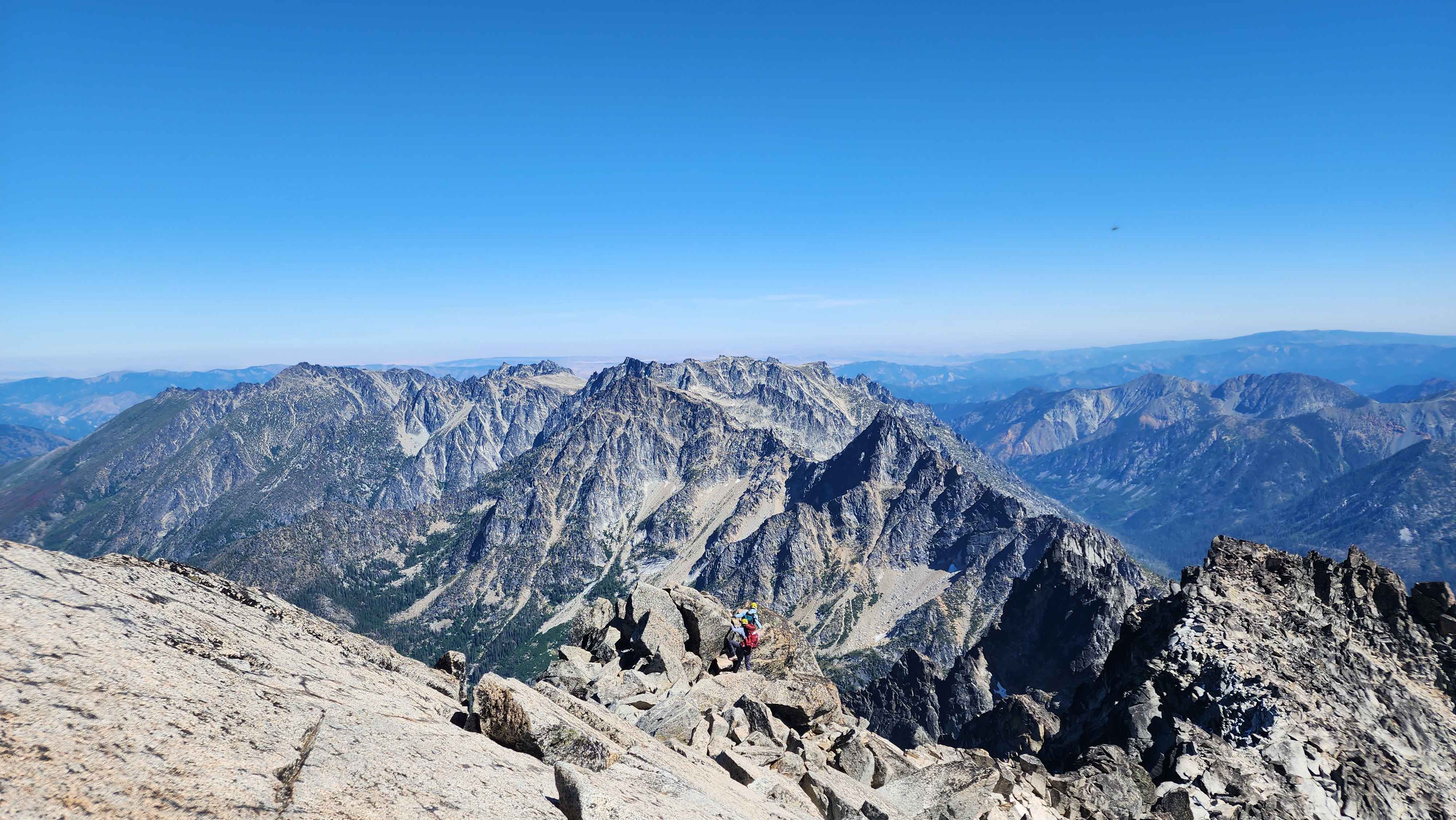
My group making their way back up to where the chute is after getting off track
We made it back to the camp site and debated if we were going to hike out or stay another night. We opted to hike out, which was another 1300ft or so of ascent, and put us at the car by 21:22. We only had to hike in the dark for about an hour.
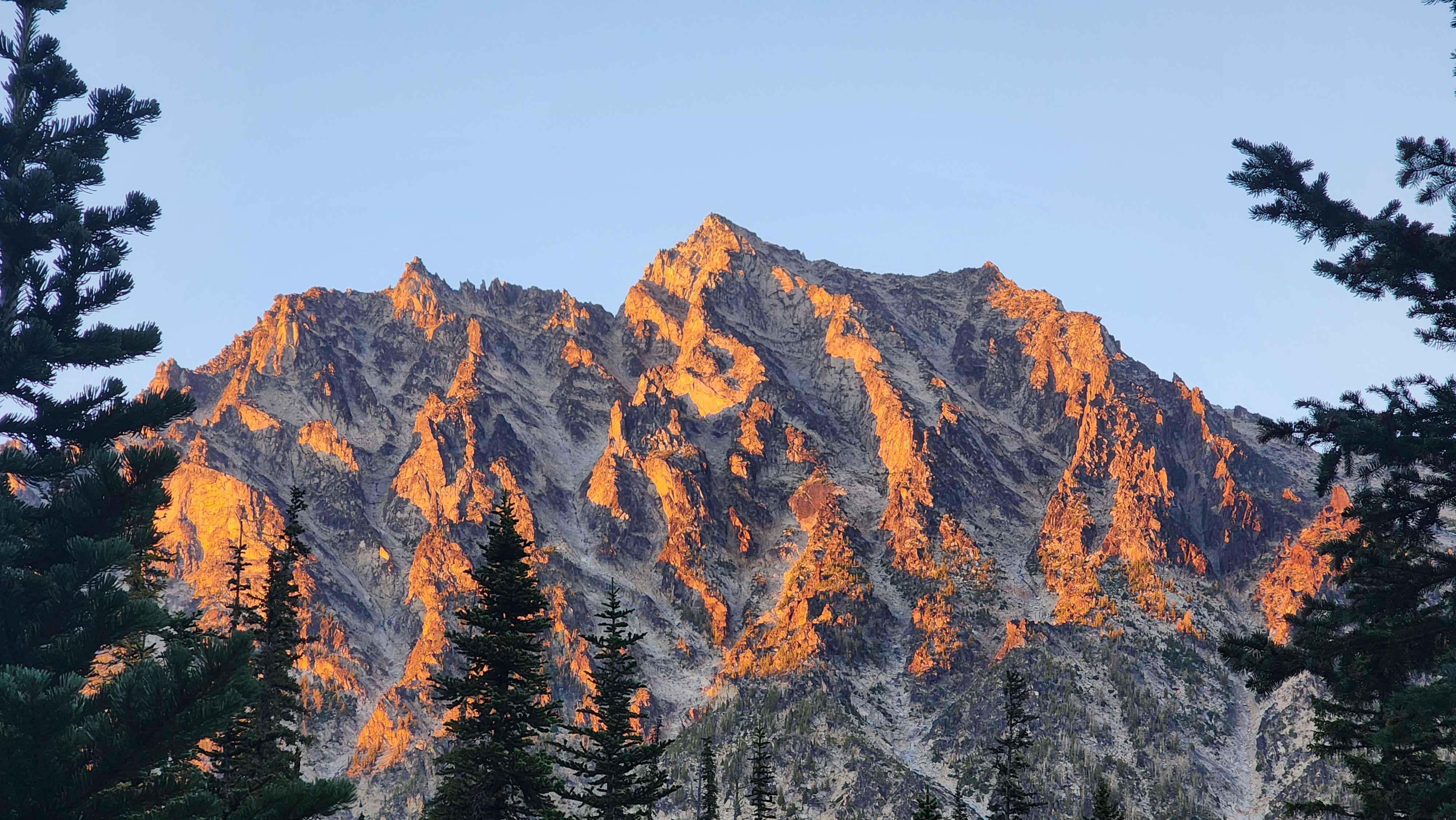
Mt Stuart glowing at sundown
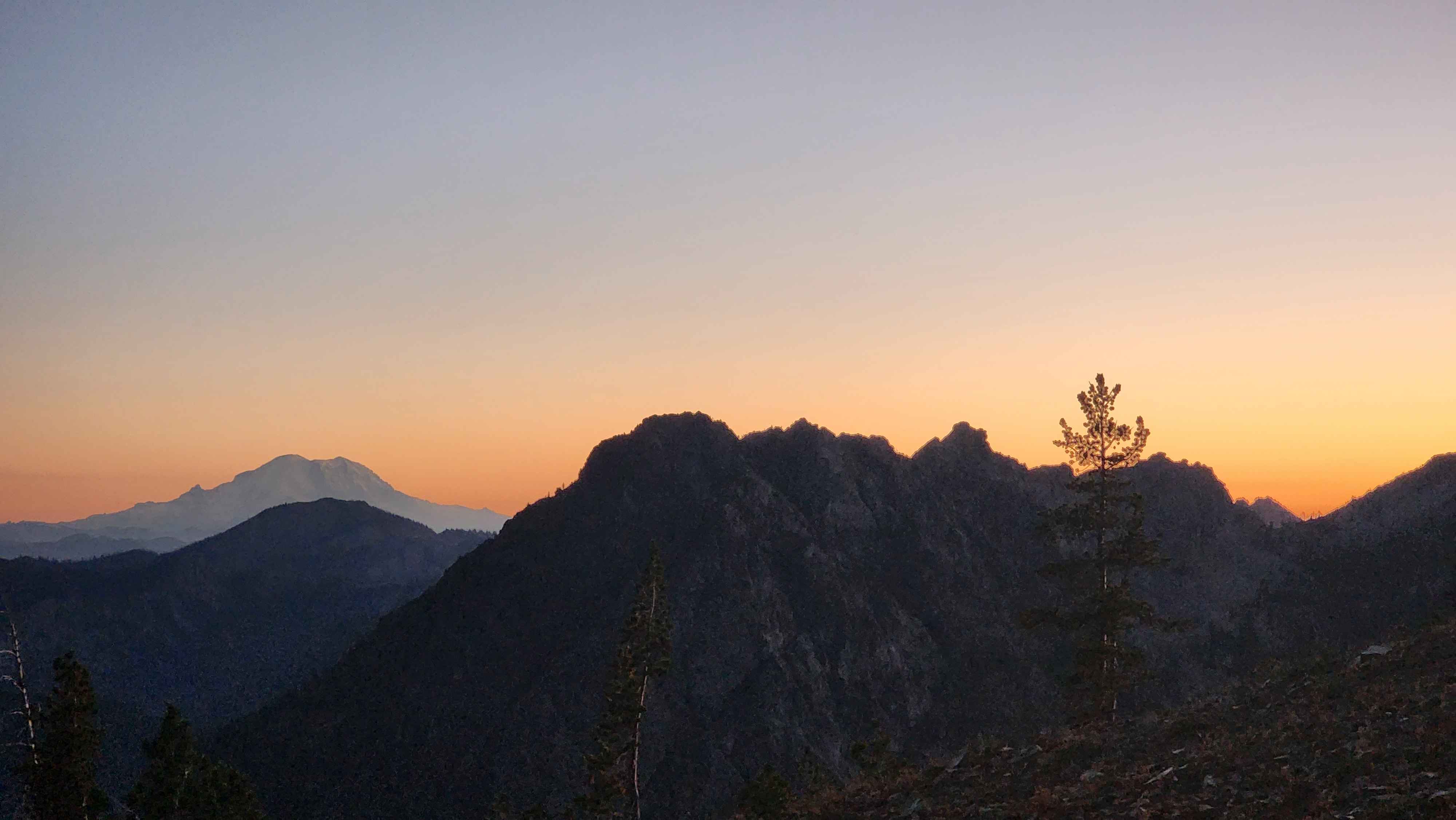
The sunset after getting over Longs Pass